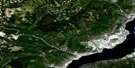
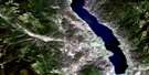
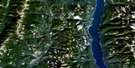
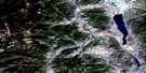
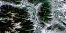
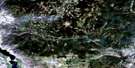
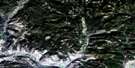
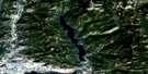
Summerland Satellite Image Map
Download Free Aerial Photo 082E12 at 1:50,000 scale
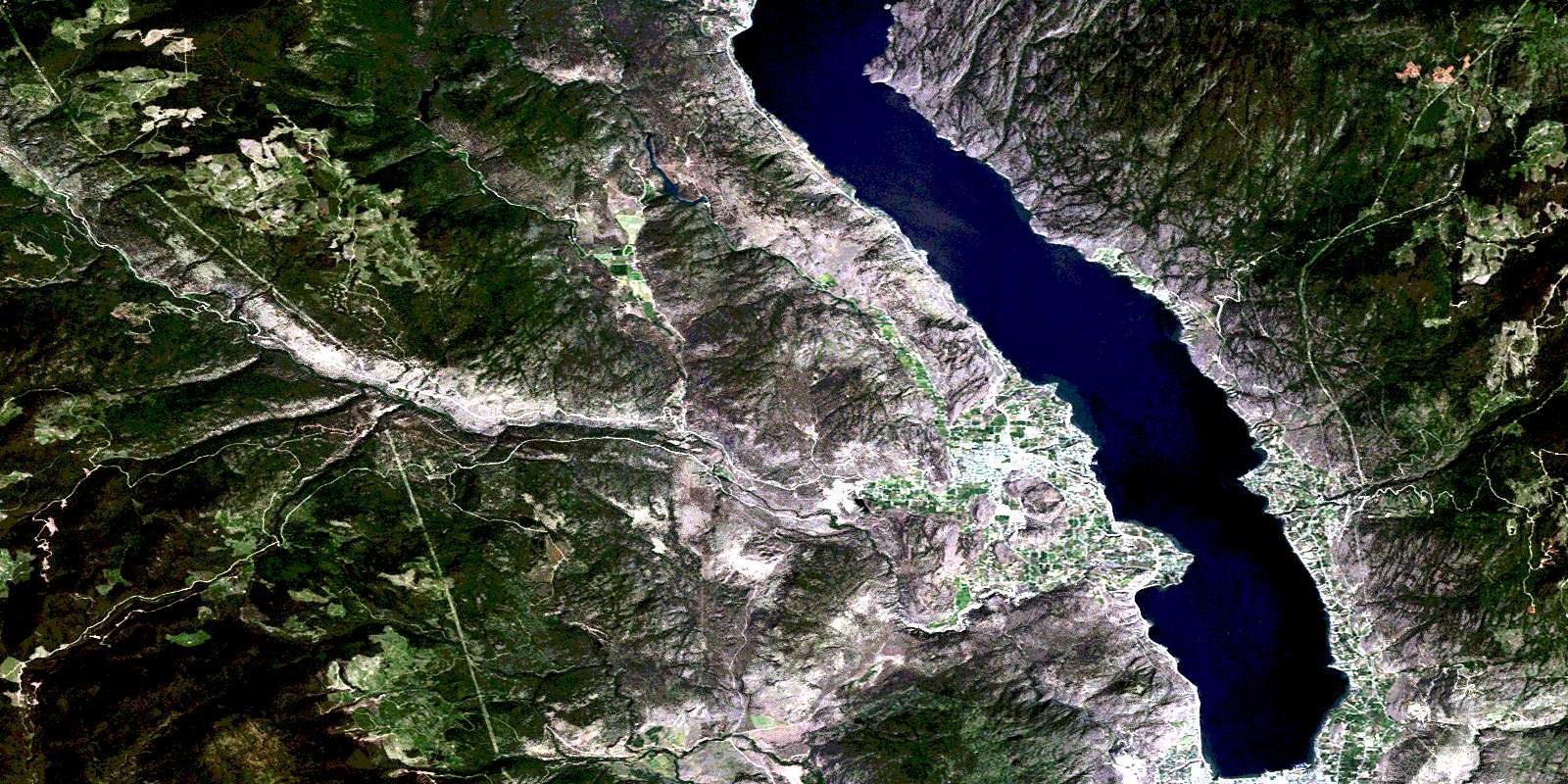
Summerland Satellite Imagery
To view this satellite map, mouse over the air photo on the right.
You can also download this satellite image map for free:
082E12 Summerland high-resolution satellite image map.
Maps for the Summerland aerial map sheet 082E12 at 1:50,000 scale are also available in these versions:
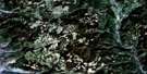
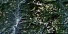
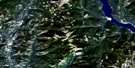
Summerland Surrounding Area Aerial Photo Maps
 |
 |
 |
 |
 |
 |
 |
 |
 |
 |
 |
 |
 |
 |
 |
 |
© Department of Natural Resources Canada. All rights reserved.
Summerland Gazetteer
The following places can be found on satellite image map 082E12 Summerland:
Summerland Satellite Image: Bays
Commando BayReluctant Dragon Cove
Summerland Satellite Image: Capes
Four Mile PointGartrell Point
Squally Point
Three Mile Point
Summerland Satellite Image: City
PentictonSummerland Satellite Image: District municipality
PeachlandSummerland
Summerland Satellite Image: Falls
Hardy FallsSummerland Satellite Image: Geographical areas
Kamloops Division Yale Land DistrictOsoyoos Division Yale Land District
Similkameen Division Yale Land District
Summerland Satellite Image: Indian Reserves
Penticton Indian Reserve 1Penticton Indian Reserve 3A
Réserve indienne Penticton 1
Réserve indienne Penticton 3A
Summerland Satellite Image: Islands
Rattlesnake IslandSummerland Satellite Image: Lakes
Agur LakeBaker Lake
Brent Lake
Chute Lake
Darke Lake
Divide Lake
Elinor Lake
Garnet Lake
Gemmill Lake
Isintok Lake
Lebanon Lake
Lequime Lake
Madeline Lake
Munro Lake
Naramata Lake
Norman Lake
Okanagan Lake
Oxbow Lake
Ratnip Lake
Tsuh Lake
Summerland Satellite Image: Mountains
Blue MountainGiants Head
Isintok Mountain
Mount Acland
Mount Campbell
Mount Conkle
Mount Eneas
Mount Munson
Mount Nkwala
Niggertoe Mountain
Okanagan Highland
Okanagan Mountain
Wild Horse Mountain
Summerland Satellite Image: Major municipal/district area - major agglomerations
Regional District of Central KootenaySummerland Satellite Image: Conservation areas
Antlers Beach ParkClaybanks Beach Park
Darke Lake Park
Eneas Lakes Park
Kickininee Park
Manitou Park
Okanagan Lake Park
Okanagan Mountain Park
Sun-Oka Beach Park
Summerland Satellite Image: Plains
Interior PlateauThompson Plateau
Summerland Satellite Image: Rivers
Arawana CreekBaerg Creek
Bearpaw Creek
Bull Creek
Camp Creek
Chute Creek
Daniels Creek
Darke Creek
Deeper Creek
Denike Creek
Deschamps Creek
Eneas Creek
Fenton Creek
Finlay Creek
Frederick Creek
Gemmill Creek
Gilser Brook
Good Creek
Hedley Creek
Isintok Creek
Johnson Spring Creek
June Creek
Kevin Brook
Kirton Creek
Koosi Creek
Lapsley Creek
Lebanon Creek
Lequime Creek
Liddell Creek
Lost Chain Creek
Naramata Creek
O'Hagan Creek
Okanagan River
Peachland Creek
Penticton Creek
Prairie Creek
Randolph Creek
Ratnip Creek
Riddle Creek
Robinson Creek
Shingle Creek
Silas Creek
Skulaow Creek
Steward Creek
Strutt Creek
Trout Creek
Trust Creek
Tsuh Creek
Turnbull Creek
Summerland Satellite Image: Unincorporated areas
AdraArawana
Chute Lake
Crescent Beach
Crump
Demuth
Faulder
Garnet Valley
Glenfir
Greata
Kirton
Naramata
Poplar Grove
Prairie Valley
Shingle Creek
Trout Creek
West Bench
West Summerland
Winslow
Summerland Satellite Image: Valleys
Meadow ValleyWild Horse Canyon
© Department of Natural Resources Canada. All rights reserved.
082E Related Maps:
082E Penticton082E01 Grand Forks
082E02 Greenwood
082E03 Osoyoos
082E04 Keremeos
082E05 Penticton
082E06 Beaverdell
082E07 Almond Mountain
082E08 Deer Park
082E09 Burrell Creek
082E10 Christian Valley
082E11 Wilkinson Creek
082E12 Summerland
082E13 Peachland
082E14 Kelowna
082E15 Damfino Creek
082E16 Edgewood
