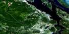
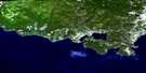
Mayne Island Satellite Image Map
Download Free Aerial Photo 092B14 at 1:50,000 scale
Mayne Island Satellite Imagery
To view this satellite map, mouse over the air photo on the right.
You can also download this satellite image map for free:
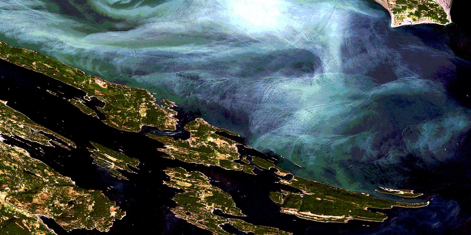
092B14 Mayne Island high-resolution satellite image map.
Maps for the Mayne Island aerial map sheet 092B14 at 1:50,000 scale are also available in these versions:
Mayne Island Surrounding Area Aerial Photo Maps
 |
 |
||
 |
 |
||
 |
 |
||
© Department of Natural Resources Canada. All rights reserved.
Mayne Island Gazetteer
The following places can be found on satellite image map 092B14 Mayne Island:
Mayne Island Satellite Image: Bays
Annette CreekAnnette Inlet
Bedwell Harbour
Bellhouse Bay
Bennett Bay
Boat Harbour
Boat Nook
Boot Cove
Boundary Bay
Brackett Cove
Brackett Cove
Breezy Bay
Bruce Bight
Campbell Bay
Church Cove
Colston Cove
Cook Cove
Cusheon Cove
David Cove
Davidson Bay
Dinner Bay
Diver Bay
Ella Bay
Ellen Bay
Fiddlers Cove
Fulford Harbour
Gallagher Bay
Ganges Harbour
Georgeson Bay
Grimmer Bay
Hamilton Cove
Hope Bay
Horton Bay
Hyashi Cove
Irish Bay
James Bay
Kadonaga Bay
Kingfisher Cove
Little Bay
Long Harbour
Lyall Harbour
Madrona Bay
Maude Bay
Miners Bay
Montague Harbour
Murcheson Cove
Murchison Cove
Narvaez Bay
Naylor Bay
Otter Bay
Payne Bay
Percival Cove
Plumper Sound
Pollard Cove
Port Browning
Porter Bight
Reef Harbour
Richardson Bay
Selby Cove
Selby Creek
Shark Cove
Shingle Bay
Sturdies Bay
Taylor Cove
Thieves Bay
Trueworthy Bight
Veruna Bay
Village Bay
Walter Bay
Welbury Bay
Welcome Cove
Whaler Bay
Winter Cove
Mayne Island Satellite Image: Beaches
Chocolate BeachHamilton Beach
Medicine Beach
O'Reilly Beach
Saturna Beach
Mayne Island Satellite Image: Capes
Ainslie PointAitken Point
Aldridge Point
Andaje Point
Annette Point
Athol Peninsula
Auchterlonie Point
Beaver Point
Burrill Point
Cain Peninsula
Cain Point
Campbell Point
Collinson Point
Crane Point
Croker Point
Digby Point
Dinner Point
East Point
Edith Point
Eleanor Point
Enke Point
Georgina Point
Glenthorne Point
Grainger Point
Gray Peninsula
Helen Point
James Point
Laura Point
Lord Point
Mary Anne Point
Matthews Point
McIntyre Point
Mikuni Point
Monarch Head
Mortimer Spit
Mouat Point
Murder Point
Nose Point
Paddon Point
Payne Point
Peile Point
Phillimore Point
Point Liddell
Portlock Point
Ralph Grey Point
Razor Point
Reserve Point
Rip Point
Rock Point
Salamanca Point
Saturna Point
Savage Point
Scoones Point
Scott Point
Selby Point
St. John Point
Stanley Point
Taylor Point
Tumbo Point
Twiss Point
Walker Hook
Welbury Point
Willey Point
Wilmot Head
Winstanley Point
Winter Point
Yeo Point
Mayne Island Satellite Image: Channels
Active PassBoat Passage
Boundary Pass
Captain Passage
Georgeson Passage
Glenthorne Passage
Navy Channel
Pender Canal
Robson Channel
Strait of Georgia
Swanson Channel
Trincomali Channel
Tumbo Channel
Mayne Island Satellite Image: Cliffs
Elliot BluffGrubb Bluffs
Mayne Island Satellite Image: Geographical areas
Cowichan Land DistrictSaltspring Island Land District
Mayne Island Satellite Image: Indian Reserves
Fulford Harbour Indian Reserve 5Mayne Island Indian Reserve 6
Réserve indienne Fulford Harbour 5
Réserve indienne Mayne Island 6
Réserve indienne Saturna Island 7
Saturna Island Indian Reserve 7
Mayne Island Satellite Image: Islands
Acland IslandsAnniversary Island
Ballingall Islets
Belle Chain Islets
Boat Island
Boat Islet
Bright Islet
Cabbage Island
Chain Islands
Channel Islands
Charles Island
Clamshell Islet
Curlew Island
Deadman Islands
Fane Island
First Sister Island
Galiano Island
Georgeson Island
Goat Island
Gossip Island
Grace Islet
Gulf Islands
Hawkins Island
Java Islets
Julia Island
King Island
King Islets
Lion Islets
Lizard Island
Mayne Island
North Pender Island
Owl Island
Page Islet
Parker Island
Pine Island
Pine Islet
Powder Islet
Prevost Island
Red Island
Red Islets
Roe Islet
Russell Island
Saltspring Island
Samuel Island
Saturna Island
Second Sister Island
Secret Island
Skull Islet
South Pender Island
Sphinx Island
Third Sister Island
Trevor Islet
Tumbo Island
Wise Island
Mayne Island Satellite Image: Lakes
Blackburn LakeCusheon Lake
Finlay Lake
Ford Lake
Lake Stowell
Lake Weston
Magic Lake Estates Water Reservoir No. 1
Pender Lake
Roe Lake
Mayne Island Satellite Image: Marine navigation features
Ganges HarbourMayne Island
Mayne Island Satellite Image: Mountains
Bald ConeBrown Range
Brown Ridge
Cramer Hill
Deacon Hill
Dent Hill
George Hill
Hall Hill
Heck Hill
Hope Hill
Lively Peak
Mount David
Mount Elford
Mount Fisher
Mount Galiano
Mount Hope
Mount Menzies
Mount Norman
Mount Parke
Mount Sutil
Mount Warburton Pike
Quadra Hill
Reginald Hill
Spalding Hill
Stockade Hill
Sutil Mountain
Mayne Island Satellite Image: Major municipal/district area - major agglomerations
Capital Regional DistrictMayne Island Satellite Image: Conservation areas
Ballingall Islets ParkBeaumont Marine Park
Beaver Point Park
Bellhouse Park
Bennett Bay Protected Area
Cabbage Island Marine Park
Gulf Islands National Park Reserve of Canada
Montague Harbour Marine Park
Montague Harbour Park
Mount Maxwell Park
Prevost Island Protected Area
Prior Centennial Park
Réserve de parc national du Canada des Îles-Gulf
Ruckle Park
South Otter Bay Protected Area
Winter Cove Marine Park
Winter Cove Park
Mayne Island Satellite Image: Provinces
British ColumbiaColombie-Britannique
Mayne Island Satellite Image: Rivers
Cusheon CreekFinlay Brook
Fulford Creek
Ganges Creek
Greig Creek
Lyall Creek
Mayne Island Satellite Image: Shoals
Atkins ReefBatt Rock
Beddis Rock
Ben Mohr Rock
Boiling Reef
Charles Rocks
Conconi Reef
Crispin Rock
Deep Ridge
Drew Rock
Enterprise Reef
Fairway Bank
Ganges Shoal
Georgina Shoals
Gossip Shoals
Governor Rock
Horda Shoal
Horda Shoals
Jackson Rock
Louisa Rock
Minx Reef
Money Maker Reef
Money Makers Rock
Parson Rock
Perry Rock
Pinnacle Rock
Rosenfeld Rock
Russell Reef
Salalikum Rock
Spire Rock
Tumbo Reef
Walker Rock
York Rocks
Mayne Island Satellite Image: Unincorporated areas
Beaver PointBoundary Bay
Fulford Harbour
Galiano
Galiano Island
Ganges
Hope Bay
Hope Bay (Pender Island P.O.-B. de p.)
Lighthouse Point
Long Harbour
Mayne
Montague Harbour
Otter Bay
Pender Island
Pender Island (Hope Bay Ldg.-Déd.)
Port Washington
Saturna
Saturna Island
Sturdies Bay
Village Bay
© Department of Natural Resources Canada. All rights reserved.
