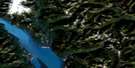
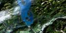
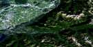
Aspen Grove Satellite Image Map
Download Free Aerial Photo 092H15 at 1:50,000 scale
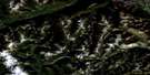
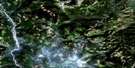
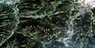
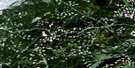
Aspen Grove Satellite Imagery
To view this satellite map, mouse over the air photo on the right.
You can also download this satellite image map for free:
092H15 Aspen Grove high-resolution satellite image map.
Maps for the Aspen Grove aerial map sheet 092H15 at 1:50,000 scale are also available in these versions:
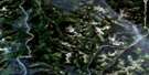
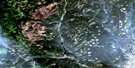
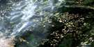
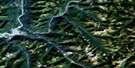
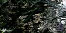
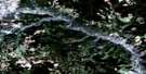
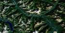
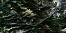
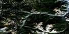
Aspen Grove Surrounding Area Aerial Photo Maps
 |
 |
 |
 |
 |
 |
 |
 |
 |
 |
 |
 |
 |
 |
 |
 |
© Department of Natural Resources Canada. All rights reserved.
Aspen Grove Gazetteer
The following places can be found on satellite image map 092H15 Aspen Grove:
Aspen Grove Satellite Image: Geographical areas
Kamloops Division Yale Land DistrictYale Division Yale Land District
Aspen Grove Satellite Image: Indian Reserves
Logan's Indian Reserve 6Paul's Basin Indian Reserve 2
Réserve indienne Logan's 6
Réserve indienne Paul's Basin 2
Aspen Grove Satellite Image: Lakes
Alleyne LakeBatstone Lake
Bluey Lake
Boss Lake
Brook Lake
Chicken Ranch Lake
Courtney Lake
Crater Lake
Davis Lake
Deadman Lake
Deadman Lake
Dodds Lake
Englishmen Lake
Fig Lake
Gillis Lake
Gladstone Lake
Goose Lake
Green Lake
Gulliford Lake
Gulliford Lake
Harmon Lake
Hastings Lake
Hook Lake
Hornet Lake
Johnny Lake
Kane Lake
Kane Lakes
Kentucky Lake
Ketcham Lake
Ketchan Lake
Kidd Lake
Lodwick Lake
Loon Lake
Loosemore Lake
Loosemore Lake
Miner Lake
Missezula Lake
Pothole Lake
Prosser Lake
Seymour Lake
Shea Lake
Summit Lake
Tahla Lake
Taylor Lake
Thalia Lake
Tinmilsh Lake
Trout Lake
Tule Lake
Upper Ketcham Lake
Aspen Grove Satellite Image: Mountains
Fairweather HillsSelish Mountain
Shovel Nose Mountain
Shovelnose Mountain
Aspen Grove Satellite Image: Conservation areas
Kentucky-Alleyne ParkKentucky-Alleyne Recreation Area
Aspen Grove Satellite Image: Plains
Thompson PlateauAspen Grove Satellite Image: Rivers
Angstadt CreekBates Creek
Brook Creek
Castillion Creek
Coldwater River
Coley Creek
Conglin Creek
Gillis Creek
Gulliford Creek
Howarth Creek
Kanevale Creek
Ketcham Creek
Ketchan Creek
Kimble Creek
Kingsvale Creek
Kwinshatin Creek
Leonard Creek
Logans Creek
McCullough Creek
McPhail Creek
Midday Creek
Nielson Creek
Nilsson Creek
Otter Creek
Pothole Creek
Salem Creek
Shouz Creek
Shrimpton Creek
Spearing Creek
Tinmilsh Creek
Two Dollar Creek
Voght Creek
Aspen Grove Satellite Image: Unincorporated areas
Aspen GroveBrodie
Brookmere
Kingsvale
Spearing
Thalia
Aspen Grove Satellite Image: Valleys
Kane Valley
© Department of Natural Resources Canada. All rights reserved.
092H Related Maps:
092H Hope092H01 Ashnola River
092H02 Manning Park
092H03 Skagit River
092H04 Chilliwack
092H05 Harrison Lake
092H06 Hope
092H07 Princeton
092H08 Hedley
092H09 Bankeir
092H10 Tulameen
092H11 Spuzzum
092H12 Mount Urquhart
092H13 Scuzzy Mountain
092H14 Boston Bar
092H15 Aspen Grove
092H16 Paradise Lake
