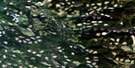
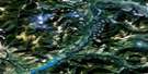
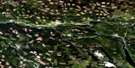
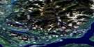
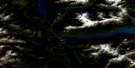
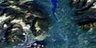
Clearwater Lake Satellite Image Map
Download Free Aerial Photo 093A01 at 1:50,000 scale
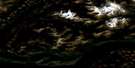
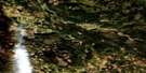
Clearwater Lake Satellite Imagery
To view this satellite map, mouse over the air photo on the right.
You can also download this satellite image map for free:
093A01 Clearwater Lake high-resolution satellite image map.
Maps for the Clearwater Lake aerial map sheet 093A01 at 1:50,000 scale are also available in these versions:
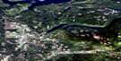
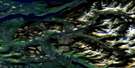
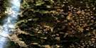
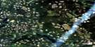
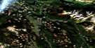
Clearwater Lake Surrounding Area Aerial Photo Maps
 |
 |
 |
 |
 |
 |
 |
 |
 |
 |
 |
 |
 |
 |
 |
 |
© Department of Natural Resources Canada. All rights reserved.
Clearwater Lake Gazetteer
The following places can be found on satellite image map 093A01 Clearwater Lake:
Clearwater Lake Satellite Image: Beaches
Caribou BeachClearwater Lake Satellite Image: Craters
Flourmill VolcanoesClearwater Lake Satellite Image: Falls
Baileys ChuteClegara Falls
Donkey Falls
Horseshoe Falls
Majerus Falls
Osprey Falls
Clearwater Lake Satellite Image: Lakes
Alice LakeClearwater Lake
Cranberry Lake
Falls Lake
Five Fingers Lake
Jack Norman Lake
Kostal Lake
Lone Spoon Lake
Majerus Lake
Mirror Lake
Pyramid Lake
Ray Lake
Shadow Lake
Spanish Lake
Zellers Lake
Clearwater Lake Satellite Image: Mountains
Cariboo MountainColumbia Mountains
McLeod Hill
Mica Mountain
Quesnel Highland
Shuswap Highland
Clearwater Lake Satellite Image: Major municipal/district area - major agglomerations
Cariboo Regional DistrictClearwater Lake Satellite Image: Conservation areas
Wellesley Gray Recreation AreaWells Gray Park
Wells Gray Recreation Area
Clearwater Lake Satellite Image: Plains
Interior PlateauClearwater Lake Satellite Image: Rapids
Normans EddyClearwater Lake Satellite Image: Rivers
Alice CreekArcher Creek
Beaver Creek
Blackwater Creek
Clearwater River
Daniel Creek
Deception Creek
Donald Creek
Donkey Creek
Falls Creek
Flourmill Creek
Lone Spoon Creek
McKusky Creek
Mink Creek
Murtle River
Spanish Creek
Clearwater Lake Satellite Image: River features
The HorseshoeClearwater Lake Satellite Image: Low vegetation
Chain Meadows
© Department of Natural Resources Canada. All rights reserved.
093A Related Maps:
093A Quesnel Lake093A01 Clearwater Lake
093A02 Mckinley Creek
093A03 Eagle (Murphy) Lake
093A04 150 Mile House
093A05 Beaver Creek
093A06 Horsefly
093A07 Mackay River
093A08 Azure Lake
093A09 Hobson Lake
093A10 Quesnel Lake
093A11 Spanish Lake
093A12 Hydraulic
093A13 Swift River
093A14 Cariboo Lake
093A15 Mitchell Lake
093A16 Mount Winder
