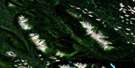
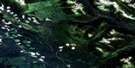
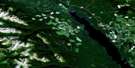
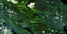
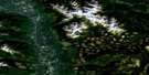
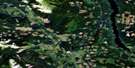
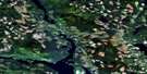
Hazelton Satellite Image Map
Download Free Aerial Photo 093M05 at 1:50,000 scale
Hazelton Satellite Imagery
To view this satellite map, mouse over the air photo on the right.
You can also download this satellite image map for free:
093M05 Hazelton high-resolution satellite image map.
Maps for the Hazelton aerial map sheet 093M05 at 1:50,000 scale are also available in these versions:
Hazelton Surrounding Area Aerial Photo Maps
 |
 |
 |
 |
 |
 |
 |
 |
 |
 |
 |
 |
 |
 |
 |
 |
© Department of Natural Resources Canada. All rights reserved.
Hazelton Gazetteer
The following places can be found on satellite image map 093M05 Hazelton:
Hazelton Satellite Image: District municipality
New HazeltonHazelton Satellite Image: Indian Reserves
Agwedin Indian Reserve 3Andak Indian Reserve 9
Anlaw Indian Reserve 4
Gitanmaax Indian Reserve 1
Gul-mak Indian Reserve 8
Gun-a-chal Indian Reserve 5
Hagwilget Indian Reserve 1
Kis-an-usko Indian Reserve 7
Kispiox Indian Reserve 1
Ksoo-gun-ya Indian Reserve 2A
Quan-skum-ksin-mich-mich Indian Reserve 4
Réserve indienne Agwedin 3
Réserve indienne Andak 9
Réserve indienne Anlaw 4
Réserve indienne Gitanmaax 1
Réserve indienne Gul-mak 8
Réserve indienne Gun-a-chal 5
Réserve indienne Hagwilget 1
Réserve indienne Kis-an-usko 7
Réserve indienne Kispiox 1
Réserve indienne Ksoo-gun-ya 2A
Réserve indienne Quan-skum-ksin-mich-mich 4
Réserve indienne Sidina 6
Réserve indienne Sik-e-dakh 2
Réserve indienne Tsitsk 3
Réserve indienne Waulp 10
Sidina Indian Reserve 6
Sik-e-dakh Indian Reserve 2
Tsitsk Indian Reserve 3
Waulp Indian Reserve 10
Hazelton Satellite Image: Lakes
Affleck LakeBras Lake
Collins Lake
Robinson Lake
Ross Lake
Six Mile Lake
Sunday Lake
Hazelton Satellite Image: Mountains
Babine MountainsBabine Range
Four Mile Mountain
Fourmile Mountain
Hazelton Peak
Kispiox Mountain
Kispiox Range
Mount Glen
Ninemile Mountain
Sidina Mountain
Skeena Mountains
Tenas Hill
Hazelton Satellite Image: Major municipal/district area - major agglomerations
Regional District of Kitimat-StikineHazelton Satellite Image: Conservation areas
Bulkley Junction ParkRoss Lake Park
Hazelton Satellite Image: Rivers
Bretson CreekBulkley River
Burdick Creek
Date Creek
Four Mile Creek
Gail Creek
Hazelton Creek
Hevenor Creek
Keynton Creek
Kispiox River
McCully Creek
Moonlit Creek
Nine Mile Creek
Pinenut Creek
Saul Creek
Sediesh Creek
Shegunia River
Sidina Creek
Six Mile Creek
Skeena River
Two Mile Creek
Utsun Creek
Hazelton Satellite Image: Unincorporated areas
FlemingGlen Vowell
Hagwilget
Kispiox
'Ksan
Two Mile
Hazelton Satellite Image: Valleys
Hagwilget CanyonHazelton Satellite Image: Villages
Hazelton
© Department of Natural Resources Canada. All rights reserved.
093M Related Maps:
093M Hazelton093M01 Old Fort Mountain
093M02 Harold Price Creek
093M03 Moricetown
093M04 Skeena Crossing
093M05 Hazelton
093M06 Suskwa River
093M07 Netalzul Mountain
093M08 Nakinilerak Lake
093M09 Bulkley House
093M10 Nilkitkwa River
093M11 Gunanoot Lake
093M12 Cutoff Mountain
093M13 Shedin Creek
093M14 Shelagyote Peak
093M15 Kotsine River
093M16 Lion Creek
