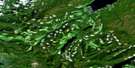
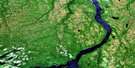
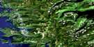
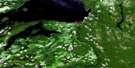
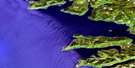
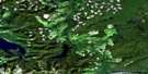
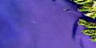
Skidegate Channel Satellite Image Map
Download Free Aerial Photo 103F01 at 1:50,000 scale
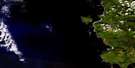
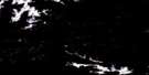
Skidegate Channel Satellite Imagery
To view this satellite map, mouse over the air photo on the right.
You can also download this satellite image map for free:
103F01 Skidegate Channel high-resolution satellite image map.
Maps for the Skidegate Channel aerial map sheet 103F01 at 1:50,000 scale are also available in these versions:
Skidegate Channel Surrounding Area Aerial Photo Maps
 |
 |
 |
|
 |
 |
||
 |
 |
||
 |
 |
© Department of Natural Resources Canada. All rights reserved.
Skidegate Channel Gazetteer
The following places can be found on satellite image map 103F01 Skidegate Channel:
Skidegate Channel Satellite Image: Bays
Alliford BayAnchor Cove
Baylee Bay
Bearskin Bay
Boomchain Bay
Christie Bay
Dawson Harbour
Dawson Inlet
Deland Bay
Englefield Bay
Fannin Bay
Gillatt Arm
Gordon Cove
Gosset Bay
Kagan Bay
Kaisun Harbour
Kitgoro Inlet
Kuper Inlet
Long Arm
Long Inlet
Mackenzie Bay
Mackenzie Cove
MacKenzie Cove
Newcombe Bay
Saltspring Bay
Security Bay
Security Cove
Security Inlet
Shoal Bay
Skidegate Inlet
South Bay
Trounce Inlet
Whiteaves Bay
Yovanovich Bight
Skidegate Channel Satellite Image: Capes
Annesley PointAnthracite Point
Belle Point
Bland Point
Bone Point
Canoe Point
Chittenden Point
Demariscove Point
Dyer Point
Exact Point
Fairlie Point
Georgianna Point
Haida Point
Hastings Point
Image Point
Josette Point
Kennedy Point
Leonide Point
McLellan Point
Newton Point
North Point
Percy Point
Pier Point
Random Point
Security Point
Steep Point
Susan Sturgis Point
Withered Point
Young Point
Skidegate Channel Satellite Image: Channels
Armentières ChannelBuck Channel
Chaatl Narrows
East Narrows
Inskip Channel
Lina Narrows
Maude Channel
Skidegate Channel
West Narrows
Skidegate Channel Satellite Image: Indian Reserves
Black Slate Indian Reserve 11Deena Indian Reserve 3
Khrana Indian Reserve 4
Lagins Indian Reserve 5
Réserve indienne Black Slate 11
Réserve indienne Deena 3
Réserve indienne Khrana 4
Réserve indienne Lagins 5
Réserve indienne Skidegate 1
Skidegate Indian Reserve 1
Skidegate Channel Satellite Image: Islands
Angle IslandBalch Islands
Berry Islands
Burnt Island
Bush Island
Carswell Island
Chaatl Island
Channel Islands
Claudet Island
Downie Island
Fleury Island
Flowery Islet
Gooden Island
Graham Island
Gust Island
Hallet Island
Helgesen Island
Hibben Island
Îles de la Reine-Charlotte
Instructor Island
Leading Island
Legace Island
Lihou Island
Lillihorn Island
Lina Island
Log Island
Maple Island
Maude Island
Meyer Island
Moresby Island
Queen Charlotte Islands
Reef Island
Robber Island
Robertson Island
Roderick Island
Sandilands Island
Sandstone Islands
Saunders Island
Scalus Island
Ship Island
Transit Island
Treble Island
Tree Islet
Triangle Island
Tuft Island
Wedge Island
Willie Island
Skidegate Channel Satellite Image: Lakes
Mosquito LakeSkidegate Lake
Skidegate Channel Satellite Image: Mountains
Bertie HillBirch Mountain
Hump Mountain
Koohoo Hill
Lambert Hill
Meadow Mountain
Mosquito Mountain
Mount Brown
Mount Chisholm
Mount Moresby
Mount Rory
Mount Seymour
Queen Charlotte Mountains
Snow Peak
Stripe Mountain
Turner Peak
Skidegate Channel Satellite Image: Rivers
Braverman CreekCameron Creek
Crystal Creek
Deena Creek
Deena River
Honna River
Indian Cabin Creek
Kagan Creek
Lagins Creek
Macmillan Creek
Mike Laurie Creek
Mud Bay Creek
Outlook Creek
Pallant Creek
Porter Creek
Skid Creek
Slatechuck Creek
South Bay Creek
Tarundl Creek
Weeping Willy Creek
Skidegate Channel Satellite Image: Shoals
Bare RocksDanube Rock
Noble Rock
Weed Rock
Skidegate Channel Satellite Image: Unincorporated areas
HainaKaisun
Moresby Camp
Skidegate
Skidegate Landing

© Department of Natural Resources Canada. All rights reserved.
