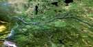
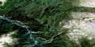
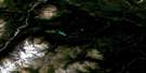
Classy Creek Satellite Image Map
Download Free Aerial Photo 104J02 at 1:50,000 scale
Classy Creek Satellite Imagery
To view this satellite map, mouse over the air photo on the right.
You can also download this satellite image map for free:
104J02 Classy Creek high-resolution satellite image map.
Maps for the Classy Creek aerial map sheet 104J02 at 1:50,000 scale are also available in these versions:
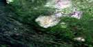
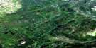
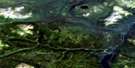
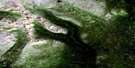
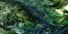
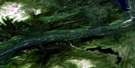
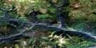
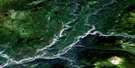
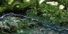
Classy Creek Surrounding Area Aerial Photo Maps
 |
 |
 |
 |
 |
 |
 |
 |
 |
 |
 |
 |
 |
 |
 |
 |
© Department of Natural Resources Canada. All rights reserved.
Classy Creek Gazetteer
The following places can be found on satellite image map 104J02 Classy Creek:
Classy Creek Satellite Image: Indian Reserves
Classy Creek Indian Reserve 8Hiusta's Meadow Indian Reserve 2
Réserve indienne Classy Creek 8
Réserve indienne Hiusta's Meadow 2
Réserve indienne Tahltan 1
Réserve indienne Tahltan 10
Tahltan Indian Reserve 1
Tahltan Indian Reserve 10
Classy Creek Satellite Image: Lakes
Boomerang LakeChara Lake
Hiusta Lake
Ira Lake
Mincho Lake
Classy Creek Satellite Image: Mountains
Mount MeehausClassy Creek Satellite Image: Conservation areas
Mount Edziza Recreation AreaStikine River Recreation Area
Classy Creek Satellite Image: Plains
Klastline PlateauStikine Plateau
Tanzilla Plateau
Classy Creek Satellite Image: Rivers
Chara CreekClassy Creek
Hartz Creek
Klastline River
Konthil Creek
Little Tuya River
Mansfield Creek
Meehaus Creek
Stikine River
Tahltan River
Tanzilla River
Tuya River
Tuyawest Creek
Classy Creek Satellite Image: Unincorporated areas
Cariboo MeadowsDays Ranch
Hiusta Meadow
Riley's
Tahltan
Classy Creek Satellite Image: Valleys
Grand Canyon of the Stikine
© Department of Natural Resources Canada. All rights reserved.
104J Related Maps:
104J Dease Lake104J01E Stikine Canyon
104J01W Stikine Canyon
104J02E Classy Creek
104J02W Classy Creek
104J03E Tahltan River
104J03W Tahltan River
104J04E Kennicott Lake
104J04W Kennicott Lake
104J05E Ketchum Lake
104J05W Ketchum Lake
104J06 Beatty Creek
104J07 Little Tuya River
104J08 Dease Lake
104J09E Little Dease Lake
104J09W Little Dease Lake
104J10 Tachilta Lakes
104J11 Granite Lake
104J12E Dudidontu River
104J12W Dudidontu River
104J13E Prairie Lake
104J13W Prairie Lake
104J14 Kawdy Creek
104J15 Calata Lake
104J16 Porter Landing
