Trinity Topo Map Online
Download Free Topo Map Sheet 002C06 at 1:50,000 scale
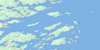
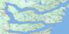
002C06 Trinity Topo Map
To view this map, mouse over the map preview on the right.
You can also download this topo map for free:
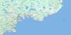
002C06 Trinity high-resolution topo map image.
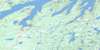
Maps for the Trinity topo map sheet 002C06 at 1:50,000 scale are also available in these versions:
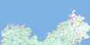
Trinity Surrounding Area Topo Maps
 |
|||
 |
 |
||
 |
 |
||
 |
 |
 |
© Department of Natural Resources Canada. All rights reserved.
Trinity Gazetteer
The following places can be found on topographic map sheet 002C06 Trinity:
Trinity Topo Map: Bays
Back CoveBritish Harbour
Cap Cove
Cat Cove
Champney's Cove
Cuckold Cove
Devils Cove
Dog Cove
English Bay
Fisher Cove
Fox Bay
Goose Cove
Green Bay
Herring Cove
Island Cove
Kerleys Harbour
Melrose Harbour
Northern Cove
Northwest Arm
Robinhood Bay
Smith Sound
Somerset Cove
Southern Bight
Southwest Arm
Spaniards Cove
Trinity Bay
Trinity Harbour
Trouty Cove
West Arm
White Cove
Trinity Topo Map: Capes
Battery PointBonaventure Head
Calf's Nose
Cap Point
Doughfig Point
English Head
Fort Point
Fox Head
Green Point
Hogs Nose
Horse Chops
Huzzie Head
Job's Head
Low Point
Mackerel Point
Maiden Point
Melrose Point
Norther Point
Nuddick Point
Oarblade Point
Pudding Point
Salmon Point
Salvage Head
Skerwink Head
South Head
Tabins Point
Walter Point
White Point
White Point
Wolf Head
Trinity Topo Map: Islands
Admiral IslandGreen Island
Maiden Islet
Pinchgut Island
Ragged Islands
Stone Island
Trinity Topo Map: Lakes
Angle PondAngle Pond
Angle Pond
Angle Pond
Angle Pond
Baileys Pond
Bartletts Ponds
Beaver House Pond
Beaver Pond
Beaver Pond
Beaver Pond
Beaver Pond
Beaver Pond
Beaver Steady
Bendys Pond
Bens Pond
Big Codger Pond
Big Path Pond
Big Pond
Big Pond
Big Pond
Box Iron Pond
Bread Pond
Bull Pond
Burnt Pond
Carys Long Pond
Church Pond
Church Pond
Church Pond
Coffee Pond
Cooks Steady
Corals Pond
Cove Pond
Cow Pond
Crockers Pond
Cross Cove Pond
Crow Pond
Dam Pond
Deep Pond
Deer Marsh Pond
Doughfig Point Pond
Duck Pond
Duck Pond
Duck Pond
Easter Pond
Fifields Pond
First Pond
Fish Pond
Five Mile Ponds
Four Ponds
Freshwater Pond
Furlongs Steady
Geese Pond
Glenns Pond
Gotts Pond
Green Bay Pond
Green Point Pond
Gull Pond
Gull Pond
Gull Pond
Gull Pond
Halfway House Pond
Halfway Pond
Harbour Pond
Harbour Pond
Harts Pond
Head Pond
Head Waters
Herring Pond
Hoddey Pond
Humber Ponds
Indian Pond
Island Pond
Island Pond
Island Pond
Island Pond
Island Pond
Jones Pond
Juniper Pond
Juniper Pond
Juniper Pond
Kearleys Pond
Keoughs Island Pond
Kerbys Pond
Kerleys Pond
Kings Pond
Kings Steadies
Kirbys Pond
Lawlors Pond
Lawyers Pond
Long Gerry
Long Pond
Long Pond
Long Pond
Long Pond
Long Pond
Long Pond
Long Pond
Long Pond
Lookout Pond
Loop Pond
Low Point Pond
Millers Pond
Morris Pond
Muddy Pond
Newcastle Pond
Nine Islands Pond
North Pond
North Pond
North West Pond
North West Ponds
Northern Cove Pond
Northwest Pond
Oarblade Pond
Philpots Pond
Plate Cove Pond
Ploughs Pond
Plows Pond
Rainbow Pond
Rattling Pond
Rex Pond
Ricketts Pond
Ricketts Steadies
Riverhead Pond
Rocky Pond
Rocky Pond
Rocky Pond
Rocky Steadies
Round Pond
Round Pond
Saddle Back Pond
Salmon Cove Pond
Salmon Pond
Salvage Pond
Sandy Pond
Schoolhouse Pond
Second Pond
Second Pond
Second Pond
Seven Pond Lakes
Southwest Pond
Spirit Pond
Square Pond
Stage Hill Ponds
Star Pond
Steady Waters
Steady Waters Ponds
Stock Cove Big Pond
Stock Pond
Stock Pond
Swyers Pond
Tea Pond
Temples Pond
Third Pond
Thomas Steadies
Tom Randells Pond
Trinity Pond
Trout Pond
Trout Pond
Trout Pond
Trout Pond
Trouty First Pond
Trouty Pond
Trouty Pond
Trouty Pond
Trouty Second Pond
Trouty Third Pond
Twin Pond
Twin Ponds
Two Northwest Ponds
Uncle Andys Pond
Walshes Pond
Walshs Pond
Watts Pond
Wolf Pond
World Pond
Trinity Topo Map: Marine navigation features
Port RextonTrinity Topo Map: Mountains
Ass HillHuzzie Hill
Rider Hill
Rocky Hill
Salvage Hill
Skerries Hill
Sugar Loaf
Trinity Topo Map: Conservation areas
Lockston Path Provincial ParkTrinity Topo Map: Rivers
Indian BrookLockston River
Rattling Brook
Salmon Cove River
Trouty River
Trinity Topo Map: Shoals
Ass RockFlat Rock
Fox Rock
Herring Rocks
Jack Rocks
Low Point Grounds
Morris Rocks
Mussel Rock
Naked Man
Ragged Rocks
Shag Rock
Skerwink Rocks
Somerset Cove Rocks
Stone Shoal
Trinity Topo Map: Towns
Port RextonTrinity
Trinity Bay North
Trinity Topo Map: Unincorporated areas
British HarbourChampney's
Champney's Arm
Champneys East
Champneys West
Champney's West
Dunfield
Dunfield
English Harbour
Goose Cove
Kerleys Harbour
Lockston
Melrose
New Bonaventure
Old Bonaventure
Plate Cove West
Port Union
Trinity East
Trouty
Trinity Topo Map: Low vegetation
Deer March
© Department of Natural Resources Canada. All rights reserved.
