Bonavista Topo Map Online
Download Free Topo Map Sheet 002C11 at 1:50,000 scale
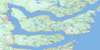
002C11 Bonavista Topo Map
To view this map, mouse over the map preview on the right.
You can also download this topo map for free:
002C11 Bonavista high-resolution topo map image.
Maps for the Bonavista topo map sheet 002C11 at 1:50,000 scale are also available in these versions:
Bonavista Surrounding Area Topo Maps
 |
|||
 |
 |
||
 |
 |
||
 |
 |
 |
© Department of Natural Resources Canada. All rights reserved.
Bonavista Gazetteer
The following places can be found on topographic map sheet 002C11 Bonavista:
Bonavista Topo Map: Bays
Amherst CoveBack Cove
Backside Cove
Bayleys Cove
Birchy Cove
Black Bay
Blackhead Bay
Bonavista Bay
Bonavista Harbour
Broad Cove
Cable John Cove
Castle Cove
Catalina Harbour
Danson Cove
Deep Cove
Elliston Cove
Fish Point Gulch
Keels Cove
Kings Cove
Knights Cove
Lance Cove
Little Catalina Harbour
Monk Bay
Newmans Cove
Open Hall
Plate Cove
Port Union
Red Cove
Rolling Cove
Shepherd Cove
Southeast Cove
Spillars Cove
Tickle Cove
Wild Bay
Wolf Cove
Bonavista Topo Map: Beaches
Southwest BreakerBonavista Topo Map: Capes
Arch Cliff PointArrow Point
Bare Head
Black Head
Broad Head
Burnt Head
Burnt Point
Burnt Point
Calves Nose
Canaille Point
Cape Bonavista
Cape L'Argent
Civil Head
Courages Point
Cuckold Head
Danson Head
Elliston Point
Flowers Point
Goodland Point
Hiscock's Point
Kings Cove Head
Knights Point
Moses Point
North Head
Rowland Head
Shepherd Point
Southern Head
Spillars Point
Western Head
Wolf Head
Bonavista Topo Map: Islands
Green IslandGreen Island
Gull Island
Manuel Island
Manuel Islands
North Bird Island
Red Cliff Island
South Bird Island
Squarry Island
Stone Island
Bonavista Topo Map: Lakes
Abbotts SteadyBeaver Pond
Big Pond
Big Rocky Pond
Broad Cove Pond
Chapel Pond
Cliff Pond
Clift Pond
Corn Pond
Daniels Pond
Diamonds Pond
Dog Pond
Dragnet Pond
Drake Pond
Duck Pond
Earth Ponds
Fishers Pond
Fishpoint Pond
Floods Pond
Fowlows Pond
Franeys Pond
Georges Pond
Grassy Steady
Gull Pond
Gully Pond
Hodderville Pond
Hoddey Pond
Horseshoe Pond
Island Pond
Island Pond
Island Pond
Island Pond
Knights Cove Pond
Lewis Pond
Lewis Pond
Little Island Pond
Little Rocky Pond
Long Pond
Long Pond
Long Pond
Lookout Pond
Lukes Pond
Middle Pond
Monkeys Pond
Morgans Pond
Mouse Hill Pond
Nolan Pond
Oar Pond
Plate Cove Big Pond
Plate Cove Pond
Rocky Pond
Round Pond
Saddle Pond
Slate Pond
Stock Cove Big Pond
Swibbs Cove Pond
Telleys Pond
Tickle Cove Pond
Trout Pond
Trout Pond
Trout Pond
Trouty Pond
Twin Ponds
Two Arm Pond
Whirl Pond
Bonavista Topo Map: Mountains
Burnt RidgeButchers Nose
Geralds Hill
Horse Chops
L'Argent Hill
L'Argent Hill
Snelgroves Hill
The Battery
Bonavista Topo Map: Conservation areas
Dungeon Provincial ParkLieu historique national du Canada de l'Établissement-Ryan
Maberly Provincial Park
Ryan Premises National Historic Site of Canada
Bonavista Topo Map: Rivers
Georges Pond BrookBonavista Topo Map: Shoals
Bacon Bone RockBrandies Shoal
Brandy Rocks
Cary Rock
Charlton Rock
Clam Rock
Dacres Rock
Doctors Ledge
Foggy Rock
Green Ridge
Green Rock
Lowe Rock
Matthews Ground
Pigeon Ledge
Pigeon Rock
Poor Shoal
Red Cove Rock
Red Rock
Skimmerton Ground
Slades Rock
Snurns Ledge
Spillars Ledge
The Brandishes
Tinker Rocks
White Rock
Wizard Rock
Bonavista Topo Map: Towns
BonavistaDuntara
Elliston
Keels
King's Cove
Little Catalina
Trinity Bay North
Bonavista Topo Map: Unincorporated areas
Amherst CoveBirchy Cove
Catalina
Hodderville
Kings Cove
Knights Cove
Lancaster
Lance Cove
Maberly
Middle Amherst Cove
Newmans Cove
Open Hall
Open Hall-Red Cliffe
Plate Cove East
Plate Cove West
Port Union
Red Cliff
Spillars Cove
Spillers Cove
Stock Cove
Tickle Cove
Upper Amherst Cove
Bonavista Topo Map: Villages
Broad Cove
© Department of Natural Resources Canada. All rights reserved.
