St Brendan's Topo Map Online
Download Free Topo Map Sheet 002C13 at 1:50,000 scale
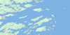
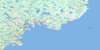
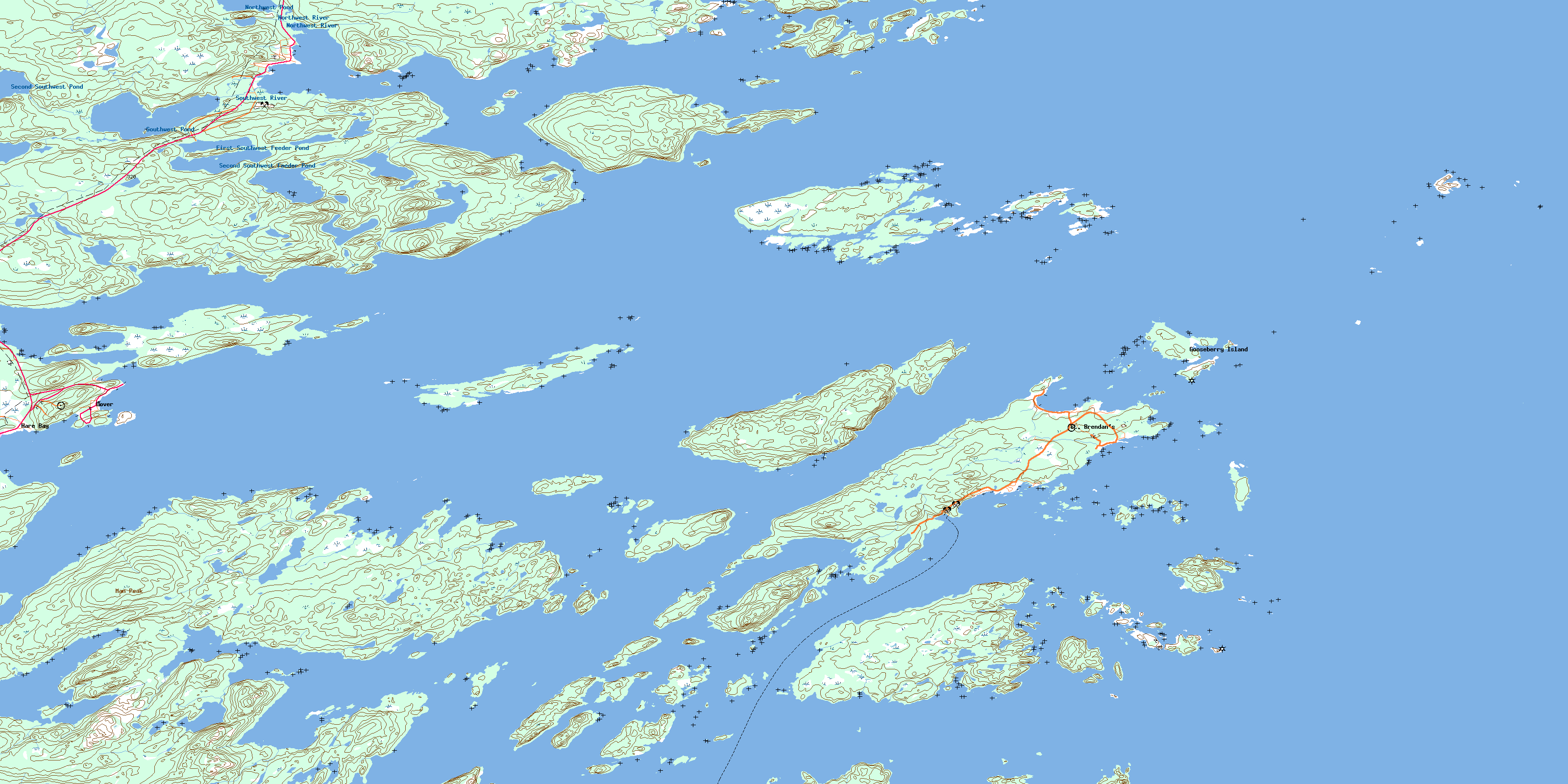
002C13 St Brendan's Topo Map
To view this map, mouse over the map preview on the right.
You can also download this topo map for free:
002C13 St Brendan's high-resolution topo map image.
Maps for the St Brendan's topo map sheet 002C13 at 1:50,000 scale are also available in these versions:
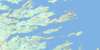
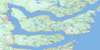
St Brendan's Surrounding Area Topo Maps
 |
|||
 |
 |
||
 |
 |
||
 |
 |
 |
© Department of Natural Resources Canada. All rights reserved.
St Brendan's Gazetteer
The following places can be found on topographic map sheet 002C13 St Brendan's:
St Brendan's Topo Map: Bays
Ackwards CoveAshes Cove
Askel Cove
Back Badger Cove
Back Cove
Badger Cove
Bait Cove
Bait Cove
Barracks Cove
Beaches Cove
Beaches Harbour
Bear Cove
Bear Cove
Big Dog Cove
Black Duck Cove
Black Duck Cove
Black Duck Cove
Blacks Cove
Blacks Cove
Bonavista Bay
Bullocks Cove
Butchers Cove
Butlers Cove
Cannon Head Cove
Carters Cove
Cat Bay
Chalky Cove
Clay Cove
Cottels Arm
Cranberry
Deep Cove
Deep Cove
Dick Allens Cove
Dog Cove
Dog Cove
Drake Cove
Eagle Cove
Fish Cove
Frost Cove
Gander Cove
Gander Cove
Garden Cove
Gilliams Harbour
Goodwithy Harbour
Goose Cove
Gooseberry Harbour
Great Content Cove
Gut Cove
Hancocks Cove
Hare Bay
Hide Away Cove
Iris Cove
Jim Sydneys Cove
Joeys Farm
Lanes Harbour
Little Bait Cove
Little Content Cove
Little Dog Cove
Lockers Bay
Loo Cove
Lower Gander Cove
Man Point Cove
Martins Cove
Mole Cove
Morris Cove
Mouse Island Cove
Muddy Cove
Northeast Bottom
Northern Harbour
Northwest Arm
Northwest Arm
Old House Cove
Old Womans Cove
Osmonds Cove
Pennys Cove
Powell Cove
Rocky Bay
Rocky Bay
Round Harbour
Round Harbour
Salvage Mans Harbour
Seal Cove
Seal Cove
Shadows Harbour
Shoal Bay
Shoal Cove
Southern Harbour
Southwest Arm
Squid Arm
Swile Cove
Three Brooks
Tom Whites Cove
Trinity Bay
Turnip Cove
Upper Gander Cove
Virgin Cove
Western Harbour
Western Harbour
Wild Cove
Winsors Harbour
Yellow Point Cove
St Brendan's Topo Map: Beaches
Cashins BeachDeer Island Lane
Long Beach
Man Point Shore
Nealers Beach
The Beaches
The Pipeberry
Wild Beach
St Brendan's Topo Map: Capes
Angel HeadAshes Cove Head
Beaches Head
Birchy Head
Birchy Head
Bloody Bay Point
Bloody Point
Braggs Point
Burnt Point
Cannon Head
Chalky Head
Charles Head
Connors Point
Deer End
Deer Island End
Dog Point
Draining Point
Goose Cove Point
Gull Point
Hare Cut Point
Hobbs Head
Lewis Head
Little Chalky Head
Long Point
Long Point
Long Point
Man Point Head
Nealers Head
North Point
Pelleys Head
Pinchers Head
Powell Cove Head
Rocky Bay Point
Skerries Head
Souther Point
Southern Point
Stage Head
The Owl
Willis Island Point
St Brendan's Topo Map: Channels
Big TickleBlind Tickle
Burnt Island Tickle
Cat Gut
Cottels Tickle
Dark Hole
Dark Hole
Deer Island Tickle
Gilliams Tickle
Great Swerry Tickle
Long and Hungry
Long Tickle
Marys Tickle
Morris Channel
Pinchers Tickle
Shoal Tickle
Souther Tickle
The Rattle
Trinity Gut
Varket Channel
St Brendan's Topo Map: Islands
Ackwards IslandAsh Island
Ballast Island
Bar Island
Bard Islands
Beef Island
Belle Isle
Berry Head
Bessy Island
Black Duck Island
Black Duck Island
Black Island
Black Puffin
Bloody Island
Braggs Island
Bragg's Island
Broad Island
Brown Islands
Burnt Island
Burnt Island
Card Island
Castle Island
Clay Cove Island
Coal Harbour Island
Coal Island
Coleman Islet
Columbia Island
Cook Room Island
Cottel Island
Cottells Island
Courting Island
Coward Islands
Cut Off
Daleys Island
Deer Island
Deer Islands
Deer Shag Islets
Double Shag Island
Drake Island
Fair Island
Fair Islands
Flat Island
Flat Island
Flat Islands
Flips Island
Fox Island
Fryingpan Island
Full Island
Fuzz Island
Grassy Gull Islet
Grassy Island
Grassy Island
Great Black Island
Green Island
Grindstone Island
Gulch Island
Gull Island
Gull Islets
Hail Island
Hare Bay Island
Hare Island
Hare Island
Hollands Island
Horsechops
Hunch Island
Indian Island
Inner Gooseberry Islands
Inside Battery Island
Jack Barrs Island
Kanes Island
Kellys Island
Lakeman Island
Lewis Island
Little Barr Island
Little Burnt Island
Little Fryingpan Island
Little Grassy Island
Little Island
Little Lakemans Islands
Little Mouse Island
Lockers Flat Island
Martin Island
Martin Sheppards Island
Marys Island
Mole Islands
Morris Island
Mouse Island
North Island
North Island
Offer Gooseberry Island
Old Burnt Island
Outside Battery Island
Partridge Island
Pat Whites Island
Pauls Island
Perlican Island
Philphotts Island
Pincher Island
Pitt Sound Island
Pitts Island
Popplestone Island
Pork Island
Powderhorn Island
Puffin Island
Puffin Island
Puffin Island
Rocky Islands
Round Bottle Island
Saint Island
Samson (Flat) Islands
Sand Islands
Shag Island
Shag Island
Shag Islet
Shelf Island
Shellbird Islands
Ship Island
Shoal Island
South Shag Island
Southern Island
Southwest Island
Taylors Island
The North Brandies
The South Brandies
Tinker Island
Tumbler Island
Turners Island
Varket Islet
Willis Island
Wings Island
Woody Island
Wreck Island
St Brendan's Topo Map: Lakes
Ackwards PondAshes Cove Pond
Bear Cove Pond
Beaver Pond
Blind Pond
Cashins Pond
Chalky Head Pond
Charles Head Pond
Charles Head Steady
Cottels Pond
First Church Pond
First Loo Cove Pond
First Southwest Feeder Pond
First Three Brooks Pond
Flashet
Fourth Three Brooks Pond
Franks Pond
Fryingpan Pond
Georges Pond
Gull Pond
Long Pond
Man Point Pond
Mouse Island Steady
Muddy Pond
Northwest (First) Pond
Northwest Pond
Old Womans Pond
Puncheon Pond
Round Pond
Salt Water Pond
Salt Water Pond
Second Church Pond
Second Loo Cove Pond
Second Pond
Second Southwest Feeder Pond
Second Southwest Pond
Second Three Brooks Pond
Skembisses Pond
Southwest Pond
Third Pond
Third Three Brooks Pond
Tom Whites Pond
Treasures Pond
Treasures Steadies
Turnip Cove Pond
St Brendan's Topo Map: Mountains
Blacks HeadChalky Hills
Hart Hill
Man Peak
St Brendan's Topo Map: Rivers
Blacks BrookContent Brook
Northwest River
Southwest River
St Brendan's Topo Map: River features
Bloody Bay ReachBloody Reach
Content Reach
Cottel Reach
Lakeman Reach
Lockers Reach
Pitt Sound Reach
Willis Reach
St Brendan's Topo Map: Shoals
Anstey RockBakers Loaf
Berry Rocks
Big Grassy Gull Rocks
Billy Rock
Black Rock
Black Rock
Black Rock
Blue Gull Rock
Braggs Rock
Bruce Cove Rock
Columbia Rock
Content Rocks
Easter Rocks
Fishing Rock
Flat Rock
Freds Rock
Grassy Rock
Grassy Rocks
Grassy Rocks
Grassy Shag Rock
Gulch Island Rock
Gull Rocks
Inner Brandy Rock
Johnny Browns Rocks
Keans Rock
Lackington Rock
Malone Rock
Man of War Rock
Middle Rocks
Mooring Rocks
Mount Stamford Rock
North Brown Rocks
Pinchers Rocks
Prentice Rock
Rugged Rocks
Saint Rock
Saturday Ledge
Shag Rock
Ships Rock
South BrownRocks
Stoney Rock
The Dumpling
Twin Rock
Virgin Rock
Whelping Rock
St Brendan's Topo Map: Towns
Centreville-Wareham-TrinityDover
Hare Bay
St. Brendan's
Wellington
St Brendan's Topo Map: Unincorporated areas
Bragg's IslandDeer Island
Dock Cove
Fair Island
Flat Islands
Gooseberry Island
Haywards Cove
Round Harbour
Samson
Shalloway Cove
Sydney Cove
Trinity
St Brendan's Topo Map: Low vegetation
Big MarshTims Marsh
© Department of Natural Resources Canada. All rights reserved.
