St Julien's Topo Map Online
Download Free Topo Map Sheet 002M04 at 1:50,000 scale
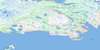
002M04 St Julien's Topo Map
To view this map, mouse over the map preview on the right.
You can also download this topo map for free:
002M04 St Julien's high-resolution topo map image.
Maps for the St Julien's topo map sheet 002M04 at 1:50,000 scale are also available in these versions:
St Julien's Surrounding Area Topo Maps
 |
 |
||
 |
 |
||
 |
|||
 |
© Department of Natural Resources Canada. All rights reserved.
St Julien's Gazetteer
The following places can be found on topographic map sheet 002M04 St Julien's:
St Julien's Topo Map: Bays
Admiralty CoveAriege (Belvy) Bay
Bière Cove
Big Spring Inlet
Buse Point Bay
Canada Cove
Capelan Bay
Capelaniers Bay
Caplan Bay
Corbeau Cove
Courlieux Cove
Cow Bay
Croque Harbour
Deep Bay
Drac Bay
Épine Cadoret
Fischot Harbour
Fishermans Cove
Flamands Cove
Four Harbour
Grandois Harbour
Great Buse Bay
Great Islets Harbour
Great St. Julien Harbour
Green Cove
Grise Point Bay
Groux Bay
Hare Bay
Houardin Cove
Irish Bay
Kearney Cove
Landing Cove
Large Stone Bay
Le Fond
Little Islets Harbour
Little Spring Inlet
Little St. Julien Harbour
Long Bay
Maiden Arm
Million Cove
Moules Bay
Park Cove
Pelletier Bay
Plover Bay
Port Cove
Prince Edward Bay
Salmon Bay
Sculpin Gulch
Shoal Arm
Southern Arm
Square Cove
Starboard Cove
Trois Isles Bay
Trompeuse Bay
Verte Bay
Virgin Bay
W Cove
St Julien's Topo Map: Capes
Bald HeadBlanche Point
Bonhomme Point
Burnt Point
Calas Point
Cape Croix
Cape Eagle
Chevaliers Point
Cow Point
Echelle Point
Genille Point
Grelins Point
Grise Point
Groux Point
Hacketts Head
Indre Point
Jeanne Point
Jehenne Point
Johnson Point
La Source Point
Little St. Julien Point
Loup Marin Point
Maiden Point
Malouine Point
Moustiques Point
Northeast Point
Northern Peninsula
Observation Point
Point Enragée (Fish Point)
Pointe à l'Aurore
Rets Point
River Point
Sculpin Point
Tortoise Point
Vide Bidon Point
Watering Cove Point
Windy Point
St Julien's Topo Map: Channels
American TickleEaster Tickle
Fischot Channel
Le Goulot
St. Julien Tickle
St Julien's Topo Map: Islands
Bare IslandBasse Island
Bigue Island
Black Island
Brent Islands
Cailloux Island
Chaberet Island
Charles Island
Chasseurs Island
Corbeau Island
Deaths Head Island
Demètre Island
Devarenne (Bushy) Island
Direction Island
Double Island
Elizabeth Island
English Island
Fischot Island
Frommy Island
Gilliat Island
Goelands Island
Goose Island
Great Cormorandier Island
Great Verdon Island
Gros Plomb Island
Little Cormorandier Island
Little Madame Island
Little Verdon Island
Long Island
Louisa Island
MacGray Island
Madame Island
Maria Island
Massacre Island
Melier Island
Monk Island
Northeast Island
Observatory Island
Paul Island
Petit Rocher
Pigeon Island
Port Island
Pouilleux Island
Pradet Island
Shoal Arm Island
South Island
Spring Island
St. Julien Island
Starboard Island
St Julien's Topo Map: Lakes
Coles PondSalt Pond
Tom Roses Pond
White Hump Pond
St Julien's Topo Map: Mountains
Alma HillBay Peak
Boussole Hill
Direction Hill
Forest Hill
Genille Peak
Great Buse
La Source Hill
Little Buse
St. Julien Peak
The Peak
Tortoise Hill
St Julien's Topo Map: Conservation areas
Hare Bay Ecological ReserveHare Bay Seabird Ecological Reserve
St Julien's Topo Map: Rivers
Cascade StreamFreshwater Creek
St Julien's Topo Map: Shoals
Baleineau LedgeBrent Rock
Bruyantes Rock
Buse Point Bank
Camus Shoal
Corlet Shoal
Cow Shoal
Direction Reef
Duchayla Rock
Glaziou Shoal
Goelands Rock
Great Cormorandier Rock
Indre Shoal
Jehenne Shoal
La Baleine Rock
La Baleine Rock
Le Muloux
Lecorre Rock
Legendre Shoal
Louis Lemaire Shoal
Massacre Rock
Melier Rock
Melier Shoal
Mid-Channel Rock
Mulou Shoal
Northwest Shoal
Piroque Shoal
Répissé Shoal
Ship Shoal
Souriceau Rock
Souris Rock
Sournoise Shoal
Tetard Bank
Thistle Shoal
Virgin Shoal
St Julien's Topo Map: Towns
Main BrookSt Julien's Topo Map: Unincorporated areas
Burnt VillageCroque
Croque
Croque
Fischot Islands
Four Harbour
Grandois
Kenney's Cove
North East Croque
Pointe à l'Aurore
South West Croque
Southwest Croque
Spring Village
St. Juliens
St. Julien's
St Julien's Topo Map: Villages
Fishot Islands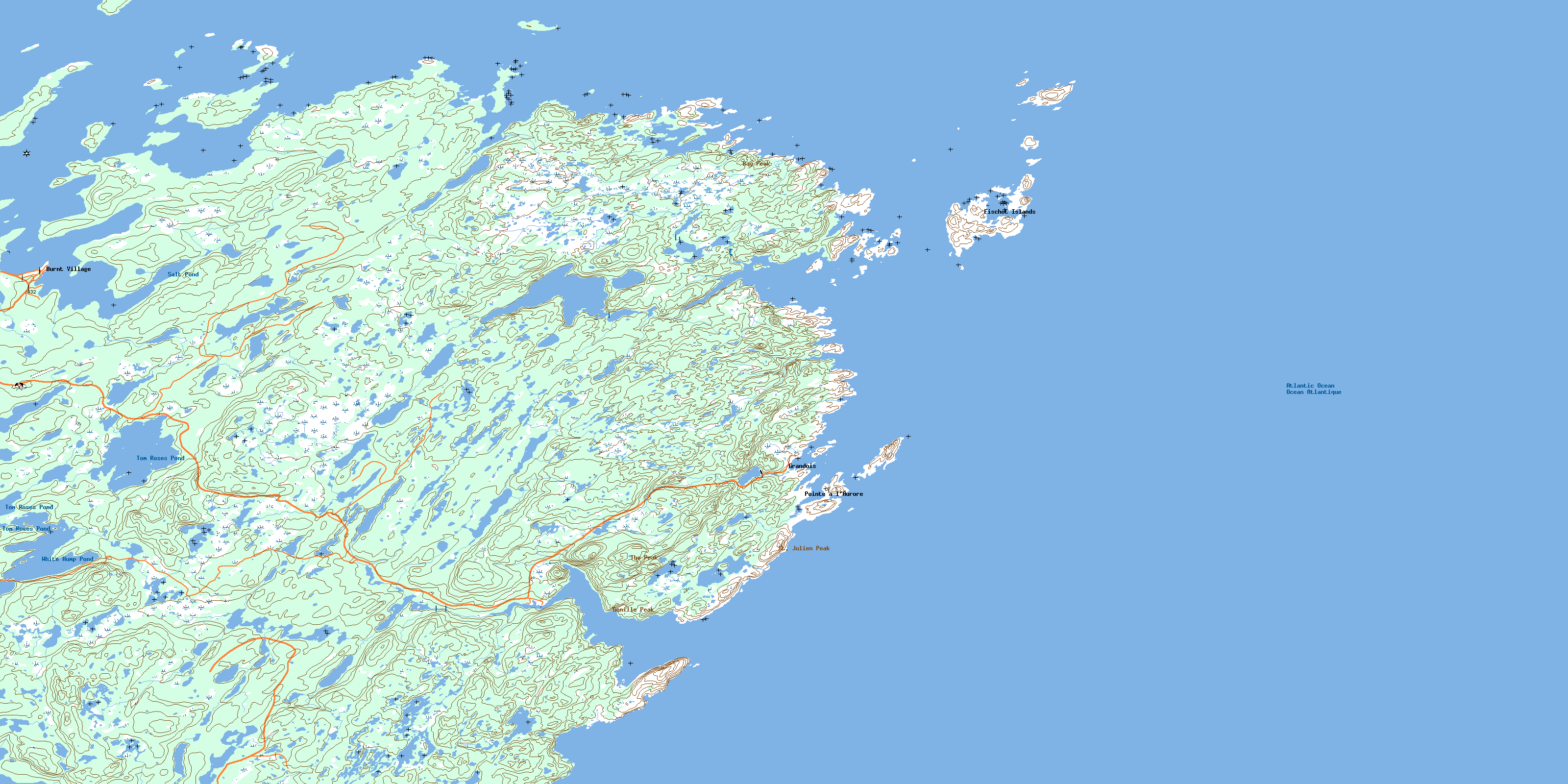
© Department of Natural Resources Canada. All rights reserved.
