Quirpon Topo Map Online
Download Free Topo Map Sheet 002M11 at 1:50,000 scale
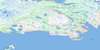
002M11 Quirpon Topo Map
To view this map, mouse over the map preview on the right.
You can also download this topo map for free:
002M11 Quirpon high-resolution topo map image.
Maps for the Quirpon topo map sheet 002M11 at 1:50,000 scale are also available in these versions:
Quirpon Surrounding Area Topo Maps
 |
 |
||
 |
 |
||
 |
|||
 |
© Department of Natural Resources Canada. All rights reserved.
Quirpon Gazetteer
The following places can be found on topographic map sheet 002M11 Quirpon:
Quirpon Topo Map: Bays
Camel Island HarbourCapelanier Bay
Clous Cove
Clue Cove
Cod Cove
Colombier Cove
Dégrat Harbour
Garden Cove
Garden Cove
Good Cove
Grand Cove
Grand Galets Bay
Grapnel Cove
Grassy Cove
Great Cove
Griquet Harbour
Jacques Cartier Road
La Reine Cove
Lancy Ball Bay
Lighthouse Cove
Little Quirpon Harbour
Noble Cove
Noddy Bay
North Bay
Northwest Bay
Orleans Cove
Pigeon Cove
Quirpon Harbour
Ron Galets Bay
Southwest Bay
Trinity Bight
White Cape Harbour
Wood Bay
Quirpon Topo Map: Capes
Alun PointBay Point
Breaker Point
Broize Point
Cape Bauld
Cape Dégrat
Cape Mauve
Cape Noir
Cape Raven
Cobbler Point
Cod Cove Point
Colombia Point
Cove Point
Dumenil Point
Galets Head
Grand Galets Point
Green Point
Herbert Point
Lancy Ball Point
Noble Point
Noddy Bay Head
Noddy Point
Northern Peninsula
Orleans Point
Partridge Point
Point Vert
Ron Galets Head
Sealet Head
Split Point
Storm Cape
Tempest Point
Whale Point
White Cape
White Point
Wild Cove Point
Quirpon Topo Map: Channels
Détroit de Belle IsleSheep Channel
Strait of Belle Isle
Quirpon Topo Map: Islands
Big Cobbler IslandBlack Island
Camel Island
Crab Island
Dégrat Island
Foirou Island
Four Ears Island
Grandmother Island
Griquet Island
Jacques Cartier Island
Little Cobbler Island
Merchant Island
Nobles Island
Prune Island
Quirpon Island
Salt Island
Sheep Island
Ship Island
The Islets
Vincent Island
White Islands
Quirpon Topo Map: Mountains
Crow HeadHump Hill
Morne Fontan
Morne Fontan Hill
Round Hill
Quirpon Topo Map: Shoals
Baleine RockBarrack Rocks
Barracks Rocks
Butterpot Rock
Canias Rock
Corco Bank
Lancy Pigeon
Lancy Pigeon Bank
League Rock
Madeleine Shoal
Maria Reefs
Peaked Rock
Salmon Rock
Sheep Bank
Ship Island Bank
Whale Back
White Rocks
Quirpon Topo Map: Towns
St. Lunaire-GriquetQuirpon Topo Map: Unincorporated areas
GriquetGunners Cove
Hay Cove
Little Quirpon
Noddy Bay
Quirpon
Spillards Cove
Spillars Cove
St. Lunaire
Straitsview
Straitsview
Quirpon Topo Map: Valleys
Deep Gulch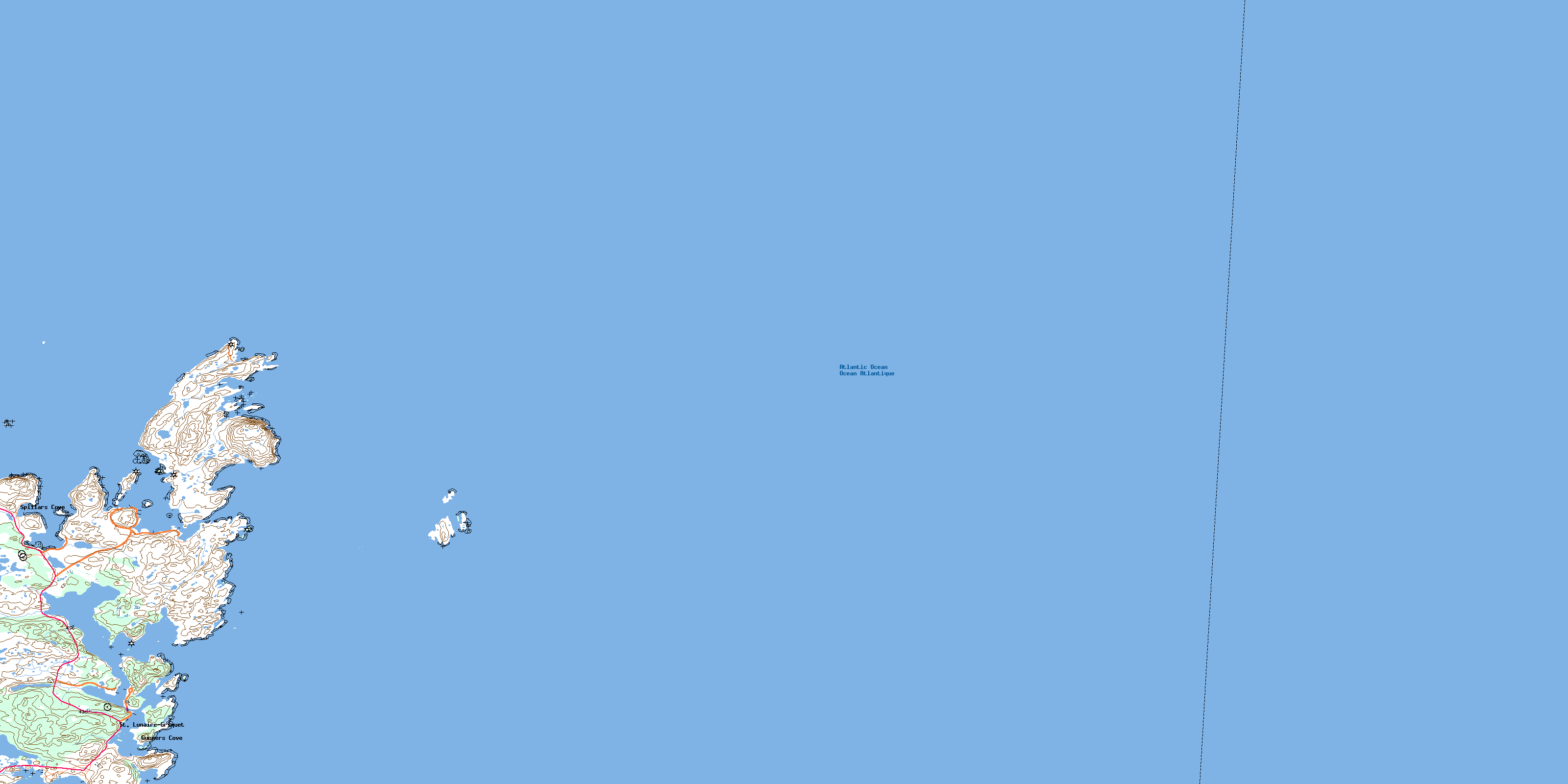
© Department of Natural Resources Canada. All rights reserved.
