Lockeport Topo Map Online
Download Free Topo Map Sheet 020P11 at 1:50,000 scale
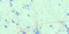
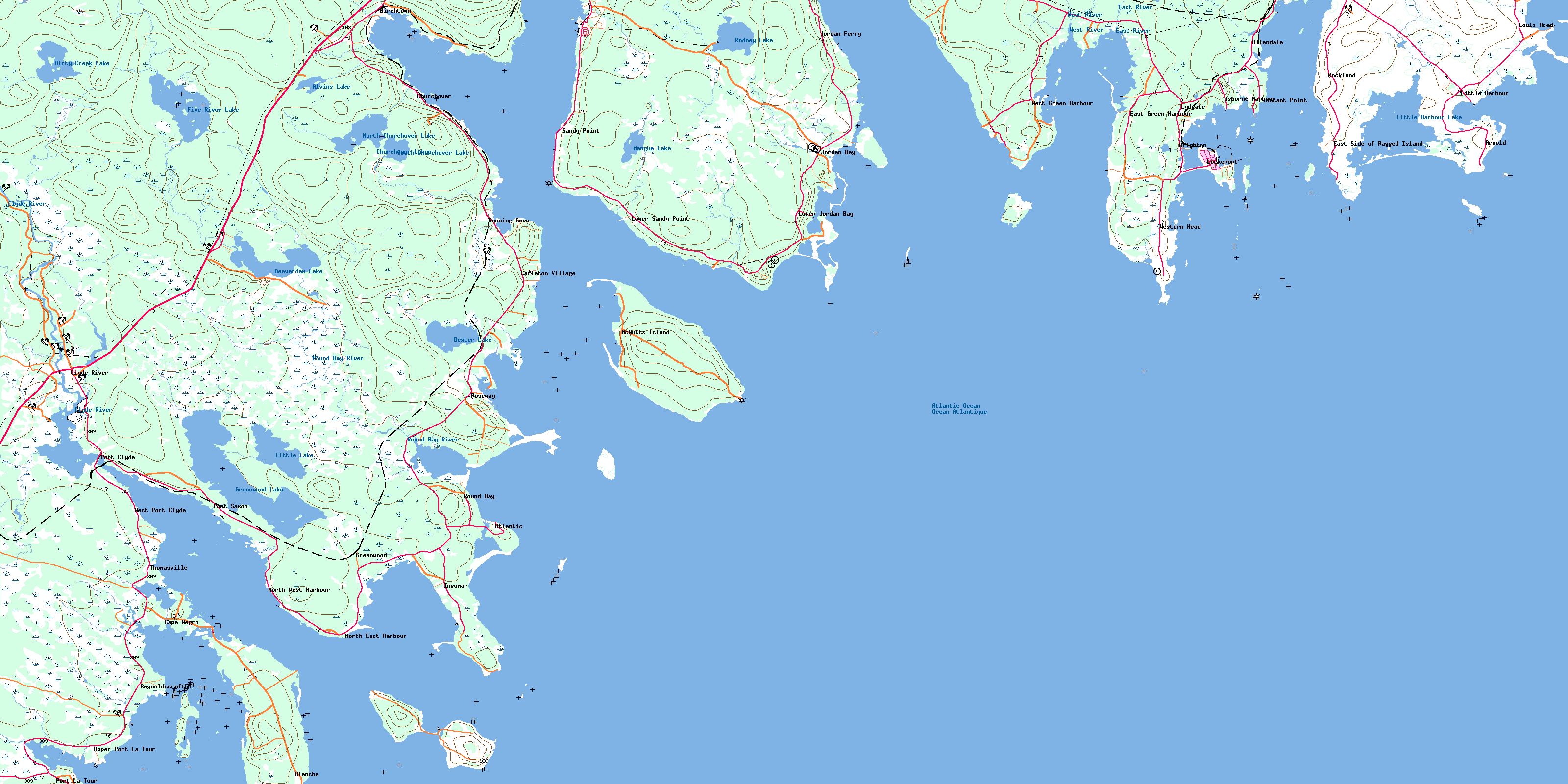
020P11 Lockeport Topo Map
To view this map, mouse over the map preview on the right.
You can also download this topo map for free:
020P11 Lockeport high-resolution topo map image.
Maps for the Lockeport topo map sheet 020P11 at 1:50,000 scale are also available in these versions:
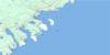
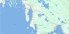
Lockeport Surrounding Area Topo Maps
 |
 |
 |
|
 |
 |
||
 |
 |
||
© Department of Natural Resources Canada. All rights reserved.
Lockeport Gazetteer
The following places can be found on topographic map sheet 020P11 Lockeport:
Lockeport Topo Map: Bays
Back HarbourBerrys Bay
Bills Cove
Birchtown Bay
Black Point Bay
Blackbeards Cove
Blanche Cove
Clam Creek
Clarks Cove
Dung Cove
East Cove
Front Harbour
Green Harbour
Gunning Cove
Hagars Cove
Hell Hole
Jordan Bay
Little Harbour
Lockeport Harbour
Lyles Bay
Malcolms Cove
McGrath Cove
Myrtle Cove
Negro Harbour
North East Harbour
Northeast Harbour
Northwest Creek
Osborne Harbour
Paddys Cove
Pauls Cove
Pond Cove
Port La Tour
Port Latour
Roaches Cove
Roseway Harbour
Round Bay
Sheep Bar Cove
Shelburne Bay
Shelburne Harbour
Slates Creek
Stephens Cove
Stoney Cove
Swaines Cove
The Anchorage
Townsends Harbour
Upper Island Bay
West Cove
Lockeport Topo Map: Beaches
Black Point BeachBlacksmiths Beach
Blow Breaker
Blow Breaker (Eastern Bull)
Carleton Village Shore
Crescent Beach
Egg Beach
Emulous Breakers
Hales Beach
Long Beach
Long Beach
Lower Beach
MacKenzies Breaker
Pierces Beach
Pollys Meadow Beach
Rood Head Breaker
Roseway Beach
Sheep Bar
Southeast Breaker
Southwest Breaker
Southwest Breakers
The Bar
The Horseshoe
The Marsh Bar
West Point Breaker
Lockeport Topo Map: Capes
Abbotts PointBethels Point
Black Point
Bony Point
Burnt Head
Cape Negro
Cape Roseway
Captain Jones Point
Conrads Point
Cranes Point
Cumming Point
Dahls Point
Days Point
East Point
East Point
Fish Flake Point
Fort Point
Fort Point
Government Point
Hart Point
Harts Point
Haystack Head
Hemeon Head
Hemeons Head
Hemeons Point
Isaac Ackers Point
Jenkins Head
Jennys Point
John Point
Jordan Point
Locke Point
Louis Head
Middle Head
Northwest Spit
Northwest Spit
Oak Point
Patterson Point
Pattersons Point
Pleasant Point
Pompee Point
Purgatory Point
Raspberry Head
Red Head
Rood Head
Sams Point
Sand Point
Sandy Point
Sarah Lees Point
Seal Point
Shingle Point
Shooting Point
Southwest Point
Sperrys Point
Stokes Head
Stoney Point
Surf Point
Surf Point
Wallaces Point
West Point
Western Head
Western Head
Lockeport Topo Map: Channels
Bangays HoleEast Entrance
Eastern Way
Fairway Passage
Lockeport Western Way
Narrow Passage
Ram Island Passage
Ram-island Passage
The Gut
The Guzzle
The Haulover
The Passageway
West Entrance
Western Way
Wide Passage
Lockeport Topo Map: Cliffs
Northeast BluffRed Bank
Lockeport Topo Map: Falls
Nelsons FallsQuinns Falls
Lockeport Topo Map: Geographical areas
ShelburneLockeport Topo Map: Islands
Ambers IslandApple Island
Benham Island
Berrys Island
Big Island
Blue Gull Island
Blue Island
Boxing Island
Brant Thrum
Bruce Island
Bull Island
Cape Negro Island
Carter Island
Carters Island
Clam Island
Clarks Island
Cranberry Island
Davis Island
De Mings Island
Demings Island
Douglas Island
Firth Island
Fox Island
Gooseberry Island
Green Island
Grey Island
Hughes Island
Jenkins Island
John Island
Johns Island
Kenney Island
Locke Island
Lockes Island
MacKays Island
McLean Island
McNutt Island
McNutts Island
Mink Island
Mink Island
Nicholson Island
Potato Island
Rain Island
Ram Island
Ram Island
Round Island
Round Island
Snows Thrum
Spectacle Island
Squaw Island
Stephens Island
Sugar Loaf Island
Tea Chest Island
Tea-chest Island
The Nubble
Thrum Cap
Thrum Island
Tony Island
William Island
Williams Island
Lockeport Topo Map: Lakes
Alvin LakeAlvins Lake
Beaverdam Lake
Church Over Lakes
Churchover Lakes
Dexter Lake
Dirty Creek Lake
Dirty-creek Lake
Five River Lake
Fresh Pond
Gibsons Pond
Gooseberry Pond
Greenwood Lake
Hardys Millpond
Jobs Pond
Lily Pond
Little Harbour Lake
Little Lake
Long Beach Pond
Mangum Lake
Matthews Lake
Morris Lake
North Churchover Lake
Pulpmill Pond
Rodney Lake
Salt Pond
South Churchover Lake
Swims Iceponds
Lockeport Topo Map: Mountains
Church HillFox Ridges
Ginger Hill
Reids Hill
Lockeport Topo Map: Major municipal/district area - major agglomerations
BarringtonShelburne
Lockeport Topo Map: Rivers
Ackers BrookAlvins Lake Brook
Beaverdam Brook
Birchtown Brook
Bowers Brook
Clyde River
Dexter Lake Brook
Dirty Creek
East Brook
East River
Goose Creek
Judas Creek
Kens Brook
Little Goose Creek
MacDonalds Creek
Mill Creek
Old Barn Brook
Reuben Meisners Brook
Round Bay River
Round-bay River
Sandy Point Brook
South Churchover Lake Brook
Stewarts Brook
Stokes Brook
Thurstons Creek
West Brook
West River
Western Extension
Western Extension Brook
Lockeport Topo Map: Shoals
Abundance RockAdamant Rock
Adamant Shoal
Alicks Rock
Bartletts Ledge
Bell Rock
Big Dick
Big Flat Rock
Big Ledge
Big Ledge
Bird Rock
Black Point Ledges
Black Point Rock
Black Rock
Black Rocks
Blind Dick
Boxing Rock
Brig Georges Ledge
Budget Rock
Bull Rock
Chain Ledge
Clay Bank
Collupy Rock
Cottmans Rock
Cove Rock
Dumpling Rock
Dunns Rock
Emulous Reef
Evelyns Rock
Farm Ledge
Five Fathom Shoal
Fort Rock
Fox Bar
Franks Ledge
Georges Rock
Gids Ledge
Grey Rocks
Grog Rock
Gull Rock
Gull Rock
Halibut Tail Shoal
Hart Point Rock
Harts Point Rock
Jaw Lock
Jig Rock
John Smiths Ledge
Johns Island Rock
Jordan Bay Gull Rock
Kelp Shoal
Laurier Rock
Little Dick
Little Flat Rock
Long Rock
Long Shoal
Lower Wharf Rock
Mackerel Rock
Mackerel Rock
Mad Rocks
Man of War Rock
McKay Rock
Middle Ground
Middle Ledge
Middle Rock
Middle Rock
Mohawk Ledge
Net Rock
Old Cow Reef
Old Mother Slate Rock
Outer Farm Ledge
Peppers Rock
Potter Ledge
Potters Ledge
Round Rock
Round Rock
Round Shoal
Sams Rock
Scalp Rock
Sea Dogs
Sea-dogs
Seal Ledge
Seal Ledges
Seal Point Ledge
Seal Rocks
Shag Rock
Soldiers Ledge
South Ledge
Southeast Reef
Southwest Rock
Southwest Rocks
Spoon Ledge
Strap Tub Rock
Strap-tub Rock
Sunken Ledge
Teakettle Rocks
The Doughboy
The Hummock
The Jolt
The Sisters
The Sisters
Three Fathom Shoal
Thrum Rock
Thrumcap Ledge
Thrumcap Rock
Tickey Shoal
Tickeys Shoal
Triangle Rocks
Trinidad Rock
Upper Ledge
Upper Wharf Rock
Whale Rock
Wharf Rock
Lockeport Topo Map: Towns
LockeportLockeport Topo Map: Unincorporated areas
AllendaleArnold
Atlantic
Birchtown
Blanche
Brighton
Cape Negro
Cape Negro Island
Carleton Village
Church Over
Churchover
Clyde River
Crowell
East Green Harbour
East Side of Ragged Island
Green Harbour
Greenwood
Gunning Cove
Ingomar
Jordan Bay
Jordan Ferry
Little Harbour
Lockeport Station
Louis Head
Lower Jordan Bay
Lower Sandy Point
Lydgate
McNutt Island
McNutts Island
North East Harbour
North West Harbour
Osborne Harbour
Pleasant Point
Port Clyde
Port La Tour
Port Latour
Port Saxon
Reynoldscroft
Rockland
Roseway
Round Bay
Sandy Point
Swansburg
Thomasville
Upper Port La Tour
Upper Port Latour
West Green Harbour
West Port Clyde
Western Head
Lockeport Topo Map: Low vegetation
Bowers MeadowsDirty Creek Bog
Quinns Meadow
The Bog
The Marsh
© Department of Natural Resources Canada. All rights reserved.
