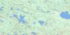
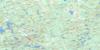
Round Lake Topo Map Online
Download Free Topo Map Sheet 031F12 at 1:50,000 scale
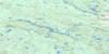
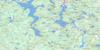
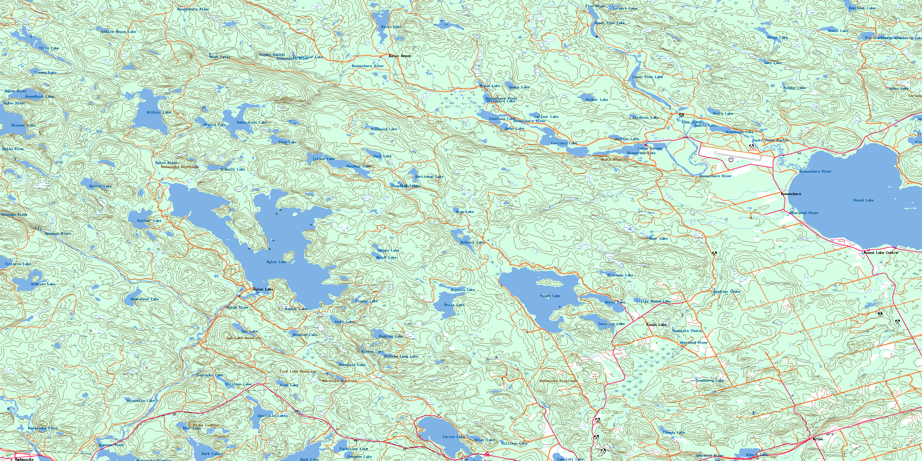
031F12 Round Lake Topo Map
To view this map, mouse over the map preview on the right.
You can also download this topo map for free:
031F12 Round Lake high-resolution topo map image.
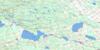
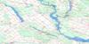
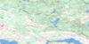
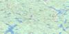
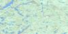
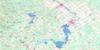
Maps for the Round Lake topo map sheet 031F12 at 1:50,000 scale are also available in these versions:
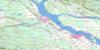
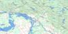
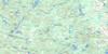
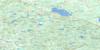
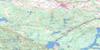
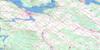
Round Lake Surrounding Area Topo Maps
 |
 |
 |
 |
 |
 |
 |
 |
 |
 |
 |
 |
 |
 |
 |
 |
© Department of Natural Resources Canada. All rights reserved.
Round Lake Gazetteer
The following places can be found on topographic map sheet 031F12 Round Lake:
Round Lake Topo Map: Bays
Bell BayBells Bay
Bonnechere Bay
Burnt Depot Bay
Burnt Shanty Bay
Dennisons Bay
Dunne's Bay
Enos Bay
Little Cub Bay
Reynolds Bay
Rorys Bay
Smiths Bay
St. Patricks Bay
White Mountain Bay
Round Lake Topo Map: Capes
Black PointLong Point
Round Lake Topo Map: Channels
Gaudreaus NarrowsGreenwoods Narrows
Thomas Narrows
White Mountain Narrows
Round Lake Topo Map: Falls
High FallsJenkins Chute
Mountain Chute
Round Lake Topo Map: Geographical areas
BurnsClancy
Dickens
Guthrie
Hagarty
Jones
Lyell
Master
Murchison
Nipissing
Richards
Sherwood
Round Lake Topo Map: Islands
Big Green IslandBurnt Island
Cherry Island
Crab Island
Edwards Island
Idylwild Island
Little Green Island
McGuires Island
Pine Island
Sleigh Island
Tight Little Island
Turkey Island
Victoria Island
Round Lake Topo Map: Lakes
Achillea LakeAcorn Lake
Albert Lake
Alsever Lake
Arabis Lake
Argue Lake
Aylen Lake
Baldwins Lake
Balfour Lake
Bark Lake
Basin Lake
Bear Lake
Bear Lake
Beaverdam Lake
Beechnut Lake
Begonia Lake
Big Cranberry Lake
Billings Lake
Breezy Lake
Brule Lake
Burnetts Pond
Burns Lake
Carson Lake
Chapeskis Lake
Clancy Lake
Cloudy Lake
Cloverleaf Lake
Couchain Lake
Couchain Lakes
Couchain Lakes
Couchain Lakes
Couchain Lakes
Cranberry Lake
Creepy Lake
Curriers Lake
Cybulski Lake
Deacon Lake
Dickens Long Lake
Divazie Lake
Dodge Lake
Drohans Ponds
Duck Lake
Finger Lake
Fish Lake
Gun Lake
Haskins Lake
Hoist Lake
Island Lake
Jack Lakes
Jacks Lake
Jacks Lakes
Jenkins Lake
Jocko Lake
Johns Lake
Kretzel Lake
Lafleur Lake
Laycocks Lake
Little Carson Lake
Little Cranberry Lake
Little Cub Lake
Little Hogan Lake
Little Pike Lake
Little Round Lake
Lough Garvey
Lower Pine Lake
Lupine Lake
Martineau Lake
McDonald Lake
McDonalds Pond
McGuire Lake
McKenzie Pond
McLachlin Lake
McNevin Lake
Mick Lake
Minkspaw Lake
Minnow Lake
Mishap Lake
Monkshood Lake
Moose Lake
Mountain Lake
Mugho Lake
Murphys Lake
Nipren Lake
O'Neill Lake
Oram Lake
Otter Lake
Parissien Lake
Paugh Lake
Pergeon Lake
Pike Lake
Pine Lake
Rabbit Lake
Rabbittail Lake
Redpine Lake
Rich Lake
Robitaille Lake
Rocko Lake
Rorys Lake
Round Lake
Roundbush Lake
Ruddy Lake
Ruddys Lake
Salvia Lake
Sam Lake
Sams Lake
Speckled Lake
Spectacle Lakes
Spruce Lake
Spruce Pond
St. Patricks Lake
Stevenson Lake
Stringers Lake
Stubbs Lake
Sullivan Lake
Supply Lake
Surprise Lake
Sweaks Pond
Trout Lake
Turners Lake
Upper Pine Lake
Victoria Lake
Vireo Lake
Walker Lake
Wilkins Lake
Wolfsden Lake
Woodsher Lake
Yantha Lake
Round Lake Topo Map: Mountains
Angelo HillBillings Hill
Buck Hill
Burnetts Mountain
Fish Lake Mountain
Flat Top Hill
Fox Hill
Gariepy Mountains
Gun Lake Mountain
Keetch's Mountain
Kluke Lookout
Lost Hill
Madawaska Highlands
Oak Hill
Opeongo Knob
Paint Hill
Pauls Hill
Shrine Hill
Squaw Rock
Twin Matthews Hills
White Mountain
Wilno Hills
Round Lake Topo Map: Other municipal/district area - miscellaneous
AiryHagarty and Richards
Killaloe, Hagarty and Richards
Madawaska Valley
Radcliffe
Sherwood, Jones and Burns
South Algonquin
Round Lake Topo Map: Conservation areas
Algonquin Provincial ParkBell Bay Provincial Park
Bonnechere Provincial Park
Bonnechere River Provincial Park
Carson Lake Provincial Park
Foy Property Provincial Park
Opeongo River Provincial Park
Upper Madawaska River Provincial Park
Round Lake Topo Map: Rapids
Jacks Chute RapidsPriests Rapids
Stacks Rapids
Round Lake Topo Map: Rivers
Aylen RiverBasin Creek
Bonnechere River
Byers Creek
Clancy Creek
Dupuis Creek
Hogan Creek
Jack Creek
Jacks Creek
Little Cranberry Creek
Madawaska River
McNevin Creek
Opeongo River
Paugh Creek
Pine River
Rabbittail Creek
Reserve Creek
Richards Creek
Robitaille Creek
Sherwood River
Turner Creek
Turners Creek
Wilkins Creek
Zummachs Creek
Round Lake Topo Map: Shoals
McGuirl RockRound Lake Topo Map: Unincorporated areas
Aylen LakeAylen Lake Station
Bark Lake
Basin Depot
Bonnechere
Madawaska
Opeongo
Paugh Lake
Round Lake Centre
Simpsons
Wilno
Round Lake Topo Map: Valleys
Wilno PassRound Lake Topo Map: Low vegetation
Aylen MarshBear Marsh
Brimers Marsh
Burnetts Marsh
Dennisons Marsh
Gun Lake Marsh
Peters Marsh
Sherwood Marsh
© Department of Natural Resources Canada. All rights reserved.
