Carleton Place Topo Map Online
Download Free Topo Map Sheet 031F01 at 1:50,000 scale
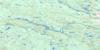
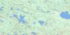
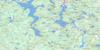
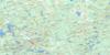
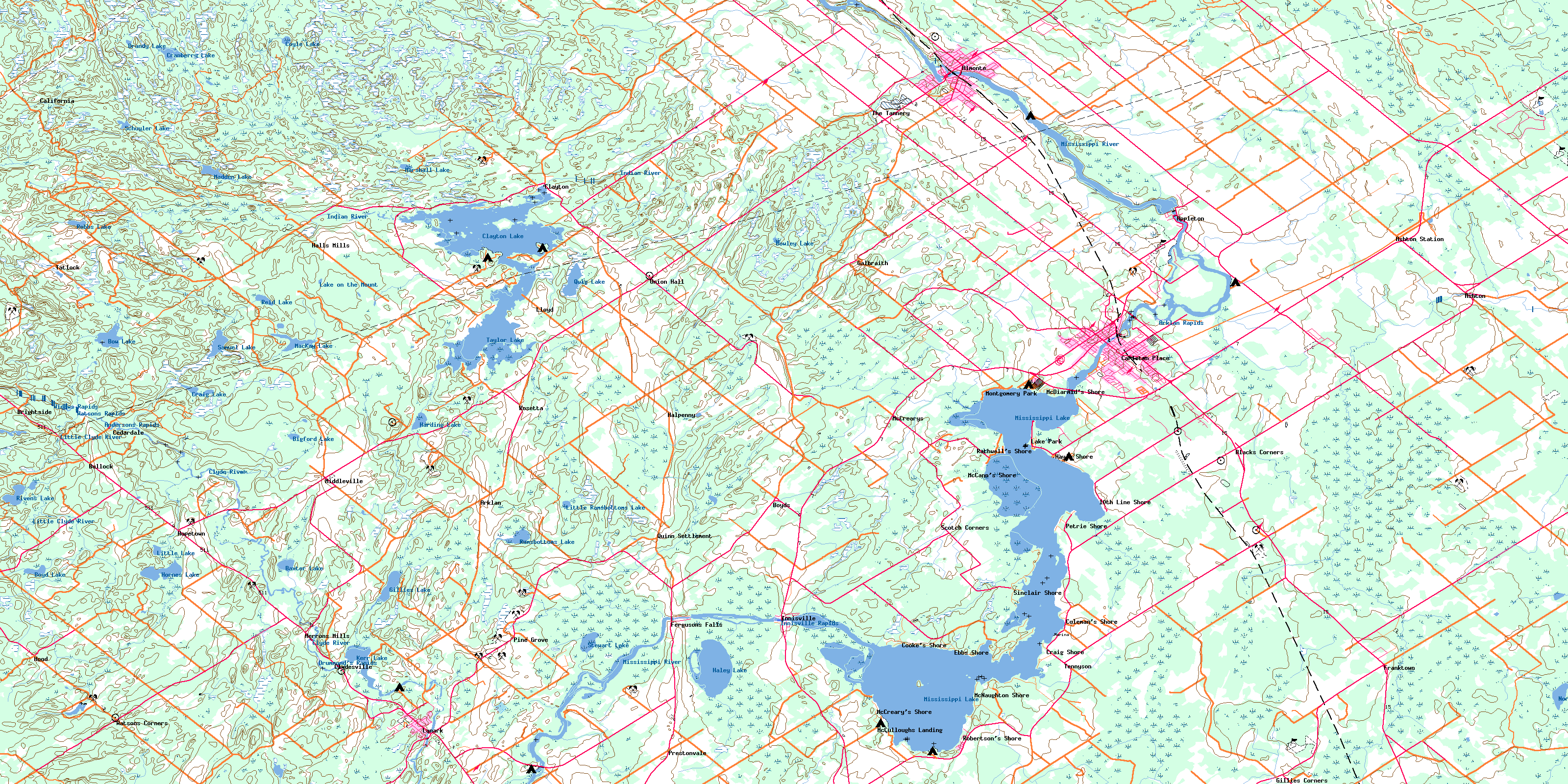
031F01 Carleton Place Topo Map
To view this map, mouse over the map preview on the right.
You can also download this topo map for free:
031F01 Carleton Place high-resolution topo map image.
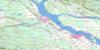
Maps for the Carleton Place topo map sheet 031F01 at 1:50,000 scale are also available in these versions:
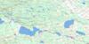
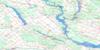
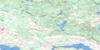
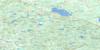
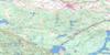
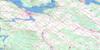
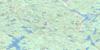
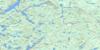
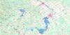
Carleton Place Surrounding Area Topo Maps
 |
 |
 |
 |
 |
 |
 |
 |
 |
 |
 |
 |
 |
 |
 |
 |
© Department of Natural Resources Canada. All rights reserved.
Carleton Place Gazetteer
The following places can be found on topographic map sheet 031F01 Carleton Place:
Carleton Place Topo Map: Bays
Black Bass BayCode Bay
Duff Bay
Ebbs Bay
Flintoft Bay
Greers Bay
Hunters Bay
Kinch Bay
King Bay
Kings Bay
Mallochs Bay
McEwen Bay
McGibbon Bay
Osborne Bay
Potato Bay
Pretties Bay
Thomson Bay
Carleton Place Topo Map: Capes
Allan PointAllans Point
Anchor Point
Birch Point
Black Point
Brown Point
Dixon Point
Ebbs Point
Father Point
Grasshopper Point
King Point
Mannies Point
Manny Point
Manny's Point
McGibbon Point
McNaughton Point
Norway Point
Pickerel Point
Poole Point
Robertson Point
Robertson's Point
Rocky Point
Squaw Point
Two Oaks Point
Carleton Place Topo Map: Channels
The RiverCarleton Place Topo Map: City
OttawaCarleton Place Topo Map: Cliffs
High BankCarleton Place Topo Map: Forests
The Burnt LandsWolf Grove
Wolves Grove
Carleton Place Topo Map: Geographical areas
BeckwithDalhousie
Darling
Drummond
Goulbourn
Huntley
Lanark
Lanark
Montague
National Capital Region
Pakenham
Ramsay
Région de la Capitale nationale
Carleton Place Topo Map: Islands
Aberdeen IslandArklan Island
Birch Island
Bowlands Island
Burnt Island
Burnt Islands
Commodore Island
Dinkey-Dooley Island
Glen Isle
Grape Island
Greig Island
Hughes Island
Ireton Island
King Island
Long Island
Long View Island
Loon Island
Menzies Island
Morris Island
Pine Island
Pretties Island
Sand Island
Stafford Island
The Two Crabs
Willis Island
Wilson Islands
Carleton Place Topo Map: Lakes
Aitkman LakeBaxter Lake
Bigford Lake
Bow Lake
Bowley Lake
Boyd Lake
Brandy Lake
Clayton Lake
Coyle Lake
Craig Lake
Cranberry Lake
Gillies Lake
Haley Lake
Harding Lake
Hardy Lake
Horn Lake
Hornes Lake
Kerr Lake
Lake on the Mount
Little Lake
Little Ramsbottoms Lake
MacKay Lake
Madden Lake
Marshall Lake
Mississippi Lake
Mort Lake
Mud Lake
North Mud Lake
Quig Lake
Ramsbottoms Lake
Reid Lake
Riven Lake
Rivens Lake
Robbs Lake
Roberts Lake
Samuel Lake
Schuyler Lake
Skunk Lake
Steward Lake
Stewart Lake
Taylor Lake
Carleton Place Topo Map: Mountains
Fidlers HillMaloneys Hill
Murrays Hill
Carleton Place Topo Map: Major municipal/district area - major agglomerations
CarletonLanark
Ottawa-Carleton
Carleton Place Topo Map: Other municipal/district area - miscellaneous
BeckwithDarling
Drummond
Drummond/North Elmsley
Fitzroy
Goulbourn
Huntley
Lanark
Lanark Highlands
Lavant, Dalhousie and North Sherbrooke
Marlborough
Montague
North Elmsley
North Gower
North West Lanark
Osgoode
Pakenham
Ramsay
Rideau
Torbolton
West Carleton
Carleton Place Topo Map: Conservation areas
Mississippi Lake Bird SanctuaryMississippi Lake National Wildlife Area
Refuge d'oiseaux du Lac Mississippi
Réserve nationale de faune du Lac-Mississippi
Carleton Place Topo Map: Rapids
Almonte RapidsAndersons Rapids
Appleton Rapids
Arklan Rapids
Drummond's Rapids
Innisville Rapids
Munroes Rapids
Watsons Rapids
Widows Rapids
Carleton Place Topo Map: Rivers
Bennys CreekBlack Creek
Campbells Creek
Clyde River
Code Creek
Cody Creek
Cranberry Creek
Deweys Creek
Dowdall Creek
Ebbs Creek
Gunn Creek
Gunns Creek
Haley Creek
Hopetown Creek
Indian Creek
Indian River
Jock River
Kings Creek
Laceys Creek
Lavallee Creek
Little Clyde River
McCoys Creek
McCrearys Creek
McGibbon Creek
McIntyre Creek
Middleville Creek
Mississippi River
Ruttle Creek
Sheas Creek
Sinclair Creek
Stanley Creek
Union Hall Creek
Willows Creek
Wolf Grove Creek
Carleton Place Topo Map: Towns
Carleton PlaceMississippi Mills
Carleton Place Topo Map: Unincorporated areas
10th Line ShoreAlmonte
Appleton
Arklan
Ashton
Ashton Station
Beckwith
Black Corners
Blacks Corners
Boyd Settlement
Boyds
Brightside
Bullock
California
Cedardale
Clayton
Clydesville
Coleman's Shore
Cooke's Shore
Craig Shore
Ebbs Shore
Ferguson Falls
Fergusons Falls
Franktown
Franktown Station
Galbraith
Gillies Corners
Hall Mills
Halls Mills
Halpenny
Hay's Shore
Herron Mills
Herrons Mills
Hood
Hopetown
Innisville
Lake Park
Lanark
Lloyd
McCann's Shore
McCreary
McCrearys
McCrearys Beach
McCreary's Shore
McCulloughs Landing
McDiarmid's Shore
McNaughton Shore
Middleville
Montgomery Park
Petrie Shore
Pine Grove
Prestonvale
Quinn Settlement
Rathwell's Shore
Raycroft
Robertson's Shore
Rosetta
Scotch Corners
Sinclair Shore
Tatlock
Tennyson
The Tannery
Union Hall
Watsons Corners
Watson's Corners
Carleton Place Topo Map: Low vegetation
Goodwood MarshIsland Marsh
Snedden Meadow
© Department of Natural Resources Canada. All rights reserved.
