Bancroft Topo Map Online
Download Free Topo Map Sheet 031F04 at 1:50,000 scale
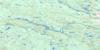
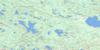
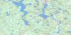
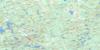
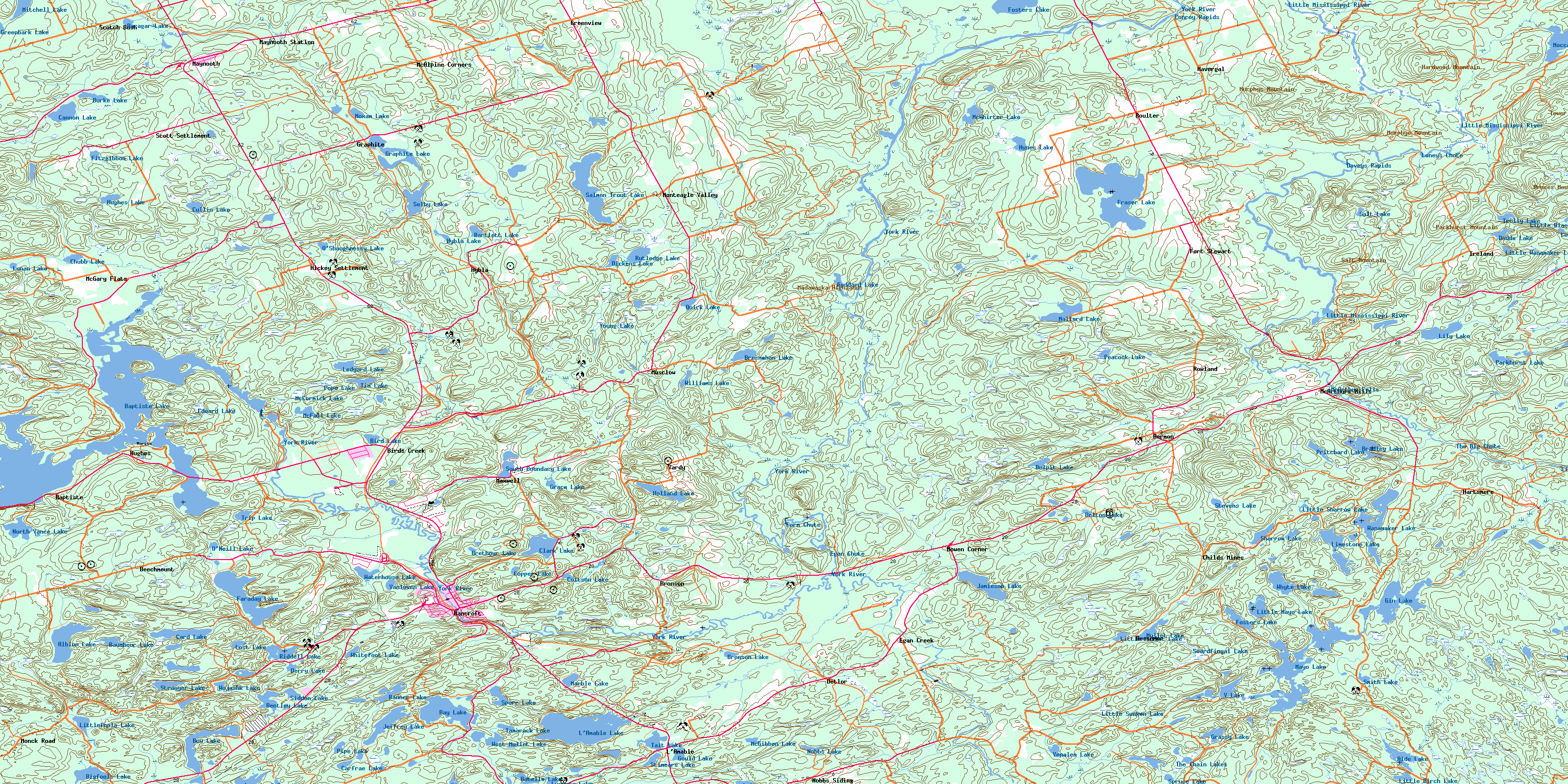
031F04 Bancroft Topo Map
To view this map, mouse over the map preview on the right.
You can also download this topo map for free:
031F04 Bancroft high-resolution topo map image.
Maps for the Bancroft topo map sheet 031F04 at 1:50,000 scale are also available in these versions:
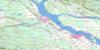
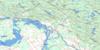
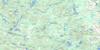
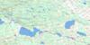
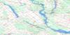
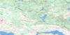
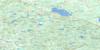
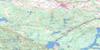
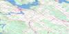
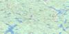
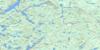
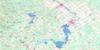
Bancroft Surrounding Area Topo Maps
 |
 |
 |
 |
 |
 |
 |
 |
 |
 |
 |
 |
 |
 |
 |
 |
© Department of Natural Resources Canada. All rights reserved.
Bancroft Gazetteer
The following places can be found on topographic map sheet 031F04 Bancroft:
Bancroft Topo Map: Bays
Branch BayDog Bay
Horseshoe Bay
Lavalley Bay
Norway Bay
Redmond Bay
Bancroft Topo Map: Channels
Dry NarrowsGreen Narrows
Bancroft Topo Map: Cliffs
The Eagles NestBancroft Topo Map: Falls
Egan ChuteFarm Chute
Loneys Chute
McArthur Falls
The Big Chute
Bancroft Topo Map: Geographical areas
AshbyCarlow
Cashel
Dungannon
Faraday
Hastings
Herschel
Lennox and Addington
Mayo
McClure
Monteagle
Raglan
Renfrew
Wicklow
Bancroft Topo Map: Lakes
Aide LakeAlbion Lake
Banner Lake
Baptiste Lake
Baragar Lake
Bartlett Lake
Batelle Lake
Baumheur Lake
Bay Lake
Belton Lake
Bentley Lake
Bigfools Lake
Bird Lake
Bow Lake
Bradley Lake
Bresnahan Lake
Brethour Lake
Bronson Lake
Bulpit Lake
Burke Lake
Cannon Lake
Card Lake
Carfrae Lake
Chip Lake
Chubb Lake
Clark Lake
Coe (Island) Lake
Coltson Lake
Copper Lake
Cullin Lake
Derry Lake
Dickens Lake
Dodds Lake
Edward Lake
Faraday Lake
Fitzgibbon Lake
Foster Lake
Fosters Lake
Fraser Lake
Gaffney Lake
Gin Lake
Goddard Lake
Gould Lake
Grace Lake
Graphite Lake
Grassy Lake
Greenbark Lake
Holland Lake
Hound Lake
Hughes Lake
Hybla Lake
Hynes Lake
Jamieson Lake
Jeffrey Lake
L'Amable Lake
Laundry Lake
Ledyard Lake
Lily Lake
Limestone Lake
Little Bear Pond
Little Birch Lake
Little Black Lake
Little Mayo Lake
Little Mullet Lake
Little Sharrow Lake
Little Sunken Lake
Little Wanamaker Lake
Littlefools Lake
Lornies Lake
Lost Lake
Lucerne Lake
Lunan Lake
Mallard Lake
Marble Lake
Mayo Lake
McCormick Lake
McFall Lake
McGibbon Lake
McWhirter Lake
Mitchell Lake
Moccasin Lake
Moxam Lake
Mullet Lake
Nobbs Lake
North Vance Lake
O'Neill Lake
O'Shaughnessy Lake
Parkhurst Lake
Peacock Lake
Pipe Lake
Plunkett Lake
Pope Lake
Pritchard Lake
Quarry Lake
Quirk Lake
Raggan Ponds
Riddell Lake
Riddles Lake
Rutledge Lake
Salmon Trout Lake
Salt Lake
Selby Lake
Sharrow Lake
Siddon Lake
Smith Lake
South Boundary Lake
Spruce Lake
Spurr Lake
Stevens Lake
Stimears Lake
Stranyer Lake
Stringer Lake
Swordfingal Lake
Tait Lake
Tamarack Lake
The Chain Lakes
Tim Lake
Trip Lake
Trolly Lake
V Lake
Vanluven Lake
Venalen Lake
Wanamaker Lake
Waterhouse Lake
West Mullet Lake
Whitefoot Lake
Whyte Lake
Williams Lake
Wojashk Lake
Young Lake
Bancroft Topo Map: Mountains
Beaudries MountainBruces Mountain
Eaglesnest Hill
Hardwood Mountain
Inwoods Hill
Loneys Hill
Madawaska Highlands
Murphys Mountain
Parkhurst Mountain
Raglan Hills
Salt Mountain
Tower Mountain
Bancroft Topo Map: Major municipal/district area - major agglomerations
HastingsLennox and Addington
Renfrew
Bancroft Topo Map: Other municipal/district area - miscellaneous
Addington HighlandsBangor, Wicklow and McClure
Brudenell and Lyndoch
Brudenell, Lyndoch and Raglan
Carlow
Carlow/Mayo
Denbigh, Abinger and Ashby
Dungannon
Faraday
Hastings Highlands
Herschel
Kaladar, Anglesea and Effingham
Mayo
Monteagle
Raglan
Tudor and Cashel
Bancroft Topo Map: Conservation areas
Egan Chutes Provincial Nature ReserveEgan Chutes Provincial Park Addition
Little Mississippi River Conservation Reserve
Bancroft Topo Map: Rapids
Conroy RapidsDaveys Rapids
The Valley Rapids
Bancroft Topo Map: Rivers
Aide CreekBentley Creek
Bird Creek
Bowen Creek
Bresnahan Creek
Cannon Creek
Cedar Creek
Clark Creek
Egan Creek
Faraday Creek
Fraser Creek
Gin Creek
Goodkey Creek
Grace Creek
Hestler Creek
Kelly Creek
L'Amable Creek
Lily Creek
Little Mississippi River
Lunan Creek
Mallard Creek
McGarry Creek
Moccasin Creek
Mullet Creek
Murphys Creek
Papineau Creek
Pennocks Creek
Quarry Creek
Quirk Creek
Rowland Creek
Salmon Trout Creek
Salt Creek
Selby Creek
Sharrow Creek
Stringer Creek
Whyte Creek
York River
Bancroft Topo Map: River features
The Great BendBancroft Topo Map: Towns
BancroftBancroft Topo Map: Unincorporated areas
BancroftBaptiste
Beechmount
Bessemer
Bessemer Junction
Birds Creek
Boulter
Bowen Corner
Bronson
Bronson Station
Childs Mines
Detlor
Egan Creek
Fort Stewart
Graphite
Green Corners
Greenview
Hartsmere
Havergal
Hermon
Hickey Settlement
Hughes
Hybla
Ireland
L'Amable
Maxwell
Maxwell Settlement
Maynooth
Maynooth Station
McAlpine Corners
McArthurs Mills
McGarry Flats
McGary Flats
Monck Road
Monteagle Valley
Musclow
New Hermon
Nobbs Siding
Rowland
Scotch Bush
Scott Settlement
Upper Hermon
Vardy
Vardy Settlement
York River
Bancroft Topo Map: Low vegetation
Kings MarshThe Red Marsh
© Department of Natural Resources Canada. All rights reserved.
