Whitedog Lake Topo Map Online
Download Free Topo Map Sheet 052L02 at 1:50,000 scale
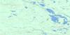
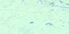
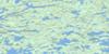
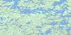
052L02 Whitedog Lake Topo Map
To view this map, mouse over the map preview on the right.
You can also download this topo map for free:
052L02 Whitedog Lake high-resolution topo map image.
Maps for the Whitedog Lake topo map sheet 052L02 at 1:50,000 scale are also available in these versions:
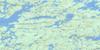
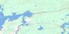
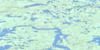
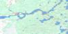
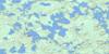
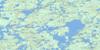
Whitedog Lake Surrounding Area Topo Maps
 |
 |
 |
 |
 |
 |
 |
 |
 |
 |
 |
 |
 |
 |
 |
 |
© Department of Natural Resources Canada. All rights reserved.
Whitedog Lake Gazetteer
The following places can be found on topographic map sheet 052L02 Whitedog Lake:
Whitedog Lake Topo Map: Bays
Billings BayDuck Bay
Ellis' Bay
Finger Bay
Lost Bay
Milner's Bay
Mine Bay
Moose Bay
Outlet Bay
Scot Bay
Vermilion Bay
West Bay
Whitedog Lake Topo Map: Beaches
Martin's BeachWhitedog Lake Topo Map: Capes
Baker's PointHatrack Point
Moore's Point
The Peninsula
Wohlwend's Point
Whitedog Lake Topo Map: Channels
Pistol Lake NarrowsRoughrock Narrows
The North Channel
Whitedog Lake Topo Map: Cliffs
Gooseneck CliffsWhitedog Lake Topo Map: Geographical areas
RuddWhitedog Lake Topo Map: Indian Reserves
Islington 29Islington Indian Reserve 29
Réserve indienne Islington 29
Réserve indienne Swan Lake 29
Swan Lake 29
Swan Lake Indian Reserve 29
Wabaseemoong 29
Whitedog Lake Topo Map: Islands
Bower's IslandBurnt Island
Castle's Island
Chapman's Island
Clark's Island
Cummings Island
Dead Boys Island
Deer Island
Green Island
Gull Island
Harbour Island
Indian Island
Octo Island
Olsen's Island
P.E.I.
Parker's Island
Pickerel Island
Pine Island
Raspberry Island
Sellers Island
The Elephant's Hump
The Sugarloaf
The Twin Islands
Vermilion Island
Whiskey Island
Whitedog Island
Wilcox Island
Whitedog Lake Topo Map: Lakes
Alexander LakeBakado Lake
Bass Lake
Bays Lake
Beaver Lake
Big Sand Lake
Blueberry Lake
Conte Lake
Cygnet Lake
Dummy Lake
Ena Lake
First Lake
Fourth Lake
Gib Lake
Gone Lake
Gooseneck Lake
Goshawk Lake
Hidden Lake
High Lake
India Lake
Little Sand Lake
Lost Lake
Moose Lake
Muskeg Narrows Lake
Musky Narrows Lake
Namego Lake
Oneman Lake
Perch Lake
Pig Lake
Pistol Lake
Portage Lake
Pothole Lake
Road Lake
Roughrock Lake
Sand Lake
Sand Lake
Second Lake
Sixth Lake
Snook Lake
Sum Lake
Swan Lake
Sword Lake
Tetu Lake
Third Lake
Tourist Lake
Trout Lake
Turtle Lake
Twelnor Lake
Umfreville Lake
Umfreville Lake
Vermilion Lake
Whitedog Lake
Worth Lake
Zodiac Lakes
Whitedog Lake Topo Map: Conservation areas
Big Sand Lake Conservation ReserveWhitedog Lake Topo Map: Rivers
English RiverFox Creek
Namego Creek
Rivière Winnipeg
Sum Creek
Sword Creek
Turtle Creek
Whitedog River
Winnipeg River
Zodiac Creek
Whitedog Lake Topo Map: Road features
Black Bear PortageWhitedog Lake Topo Map: Shoals
RockpileWindigo Rock
Whitedog Lake Topo Map: Unincorporated areas
Whitedog
© Department of Natural Resources Canada. All rights reserved.
052L Related Maps:
052L Pointe Du Bois052L01 Lount Lake
052L02 Whitedog Lake
052L03 Crowduck Lake
052L04 Pinawa
052L05 Pointe Du Bois
052L06 Ryerson Lake
052L07 Umfreville Lake
052L08 Lennan Lake
052L09 Sydney Lake
052L10 Dowswell Lake
052L11 Flintstone Lake
052L12 Maskwa Lake
052L13 Manigotagan Lake
052L14 Garner Lake
052L15 Rostoul Lake
052L16 Medicine Stone Lake
