Whitewater Lake Topo Map Online
Download Free Topo Map Sheet 062K16 at 1:50,000 scale
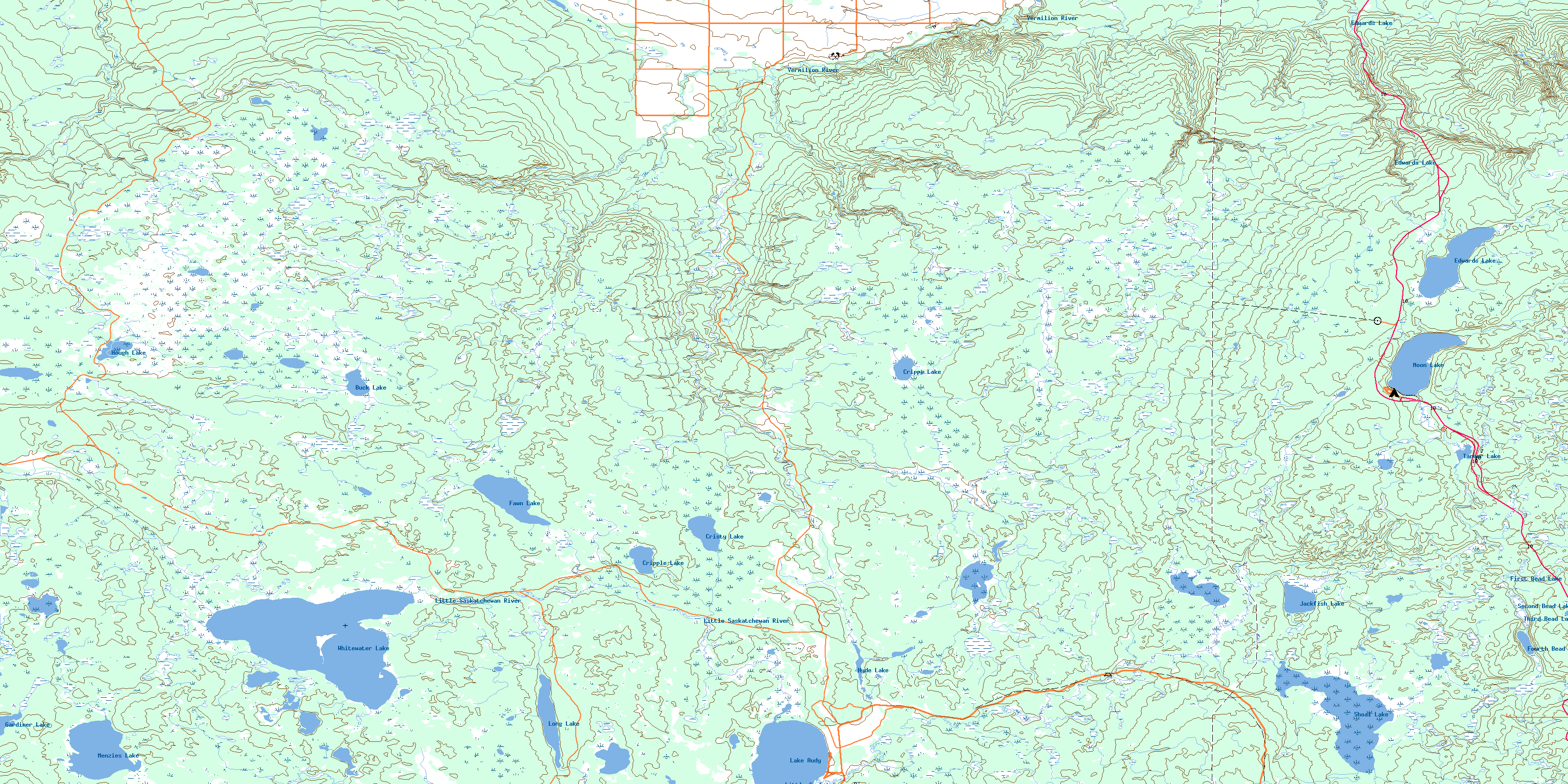
062K16 Whitewater Lake Topo Map
To view this map, mouse over the map preview on the right.
You can also download this topo map for free:
062K16 Whitewater Lake high-resolution topo map image.
Maps for the Whitewater Lake topo map sheet 062K16 at 1:50,000 scale are also available in these versions:
Whitewater Lake Surrounding Area Topo Maps
 |
 |
 |
 |
 |
 |
 |
 |
 |
 |
 |
 |
 |
 |
 |
 |
© Department of Natural Resources Canada. All rights reserved.
Whitewater Lake Gazetteer
The following places can be found on topographic map sheet 062K16 Whitewater Lake:
Whitewater Lake Topo Map: Lakes
Audy LakeBuck Lake
Cripple Lake
Cripps Lake
Cristy Lake
Edwards Lake
Fawn Lake
First Bead Lake
Fourth Bead Lake
Gardiner Lake
Hough Lake
Hyde Lake
Jackfish Lake
Lake Audy
Long Lake
Menzie Lake
Menzies Lake
Moon Lake
Second Bead Lake
Shoal Lake
Tanner Lake
Third Bead Lake
Whitewater Lake
Whitewater Lake Topo Map: Mountains
Robinson HillSpruce Hill
Whitewater Lake Topo Map: Other municipal/district area - miscellaneous
DauphinGilbert Plains
Silver Creek
Whitewater Lake Topo Map: Conservation areas
Parc national du Canada du Mont-RidingRiding Mountain National Park of Canada
Whitewater Lake Topo Map: Rivers
Buck CreekDawson Creek
Edwards Creek
Jackfish Creek
Kinnis Creek
Little Saskatchewan River
Mineral Creek
Minnedosa River
Ranch Creek
Robinson Creek
Stony Creek
Vermilion River
Vermilion River
Walker Creek
West Scott Creek
Whitewater Lake Topo Map: Unincorporated areas
Lake AudyWhitewater Lake Topo Map: Low vegetation
Big GrassKinnis Meadows
© Department of Natural Resources Canada. All rights reserved.
