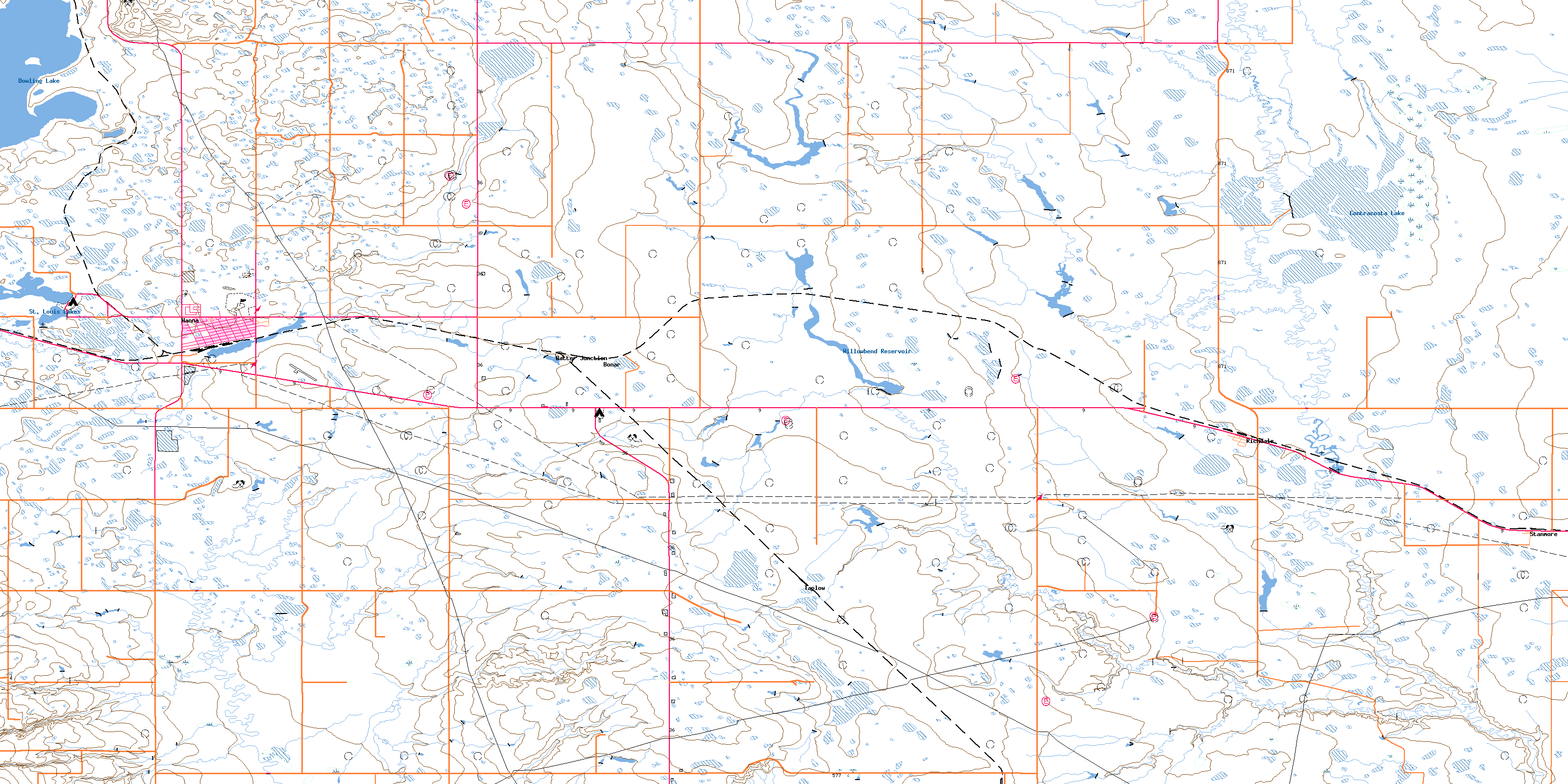
Hanna Topo Map Online
Download Free Topo Map Sheet 072M12 at 1:50,000 scale
072M12 Hanna Topo Map
To view this map, mouse over the map preview on the right.
You can also download this topo map for free:
072M12 Hanna high-resolution topo map image.
Maps for the Hanna topo map sheet 072M12 at 1:50,000 scale are also available in these versions:
Hanna Surrounding Area Topo Maps
 |
 |
 |
 |
 |
 |
 |
 |
 |
 |
 |
 |
 |
 |
 |
 |
© Department of Natural Resources Canada. All rights reserved.
Hanna Gazetteer
The following places can be found on topographic map sheet 072M12 Hanna:
Hanna Topo Map: Lakes
Contracosta LakeDowling Lake
Fox Lake
Hanalta Lake
St. Louis Lakes
Willowbend Reservoir
Hanna Topo Map: Mountains
Antelope HillsHanna Topo Map: Other municipal/district area - miscellaneous
Special Area No. 2Hanna Topo Map: Rivers
Berry CreekBullpound Creek
Hanna Topo Map: Towns
HannaHanna Topo Map: Unincorporated areas
AlnessBatter Junction
Bonar
Fleet
Richdale
Stanmore
Taplow
© Department of Natural Resources Canada. All rights reserved.
