La Ronge Topo Map Online
Download Free Topo Map Sheet 073P03 at 1:50,000 scale
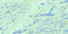
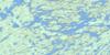
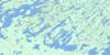
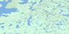
073P03 La Ronge Topo Map
To view this map, mouse over the map preview on the right.
You can also download this topo map for free:
073P03 La Ronge high-resolution topo map image.
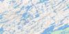
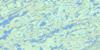
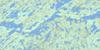
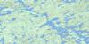
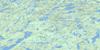
Maps for the La Ronge topo map sheet 073P03 at 1:50,000 scale are also available in these versions:
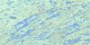
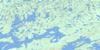
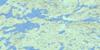
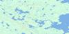
La Ronge Surrounding Area Topo Maps
 |
 |
 |
 |
 |
 |
 |
 |
 |
 |
 |
 |
 |
 |
 |
 |
© Department of Natural Resources Canada. All rights reserved.
La Ronge Gazetteer
The following places can be found on topographic map sheet 073P03 La Ronge:
La Ronge Topo Map: Bays
English BayEwen Bay
Friedman Bay
Hagarty Bay
Hamilton Bay
Hornet Bay
McGibbon Bay
Mooney Bay
Murray Bay
Nut Bay
Pettit Bay
Professor Bay
Rawson Bay
Sinclair Bay
La Ronge Topo Map: Capes
Dominion PointFoot Point
Hornet Point
MacAuley Point
Moose Point
Nut Point
Potato Point
Ross Peninsula
Williams Peninsula
La Ronge Topo Map: Channels
Campbell ChannelEnglish Narrows
Parsons Narrows
Professor Narrows
Stony Narrows
La Ronge Topo Map: Indian Reserves
Kitsakie 156BLac la Ronge 156
Little Hills 158
Little Hills 158A
Little Hills 158B
Potato River 156A
La Ronge Topo Map: Islands
Arcand IslandArcher Island
Big Island
Bonnycastle Island
Bradshaw Island
Brooks Island
Burns Island
Camp Island
Connell Island
Davis Island
Doake Island
Dog Island
Five Islands
Flatland Island
Fowler Island
Freeman Island
Giles Island
High Island
Hooge Island
Howard Island
Jackson Islands
Keown Island
Kidd Island
Kitsakie Island
Lab Island
Lanceley Island
Lefurgey Island
Loehr Island
MacNair Island
Macnair Island
Mallory Island
Mandel Island
Marshall Island
McCulloch Island
McKee Island
Mollard Island
Moore Island
Moysey Island
Murphy Islands
Murray Island
Nut Island
Professor Island
Robertson Island
Rowan Island
Schellenberg Island
Scott Island
Simpson Island
Slant Island
Soutar Island
Stueck Island
Trippe Island
Warburton Island
Weber Island
La Ronge Topo Map: Lakes
Amundson LakeBigstone Lake
Bingham Lake
Cycloid Lake
Demchenko Lake
Downton Lake
Egg Lake
Hives Lake
Lac la Ronge
Midway Lake
Nemeiben Lake
Potato Lake
La Ronge Topo Map: Conservation areas
Lac la Ronge ParkLa Ronge Topo Map: Rivers
English CreekKinosao Creek
Midway Creek
Montreal River
Potato River
Wadin Creek
Wood Creek
La Ronge Topo Map: Road features
Nut PortageLa Ronge Topo Map: Towns
La RongeLa Ronge Topo Map: Unincorporated areas
La-RongeLa Ronge Topo Map: Villages
Air Ronge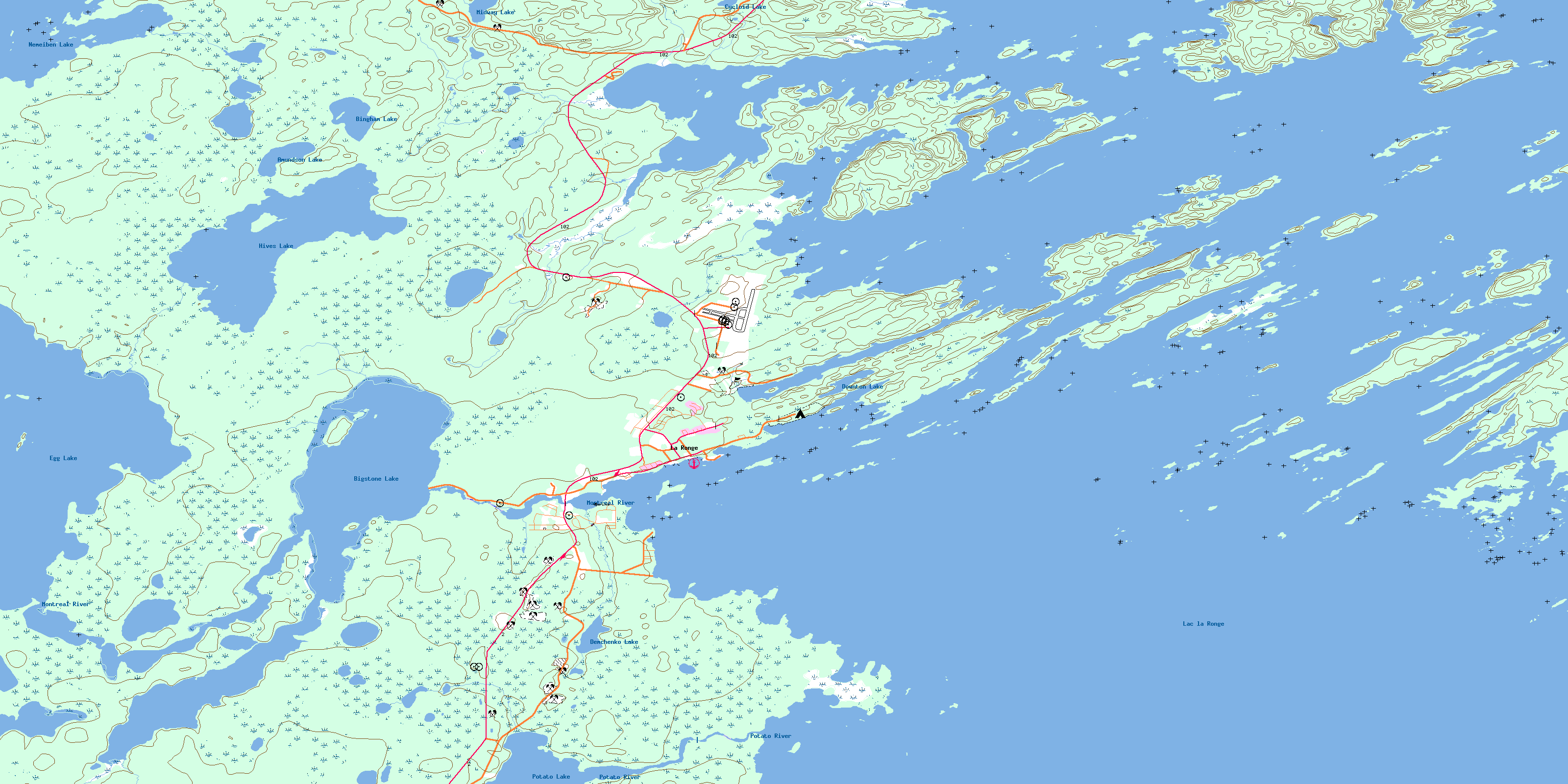
© Department of Natural Resources Canada. All rights reserved.
073P Related Maps:
073P Lac La Ronge073P01 Cartier Lake
073P02 Hunter Bay
073P03 La Ronge
073P04 Morin Lake
073P05 Morning Lake
073P06 Nemeiben Lake
073P07 Stanley Mission
073P08 Nistowiak Lake
073P09 Guncoat Bay
073P10 Otter Lake
073P11 Kavanagh Lake
073P12 Black Bear Island Lake
073P13 Eulas Lake
073P14 Mctavish Lake
073P15 Forbes Lake
073P16 Settee Lake
