Black Bear Island Lake Topo Map Online
Download Free Topo Map Sheet 073P12 at 1:50,000 scale
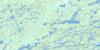
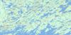
073P12 Black Bear Island Lake Topo Map
To view this map, mouse over the map preview on the right.
You can also download this topo map for free:
073P12 Black Bear Island Lake high-resolution topo map image.
Maps for the Black Bear Island Lake topo map sheet 073P12 at 1:50,000 scale are also available in these versions:
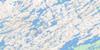
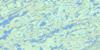
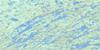
Black Bear Island Lake Surrounding Area Topo Maps
 |
 |
 |
 |
 |
 |
 |
 |
 |
 |
 |
 |
 |
 |
 |
 |
© Department of Natural Resources Canada. All rights reserved.
Black Bear Island Lake Gazetteer
The following places can be found on topographic map sheet 073P12 Black Bear Island Lake:
Black Bear Island Lake Topo Map: Bays
Brigham BayHadley Bay
Hawkins Bay
MacDougall Bay
Rogers Bay
Watson Bay
Black Bear Island Lake Topo Map: Falls
Needle FallsBlack Bear Island Lake Topo Map: Islands
Corman IslandHadley Island
Hagerty Island
Hicks Island
Hollowell Island
MacKay Island
Sturdy Island
Waminuta Island
Wamninuta Island
Black Bear Island Lake Topo Map: Lakes
Besnard LakeBlack Bear Island Lake
Boissiere Lake
Brunning Lake
Burns Lake
Campbell Lake
Fuchs Lake
Hollowell Lake
Kinosaskaw Lake
Melanson Lake
Orton Lake
Prescott Lake
Redwood Lake
Redwood Lake
Reiter Lake
Roadhouse Lake
Rodgers Lake
Romaniuk Lake
Rose Lake
Skwarchuk Lake
Smith-Jones Lake
Stewart Lake
Wells Lake
Wells Lake
Woodman Lake
Black Bear Island Lake Topo Map: Rapids
Silent RapidsBlack Bear Island Lake Topo Map: Rivers
Besnard CreekChurchill River
Rivière Churchill
Sandy River
Black Bear Island Lake Topo Map: Road features
Birch PortageNeedle (Pin) Portage
Needle Portage
Pine Portage
© Department of Natural Resources Canada. All rights reserved.
073P Related Maps:
073P Lac La Ronge073P01 Cartier Lake
073P02 Hunter Bay
073P03 La Ronge
073P04 Morin Lake
073P05 Morning Lake
073P06 Nemeiben Lake
073P07 Stanley Mission
073P08 Nistowiak Lake
073P09 Guncoat Bay
073P10 Otter Lake
073P11 Kavanagh Lake
073P12 Black Bear Island Lake
073P13 Eulas Lake
073P14 Mctavish Lake
073P15 Forbes Lake
073P16 Settee Lake
