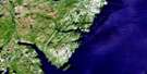
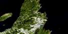
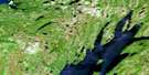
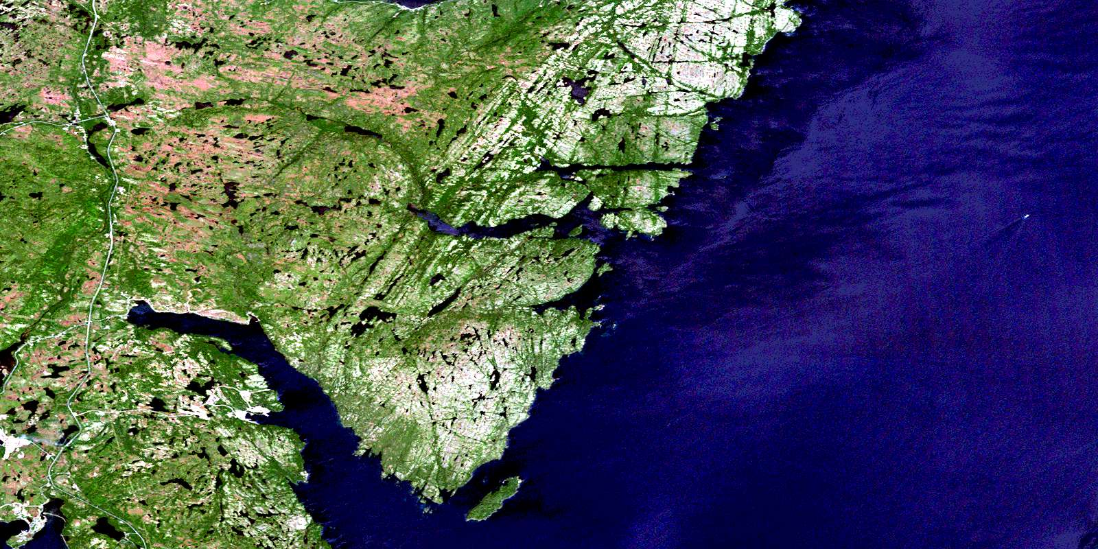
Sunnyside Satellite Image Map
Download Free Aerial Photo 001N13 at 1:50,000 scale
Sunnyside Satellite Imagery
To view this satellite map, mouse over the air photo on the right.
You can also download this satellite image map for free:
001N13 Sunnyside high-resolution satellite image map.
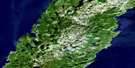
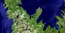
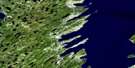
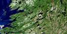
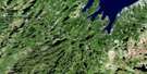
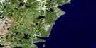
Maps for the Sunnyside aerial map sheet 001N13 at 1:50,000 scale are also available in these versions:
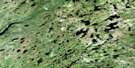
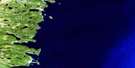
Sunnyside Surrounding Area Aerial Photo Maps
 |
 |
 |
|
 |
 |
 |
|
 |
 |
 |
|
 |
 |
 |
© Department of Natural Resources Canada. All rights reserved.
Sunnyside Gazetteer
The following places can be found on satellite image map 001N13 Sunnyside:
Sunnyside Satellite Image: Bays
Arnold's CoveBadgers
Bald Head Cove
Balsoms Cove
Big Mosquito Cove
Birch Cove
Bull Arm
Burn Cove
Centre Bay
Centre Cove
Coadys Cove
Come By Chance
Cooking Cove
Deer Harbour
Ferrish Cove
Frenchmans Cove
Garretts Cove
Goose Cove
Goose Cove
Goose Cove
Graper Rock Cove
Great Mosquito Cove
Great Southern Harbour
Green Cove
High Head Cove
Lady Cove
Leonards Cove
Little Harbour
Little Harbour
Little Mosquito Cove
Little Mosquito Cove
Little Stock Cove
Man O'War Cove
Martin Eddys Cove
Muddy Hole
Northeast Arm
Northern Bight
Old Dock
Old Womans Cove
Peddles Cove
Placentia Bay
Pumbly Cove
Rix Harbour
Rock Wood Cove
Round Harbour
Samsons Head Cove
Shag Harbour
Shoal Bay
Shoal Cove
Shoal Harbour
Sibleys Cove
Southeast Arm
Southwest Arm
Southwest Arm
St. Jones Harbour
St. Jones Without
Stock Cove
Strong Tickle
Tea Cove
The Hoof Cove
The Mat
Tom Powers Cove
Tommy Short Cove
Trap Bight
Trinity Bay
Welchs Cove
Sunnyside Satellite Image: Beaches
Come By Chance BeachCome by Chance Beach
Sandys Beach
Sunnyside Satellite Image: Capes
Arnolds Cove PeninsulaAvalon Peninsula
Bald Head
Bald Point
Big Burrow
Big Mosquito Point
Big Neck
Centre Point
Deer Harbour Head
Dumpling Point
Fillys Gaze
Goose Cove Point
Goose Head
Goose Point
Green Point
Guys Point
High Head
Isthmus of Avalon
Johns Chin
Little Head
Little Mosquito Point
Little Neck
Net Point
Niagara Point
North Head
Northern Point
Otter Rub Head
Peddles Point
Robinson Point
Samsons Head
Snails Head
Sophia Head
South Head
Southwest Head
Squib Point
Squid Point
St. Jones Head
Stanton Point
Stock Cove Point
Tea Cove Point
Thames Harbour Point
The Chimney
The Hoof
The Mat Point
Tidy Point
Sunnyside Satellite Image: Channels
Bull TickleCome By Chance Gut
Narrows
The Tickle
Sunnyside Satellite Image: Islands
Big IslandBirch Cove Island
Bull Island
Copper Island
Dog Island
Duck Islands
Frenchmans Island
Gooseberry Island
Green Island
Grub Island
McKay Island
Mouse Islands
Poor Boy Island
Rovers Island
Seal Island
Shag Islands
St. Jones Islands
Thames Island
Sunnyside Satellite Image: Lakes
101 PondsArnolds Pond
Badgers Pond
Bald Head Pond
Barasway Ponds
Beaver Pond
Big Island Pond
Big Mosquito Pond
Big Pond
Big Pond
Bill Martins Dam Pond
Birchy Pond
Black Duck
Black Duck Pond
Black Pond
Black River Pond
Blue Hill Pond
Bullocks Pond
Burgess HeadPond
Butt Pond
Caplin Cove Pond
Centre Hill Pond
Church Pond
Dam Pond
Dam Pond
Dam Ponds
Davis Pond
Deer Harbour Long Pond
Deer Harbour Pond
Deer Harbour Steady
Dog Rock Cove Pond
Double Gullies
Duck Pond
Esaus Pond
Feeder Ponds
First Long Pond
Foxy Rocks Pond
Frenchmans Pond
Freshwater Pond
Frosts Pond
Gap Pond
Goobies Pond
Goose Cove Pond
Goose Pond
Goose Pond
Goose Pond
Gull Pond
Gull Pond
Gull Pond
Gull Pond
Gull Pond Gully
Happy Pond
Headwater Ponds
Hole Pond
Isaac Johns Pond
Island Pond
Island Pond
Jack Pond
Jacks Pond
Jar Pond
Lady Cove Pond
Layden Pond
Lead of Ponds
Leonards Beach Pond
Lice Pond
Little Feeders
Little Harbour Pond
Little Jacks Pond
Little Mosquito Pond
Long Pond
Long Pond
Long Pond
Long Pond
Long Pond
Mill Cove Ponds
Mill Pond
Mill Pond
Nine Angle Pond
Norris Pond
Northeast Arm Pond
Old Dock Pond
Otter Pond
Peddles Cove Pond
Peddles Pond
Pumbly Cove Pond
Rock Ponds
Rocky Pond
Round Pond
Rushy Pond
Samsons Gully
Samsons Pond
Sandy Beach Ponds
Second Long Pond
Shoal Bay Big Pond
Shoal Bay Pond
Sibleys Cove Pond
Siding Pond
Southern Harbour Pond
Southwest Arm Gully
Spurrells Pond
Spurrells Pond
Stock Cove Gull Pond
Switch Pond
Tea Cove Pond
Third Long Pond
Thomas Ponds
Trout Pond
Trout Pond
Trout Pond
Twillick Pond
Uncle Steves Pond
Valley Ponds
Vee Pond
White Point Pond
Sunnyside Satellite Image: Mountains
Arthurs HillBears Folly
Ben Droke
Ben Droke Mountain
Big Hill
Birch Hill
Blue Hill
Burgess Head
Centre Hill
Crown Hill
Dog Rock Cove Hill
French Rock
Goose Pond Hill
Goose Pond Ridge
Green Point Hill
Grepes Nest
Hay Pooks
Hodges Cove Ridge
Jacks Lookout
Jacks Pond Hill
Naked Man
Old Man
Peas Cove Lookout
Powder Horn Hill
Powder Horn Hills
Powderhorn Hill
Red Hills
The Founder
The Lookout
The Mountain
White Hills
Sunnyside Satellite Image: Conservation areas
Jack's Pond Provincial ParkNewfoundland T'Railway Provincial Park
Sunnyside Satellite Image: Rivers
Arnolds Cove BrookBadgers Brook
Bears Track Brook
Bill Martins Brook
Black Brook
Blue Hill Brook
Centre River
Come By Chance River
Deer Harbour River
Eastern Brook
Foxy Rocks Brook
Glenview River
Halfway Bridge Brook
Hodges Cove Brook
Hodge's Cove Brook
Jacks Pond Brook
Little Mosquito Brook
Lower Brook
Manuels Brook
Middle Brook
Mill Cove Brook
Northern Brook
Old Dock Brook
Otter Path
Overfall Brook
Seal Island Brook
Shoal Bay Brook
Snooks Brook
Southern Bight Brook
Southwest Arm River
Southwest Brook
Southwest Path
Stock Cove Brook
Upper Beach Brook
Veys River
Woodmans Brook
Sunnyside Satellite Image: Shoals
Big RockBirch Cove Rock
Chalk Rocks
Elias Ledge
Flat Rocks
Gull Rock
Harbour Rocks
Island Rock
Niagara Ledge
Poor Boy Ledge
Porcupine Reef
Riff Raff Rocks
Riff Raffs
Tommy Sharp Rock
Sunnyside Satellite Image: Towns
Arnold's CoveCome By Chance
Come-by-Chance
Sunnyside
Sunnyside Satellite Image: Unincorporated areas
Arnolds Cove StationChurchills
Cobb
Garretts Cove
Glenview
Goobies
Goobies Siding
Goobies Station
Long Beach
Path End
St. Jones Without
Sunnyside Satellite Image: Low vegetation
Deer Harbour BarrenFrosts Barren
Glenview Marsh
The Flats
© Department of Natural Resources Canada. All rights reserved.
