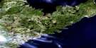
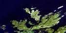
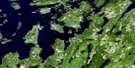
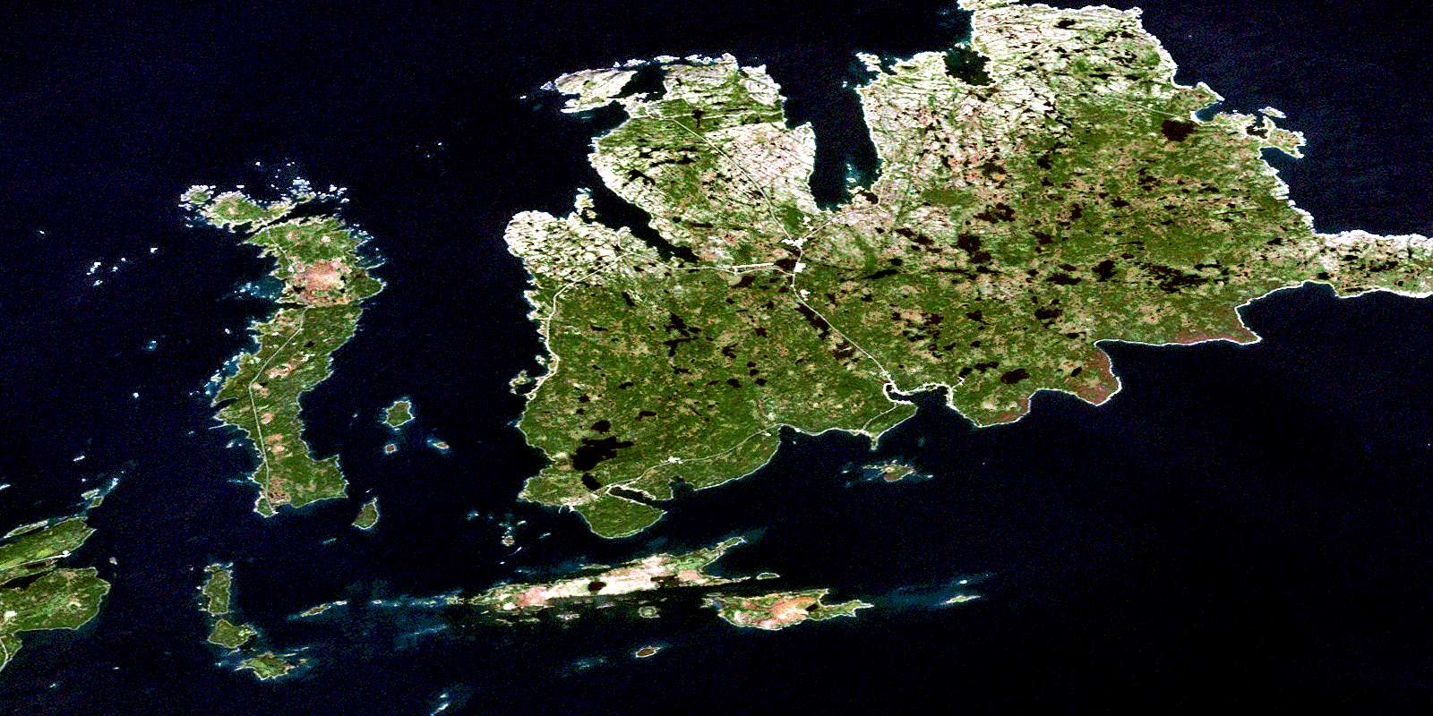
Fogo Satellite Image Map
Download Free Aerial Photo 002E09 at 1:50,000 scale
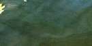
Fogo Satellite Imagery
To view this satellite map, mouse over the air photo on the right.
You can also download this satellite image map for free:
002E09 Fogo high-resolution satellite image map.
Maps for the Fogo aerial map sheet 002E09 at 1:50,000 scale are also available in these versions:
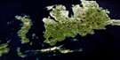
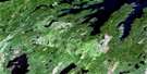
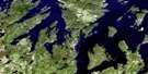
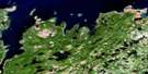
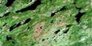
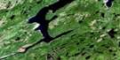
Fogo Surrounding Area Aerial Photo Maps
 |
 |
 |
|
 |
 |
 |
 |
 |
 |
 |
 |
 |
 |
 |
 |
© Department of Natural Resources Canada. All rights reserved.
Fogo Gazetteer
The following places can be found on satellite image map 002E09 Fogo:
Fogo Satellite Image: Bays
Aspel CoveBack Cove
Bakers Cove
Banks Cove
Barr'd Cove
Bear Cove
Bens Cove
Big Grebes Cove
Birch Cove
Birch Cove
Bishops Cove
Black Head Cove
Buddens Cove
Bullocks Cove
Cape Cove
Chaulkish Cove
Chaulks Cove
Chimney Cove
Cobb Cove
Cobbs Cove
Corricks Cove
Corry Cove
Deep Bay
Deep Cove
Dog Bay
Duck Cove
East Cove
Easter Cove
Eastern Cove
Eastern Cove
Elias Cove
Farewell Harbour
Fogo Harbour
Fox Cove
Fox Cove
Fox Head Cove
Granfers Cove
Hare Bay
Harts Cove
Horwood Bay
Hunts Cove
Joe Batt's Arm
Keats Cove
Kings Cove
Kippen Cove
Lion's Den Cove
Little Grebes Cove
Little Harbour
Little Partridge Cove
Little Seldom Cove
Little Wild Cove
Locks Cove
Lookout Cove
Lords Cove
Lower Larrys Cove
Lower Randells Cove
Man O' War Cove
Mary Sheppards Bottom
Moreys Harbour
Morris Lions Cove
Muddy Cove
North East Bottom
Oliver's Cove
Otter Cove
Paine's Cove
Partridge Cove
Payners Cove
Perrys Bight
Perry's Bight
Peters Cove
Peters Cove
Pumbly Cove
Puncheon Cove
Punt Cove
Raymonds Cove
Red Point Cove
Red Rock Cove
Rocky Cove
Rogers Cove
Russells Harbour
Sandy Cove
Schooner Cove
Seal Cove
Seal Cove
Seal Cove
Seargent Cove
Seldom Cove
Seldom Harbour
Shag Cove
Shoal Arm
Shoal Bay
Skinner Cove
Skinner Harbour
Snows Cove
Snows Harbour
Squid Cove
Squid Jiggin Ground
Stag Harbour
Stinking Cove
Talc Cove
The Bottom
Tilting Harbour
Toms Cove
Upper Larrys Cove
Upper Randells Cove
West Harbour
Wester Cove
White Point Cove
White Rod Cove
Wigwam Cove
Wild Bight
Wild Cove
Wild Cove
Wild Cove
Wild Cove
Wisemans Cove
Wreck Cove
Fogo Satellite Image: Beaches
Back BeachBig Beach
Black Island Breaker
Burnt Head Shore
French Beach
Long Beach
Lowlands
Fogo Satellite Image: Capes
Arthurs PointAukguells Point
Barr'd Island Head
Bignells Point
Birch Point
Black Head
Black Head Cove Point
Black Long Point
Bluff Head
Bluff Point
Bobbys Point
Bowling Pond Head
Bread Box Point
Brimstone Head
Brookes Point
Browns Cove Point
Browns Point
Buddens Point
Burkes Point
Burnt Head
Burnt Point
Cast-Net Point
Cobbs Cove Point
Corricks Head
Crow Head
Crow Head
Curless Point
Cyphers Head
Diamond Point
Dog Head
Easter Head
Easter Point
Eastern End
Eastern Head
Eastern Point
Eel Brook Point
Emberleys Point
Farewell Head
Fishing Point
Flat Point
Fogo Head
Fogo Island Point
Fox Head
Gannetts Island Point
Garrison
Garrison Point
Gaze Point
Gunners Point
Gunning Point
Hare Bay Head
Hatchet Point
Herring Net Point
Island Harbour Head
Jeffrey Head
Joe Batts Point
Kaytons Point
Kings Cove Head
Kippen Cove Point
Lion's Den Point
Locks Cove Point
Long Point
Long Point
Long Point
Long Point
Long Point
Long Point
Long Point
Lower White Point
Mansfield Point
Middle Point
North End
Oliver Cove Head
Painters Point
Paynes Point
Pelleys Head
Pellys Point
Pennys Point
Pilly Point
Podguys Point
Port Albert Peninsula
Prime Berth
Prime Berth Point
Pumbly Cove Point
Randells Cove Head
Red Point
Red Rock Cove Point
Red Rock Point
Rogers Cove Head
Rogers Point
Round Head
Rowes Point
Salmon Point
Sandy Cove Head
Sandy Cove Point
Shag Rock Point
Shannahans Point
Shoal Bay Point
Shoal Point
Shoal Point
Shoal Point
Short Point
South End
South Point
Squid Cove Point
Stag Harbour Point
Taylor's Point
The Gunning Point
The Jigging Head
The Man
Tickle Point
Upper Long Point
Upper White Point
Wester Head
Wester Point
Western End Islands
Western Head
Western Point
Whale Point
White Point
White Point
Wigwam Point
Wigwam Point
Wild Cove Point
Wild Point
Fogo Satellite Image: Caves
Blowing HoleFogo Satellite Image: Channels
Blind TickleBoatswain Tickle
Change Islands Tickle
Duck Island Tickle
Easter Tickle
Easter Tickle
Hamilton Sound
Hare Island Tickle
Indian Island Tickle
Learys Tickle
Main Tickle
Middle Tickle
Motion Tickle
Narrow Tickle
North Tickle
Northern Tickle
Pig Island Tickle
Pound Rock Tickle
Shoal Tickle
Shoal Tickle
Shoal Tickle
Sloops Tickle
Stag Harbour Run
Stag Harbour Tickle
Woody Island Tickle
Fogo Satellite Image: Cliffs
Crow CliffsRed Cliff
Fogo Satellite Image: Forests
Michael Mahoneys DroveFogo Satellite Image: Islands
Annie IslandBarnes Island
Barnet Island
Barr'd Island
Big Duck Island
Black Island
Black Island
Black Islet
Blackhead Island
Blundon's Island
Boatswain Island
Bons Island
Bons Island
Brothel Island
Brothers Island
Bullock Island
Burnt Island
Burts Island
Cann Island
Centre Island
Change Brandies
Change Island
Change Islands
Charley Island
Clay Island
Copper Island
Copper Island
Diamond Island
Dog Bay Islands
Double Island
Duck Island
Duck Island
East Garden Island
Eastern Indian Island
Farewell Duck Islands
Farewell Gull Island
Fishing Island
Fogo Brandies
Fogo Island
Fox Islands
Frances Island
Gallows Island
Gannetts Island
Goose Island
Goose Island
Goose Islands
Gooseberry Island
Grandfather Island
Grassy Islands
Grassy Islands
Graveyard Island
Handy Harbour Island
Hare Island
Hare Island
Harts Islands
Hennings Island
Indian Garden Island
Indian Islands
Indian Lookout
Kate Island
Leveret Islands
Light House Island
Little Cann Island
Little Duck Island
Little Grandfather Island
Long Island
Long Island
Lucy Island
Malcolm Island
Mathison Island
Middle Dog Bay Island
Mile Island
Mothers Island
Mouse Island
Naked Man
Nippards Island
North Dog Bay Island
North Island
Northern Harbour Island
Northern Island
Offer Island
Perry Island
Pig Island
Pig Island
Pigeon Island
Pilly Island
Point Islands
Pound Island
Pressons Island
Ragged Islands
Rags Island
Red Indian Garden Island
Ruth Island
Salmon Net Island
Shag Island
Shave Island
Sheep Island
Ship Island
Simms Island
Small Duck Island
Smoker Island
South Island
Southern Dog Bay Island
Southwest Islands
Steering Island
Stern Island
Stone Island
Stun Pole
The Barr'd Island
The Brandies
The Brandies
The Brandies
Tobacco Island
Uncle Andys Island
Upper Grassy Islands
Upper Smoker
Watch Island
Western Indian Island
Western Island
White Island
Wiseman Island
Wood Island
Woody Island
Woody Island
Woody Islands
Yellow Fox Island
Fogo Satellite Image: Lakes
Abe Adams PondAlbert Dwyers Pond
Ambrose McGraths Pond
Angle Pond
Angle Pond
Baileys Big Pond
Baileys First Pond
Bakeapple Pond
Bar Pond
Bar Rock Pond
Barnacle Pond
Berry Head Pond
Berry Head Ponds
Betsys Pond
Big Black Duck Pond
Big Bowling Pond
Big Colemans Pond
Big Marsh Pond
Big Pond
Big Pond
Big Pond
Big Pond
Big Pond
Billys Pond
Birchy Pond
Birchy Pond
Birchy Pond
Black Duck Head Pond
Black Duck Pond
Black Duck Pond
Black Duck Pond
Black Pudding Pond
Brewis Pond
Buddens Pond
Bullocks Cove Pond
Bullrush Pond
Bumble Pond
Cantrys Pond
Capemans Long Pond
Chaulks Ponds
Chisholms Pond
Clancys Pond
Coffee Ponds
Cold Hill Pond
Cold Hill Pond
Con Lanes Pond
Cooks Pond
Cool Hall Pond
Cooper Junk Pond
Country Pond
Croneans Pond
Dawes Long Pond
Deep Pond
Deer Pond
Dogskin Pond
Double Pond
Drink Brook Ponds
Dummys Pond
Dwyers Pond
Eagle Hill Pond
Eastern Cove Pond
Eastern Gull Pond
Eliza Pond
Elsworth Pond
Emberleys Pond
Father Hearns Pond
First Pond
First Pond
Fogarthy Cove Ponds
Fogo Neck Pond
Fosters Pond
Fosters Pond
Fowlers Pond
Fox Cove Pond
Francis Head Pond
Freemans Pond
Freshwater Pond
Furlongs Pond
Goose Pond
Gull Pond
Gull Pond
Gull Pond
Gull Pond
Gull Pond
Gull Pond
Gull Pond
Gull Ponds
Gulls Nest Pond
Gullyhill Pond
Gunners Pond
Handy Mish Pond
Hartrys Pond
Heads Pond
Heads Pond
Hennings Pond
Herring Pond
Horseshoe Hill Pond
Hurleys Pond
Inside Larrys Pond
Inside Long Pond
Inside Milk Pond
Inside Ratfords Pond
Inside Round Pond
Island Pond
Jim O'Keefes Pond
Jim O'Keefes Steady
Jimmy Loaders Pond
Joe Batt's Arm Pond
Joe Briens Pond
John Paynes Pond
Joshuas Pond
Juniper Pond
Kellys Pond
Kennedys Gull Pond
Killick Claw
Kippen Cove Pond
Kippen Cove Steadies
Lance au Loup Pond
Landing Pond
Larrys Flashets
Larrys Pond
Lead of Ponds
Little Bowling Pond
Little Bumble Pond
Little Colemans Pond
Little Paynes Pond
Long Pond
Long Pond
Long Pond
Long Pond
Long Pond
Long Pond of Birches
Lookout Pond
Loon Pond
Loons Pond
Low Pond
Lynches Pond
Mahoneys Pond
Mart Lukes Pond
Martin Harts Pond
Mary Dwyers Pond
Matframe Pond
McCarthys Pond
Michaels Pond
Middle Gaze Pond
Middle Gull Pond
Middle Paynes Pond
Mile Pond
Millers Pond
Mother Burkes Pond
Muddy Pond
Muskrat Pond
Muskrat Pond
Muskrat Pond
Newfoundout Pond
Newmans Pond
Old Dicks Pond
Osmonds Pond
Otter Cove Pond
Otter Pond
Otter Pond
Outside Long Pond
Outside Ratfords Pond
Outside Rocky Pond
Outside Round Pond
Palmers Pond
Park Pond
Parsons Pond
Parsons Ponds
Paynes Pond
Pearsons Hill Pond
Pelleys Pond
Picketts Pond
Pierces Pond
Pilly Pond
Pillys Pond
Pinkys Pond
Pissimare Pond
Porries Pond
Priest Pond
Prime Berth Pond
Rails Pond
River Sticks Pond
Rock In The Pond
Rocky Pond
Rocky Pond
Rocky Pond
Rocky Pond
Rocky Pond
Rocky Pond
Rocky Pond
Rocky Pond
Round Head Pond
Round Pond
Round Pond
Round Pond
Round Pond
Round Pond
Round Pond
Russells Pond
Saltwater Pond
Saltwater Pond
Scrumptious Pond
Second Pond
Second Pond
Second Pond
Second Pond Eastern
Sheath Knife Pond
Sheehans Pond
Shipping Pond
Skippers Cove Pond
Small John Paynes Pond
Snoring Pond
Snow Drift Pond
Sons Pond
Southern End Flashets
Southern Rocky Pond
Squid Cove Pond
Stag Harbour Pond
Steady Water Pond
Taylors Pond
The Flash
Third Pond
Thousand Islands Pond
Timber Brook Pond
Tom Harts Pond
Tom McGraths Pond
Tom Nippards Pond
Traverse Pond
Trout Pond
Trumps Pond
Tuckey Pond
Two Mile Rock Pond
Upper Eagle Hill Pond
Upper Gut Pond
Waddlys Pond
Walls Pond
Wester Long Pond
Western Bakeapple Pond
Western Brook Ponds
Western Country Pond
Western Gull Pond
Whalens Pond
White Point Pond
Wild Cove Pond
Wild Cove Pond
Wild Cove Pond
Wild Cove Pond
Willys Pond
Wimbles Pond
Wobby Pond
Fogo Satellite Image: Mountains
Ambrose Fords HillBerry Head
Birch Hill
Bluff Head
Bunker Hill
Burnwood Hill
Change Lookout
Church Hill
Clarkes Head
Cooks Ridge
Crow Head
Crow Head
Diamonds Hill
Durham Hill
Dwyers Ridge
Eagle Hill
Eastern Nuddick
Fowlows Ridge
French Head
Greyhound
Gunners Hill
Harlicks Hill
Hill With The Ladder On It
Horseshoe Hill
Indian Lookout
Ladder Hill
Lane's Lookout
Lighthouse Hill
Observatory Hill
Owls Nap
Pennys Hill
Scotts Hill
Ship Hill
Stag Harbour Nuddick
Stag Harbour Ridge
The Ridge
Trumps Lookout
Western Lookout
Western Nuddick
Woodpeck Hill
Woody Hill
Fogo Satellite Image: Major municipal/district area - major agglomerations
Fogo Island RegionFogo Satellite Image: Natural resources sites
Kellys PitFogo Satellite Image: Rivers
Bennetts BrookBig Brook
Big Brook
Big Gulch
Black Duck Brook
Bluffers Gulch
Bottle Gulch
Bottom Brook
Bottom Brook
Croneans Gulch
Crow Gulch
Eel Brook
Elizas Brook
Grebes Gulch
Green Gulch
Higgins Gulch
Otter Brook
Otter Brook
Pentons Brook
Running Brook
Saltwater Brook
Trumps Brook
Western Bill Gulch
Western Brook
Western Brook
Whale Gulch
Fogo Satellite Image: Shoals
Berry RocksBig Shoal
Black Reef
Black Rock
Black Rock
Black Rock
Black Rock
Black Rock
Black Rock
Bread Box
Brimstone Head Rock
Bullock Rock
Cheeky Rocks
Cooks Rocks
Creeper Ledge
Crow Head Rock
Culvert
Dean Rock
Dog Reef
Duck Island
Eastern Lookout
Eastern Shoal
Fishing Rock
Five Fathom Rock
Fogo Head Rock
Fogo Rock
Footes Rock
Fox Cove Point
Fox Rocks
Frampton Rock
Garden Rocks
Grassy Rock
Gull Rock
Gulnare Rocks
Gunners Rock
Handy Rocks
Harbour Rock
Heron Rock
Herring Rock
Ida Rock
Inner Bluff Head Rock
Inner Horny
Island Harbour Ledge
Jumping Rock
Killick Rocks
Lighthouse Ground
Lions Den Rock
Mad Mall
Middle Rock
Middle Rock
Milborn Rock
Mile Rock
Mondays Rock
Monkey Rock
Monkey Shoal
Moorham Rocks
Mussel Rock
Nanny Rock
Old Horny
Old Roger
Outer Bluff Head Rock
Payne Rock
Pilly Rock
Pipe Rock
Port Rocks
Porters Spot
Pound Rocks
Princes Horny
Rags Rock
Red Rocks
Salmon Rock
Saturday Ledge
Seal Rock
Seal Rocks
Shag Rock
Shag Rock
Shag Rocks
Shag Rocks
Shallops Rock
Shoal Spot
Simms Rock
Skinner Rock
Sleepy Ledge
Sloops Rock
Sly Rock
Southern Rock
Stag Rock
Stern Island Shoal
Sunker
Sunny Ledge
The Sisters
Tinker Rock
Tommy Princes Horny
Turpins Rock
Vesuvius Rock
Watch Island Rock
Watch Rock
Water Bears
Water Bears
Western Head Rock
Whale Back Rocks
White Ground
Fogo Satellite Image: Towns
Change IslandsFogo
Joe Batt's Arm-Barr'd Islands
Joe Batt's Arm-Barr'd Islands-Shoal Bay
Seldom-Little Seldom
Tilting
Fogo Satellite Image: Unincorporated areas
Barr'd IslandsCape Cove
Deep Bay
Eastern Cove
Eastern Tickle
Indian Islands
Island Harbour
Island Harbour
Joe Batt's Arm
Little Seldom
Pentons Heights
Seldom
Seldom Come By
Shoal Bay
Stag Harbour
Stag Harbour
Fogo Satellite Image: Valleys
Drovers GulchField of Battle
Nannys Hole
Fogo Satellite Image: Low vegetation
Bakeapple MarshBig Brown Marsh
Big Marsh
Bishops Marsh
Black Pudding Marsh
Country Marsh
Muddy Cove Marsh
Snows Harbour Marsh
Southern End Marsh
Square Marsh
The Big Marsh
The High Mish
© Department of Natural Resources Canada. All rights reserved.
002E Related Maps:
002E Botwood002E01 Weir's Pond
002E02 Gander River
002E03 Botwood
002E04 Hodges Hill
002E05 Robert's Arm
002E06 Point Leamington
002E07 Comfort Cove-Newstead
002E08 Carmanville
002E09 Fogo
002E10 Twillingate
002E11 Exploits
002E12 Little Bay Island
002E13 Nippers Harbour
002E14 Cape St. John
002E16 Little Fogo Islands
