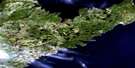
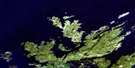
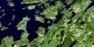
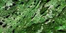
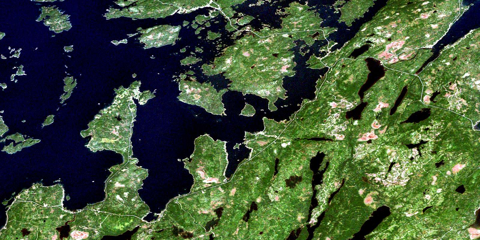
Comfort Cove-Newstead Satellite Image Map
Download Free Aerial Photo 002E07 at 1:50,000 scale
Comfort Cove-Newstead Satellite Imagery
To view this satellite map, mouse over the air photo on the right.
You can also download this satellite image map for free:
002E07 Comfort Cove-Newstead high-resolution satellite image map.
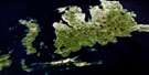
Maps for the Comfort Cove-Newstead aerial map sheet 002E07 at 1:50,000 scale are also available in these versions:
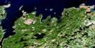
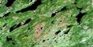
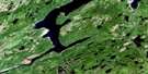
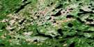
Comfort Cove-Newstead Surrounding Area Aerial Photo Maps
 |
 |
 |
|
 |
 |
 |
 |
 |
 |
 |
 |
 |
 |
 |
 |
© Department of Natural Resources Canada. All rights reserved.
Comfort Cove-Newstead Gazetteer
The following places can be found on satellite image map 002E07 Comfort Cove-Newstead:
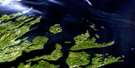
Comfort Cove-Newstead Satellite Image: Bays
Bay of ExploitsBirchy Bay
Burnt Bay
Chapel Cove
Comfort Cove
Dog Bay
Eastern Harbour
Emily Cove
Horwood Bay
Indian Arm
Intricate Harbour
Loon Bay
Loon Harbour
Michael's Harbour
Newstead Harbour
South Harbour
St. Michael's Harbour
Summerford Arm
Village Cove
Western Harbour
Western Harbour
Comfort Cove-Newstead Satellite Image: Capes
Chapel HeadComfort Head
Farmer Head
Indian Head
Long Point
Long Point
Long Point
Net Cove Head
Reddetts Head
South Head
Comfort Cove-Newstead Satellite Image: Channels
Birchy Island TickleCamel Passage
Samson Tickle
Comfort Cove-Newstead Satellite Image: Cliffs
Shag CliffComfort Cove-Newstead Satellite Image: Islands
Berry IslandBirchy Island
Buchan Island
Camel Island
Chapel Island
Cinder Island
Coal All Island
Coffin Island
Comfort Island
Cone Island
Cranberry Island
Cranpot Island
Duck Island
Duck Island
Farmers Island
Gleed Island
Green Island
Gull Island
Hornet Island
Indian Islands
Inspector Island
Jock Islands
Knights Island
North Samson Island
Passage Island
Pine Island
Pyke Island
Rudder Island
Scrub Island
Shag Cliff Islands
Sivier Island
South Samson Island
Squire Island
Steering Island
The Sugar Loaf
Tinker Island
Tinker Island
Transit Island
Whortleberry Island
Yellow Fox Island
Comfort Cove-Newstead Satellite Image: Lakes
Burnt LakeDildo Pond
Duder Lake
First Pond
Long Pond
Rocky Pond
Second Pond
Ten Mile Lake
Comfort Cove-Newstead Satellite Image: Conservation areas
Dog Bay Pond Provincial ParkIndian Cove Neck Provincial Park
Comfort Cove-Newstead Satellite Image: Rivers
Indian Arm BrookJoshuas Brook
Jumper Brook
Comfort Cove-Newstead Satellite Image: River features
The ReachComfort Cove-Newstead Satellite Image: Road features
Curtis CausewayComfort Cove-Newstead Satellite Image: Shoals
Chisholm BankMussel Bed Rocks
Surprise Shoals
Three Mile Rock
Comfort Cove-Newstead Satellite Image: Towns
BaytonaBirchy Bay
Campbellton
Comfort Cove-Newstead
Cottlesville
Summerford
Comfort Cove-Newstead Satellite Image: Unincorporated areas
Birchy Bay NorthBoyd's Cove
Clarke's Head
Cottle's Island-Luke's Arm
Gander Bay North
Gay Side
Horwood
Horwood North
Loon Bay
Michael's Harbour
Newstead
North Samson Island
Rodger Cove
Rodgers Cove
Samson Island
Samson's Island
St. Michael's Harbour
Stoneville
Strong's Island
Comfort Cove-Newstead Satellite Image: Villages
Comfort CoveGayside
© Department of Natural Resources Canada. All rights reserved.
002E Related Maps:
002E Botwood002E01 Weir's Pond
002E02 Gander River
002E03 Botwood
002E04 Hodges Hill
002E05 Robert's Arm
002E06 Point Leamington
002E07 Comfort Cove-Newstead
002E08 Carmanville
002E09 Fogo
002E10 Twillingate
002E11 Exploits
002E12 Little Bay Island
002E13 Nippers Harbour
002E14 Cape St. John
002E16 Little Fogo Islands
