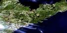
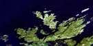
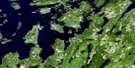
Twillingate Satellite Image Map
Download Free Aerial Photo 002E10 at 1:50,000 scale
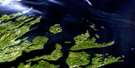
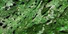
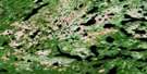
Twillingate Satellite Imagery
To view this satellite map, mouse over the air photo on the right.
You can also download this satellite image map for free:
002E10 Twillingate high-resolution satellite image map.
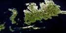
Maps for the Twillingate aerial map sheet 002E10 at 1:50,000 scale are also available in these versions:
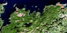
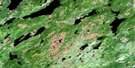
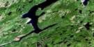
Twillingate Surrounding Area Aerial Photo Maps
 |
 |
 |
|
 |
 |
 |
 |
 |
 |
 |
 |
 |
 |
 |
 |
© Department of Natural Resources Canada. All rights reserved.
Twillingate Gazetteer
The following places can be found on satellite image map 002E10 Twillingate:
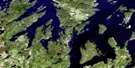
Twillingate Satellite Image: Bays
Back HarbourBay of Exploits
Beachy Cove
Beachy Cove
Bear Cove
Beaver Cove
Black Island Harbour
Bluff Head Cove
Bridgeport Harbour
Bridger Cove
Browneys Cove
Burnt Arm
Byrne Cove
Carter's Cove
Cat Cove
Chanceport Harbour
Chimney Cove
Chockin Cove
Clarkes Cove
Cobbs Arm
Codjack Cove
Connert Head Cove
Cottle's Bay
Cross Cove
Davy Button Cove
Devils Cove
Dog Bay
Dumpling Cove
Durrell Arm
Farmers Arm
Fools Harbour
Friday Bay
Gallows Cove
Gillott Cove
Goshens Arm
Gut Arm
Herring Cove
Horwood Bay
Indian Cove
Jenkins Cove
Jenkins Cove
Kiar Cove
Kiddle Cove
Little Beaver Cove
Little Bridgeport Harbour
Little Byrne Cove
Little Harbour
Little Harbour Bight
Little Wild Cove
Lobster Harbour
Luke's Arm
Manuel Cove
Manuels Cove
Milliners Arm
Moreton's Harbour
Morton Cove
Mudford Cove
Ninepin Arm
Old House Cove
Parsons Cove
Pearce Harbour
Pikes Arm
Pomley Cove
Potash Cove
Puzzle Bay
Puzzle Harbour
Robins Cove
Rodney Cove
Roses Harbour
Rushy Cove
Saffron Cove
Salt Harbour
Sam Cove
Sam Jeans Cove
Sealing Cove
Sleepy Cove
Southern Harbour
Spillers Cove
Squid Cove
Starve Harbour
Tilt Cove
Tizzard's Harbour
Toogood Arm
Twillingate Harbour
Upper Gut Arm
Virgin Arm
Webber Bight
Western Head Cove
Wild Bight
Wild Cove
Twillingate Satellite Image: Beaches
Great French BeachLong Beach
Twillingate Satellite Image: Capes
Back Harbour HeadBeaver Head
Black Point
Bluff Head
Bread and Butter Point
Bridgeport Harbour Head
Burns Point
Carter Head
Carters Head
Clam Rock Head
Coddle Point
Crow Head
Cuckold Point
Deepwater Point
Devils Cove Head
Dicky Head
Dumpling Point
East Crow Head
East Point
French Head
Gunning Head
Handkerchief Cove Head
Hell Grapple Head
Hell-mouth Head
Herring Head
Herring Neck
Horney Head
Long Point
Lower Head
Moreton's Harbour Head
Moses Point
Muddy Hole Point
Old House Cove Head
Pearce Harbour Point
Port Albert Peninsula
Puzzle Harbour Head
Ragged Point
Rose Head
Round Head
Spillers Point
Starve Head
Tickle Point
Tizzard's Harbour Head
Western Head
Wild Bight Head
Wild Point
Young Point
Twillingate Satellite Image: Channels
Black Island TickleBurnt Island Tickle
Gut Tickle
Herring Head Tickle
Long Tickle
Main Tickle
Shoal Tickle
Twillingate Satellite Image: Cliffs
The PinnacleTwillingate Satellite Image: Islands
Anderson IslandBacalhao Island
Back Harbour Gull Island
Batrix Island
Berry Island
Berry Island
Big Gull Island
Black Island
Black Island
Brandies
Bridgeport Island
Burnt Island
Chance Harbour Island
Christopher Island
Cottle's Island
Cottle's Storehouse Island
Crow Head Island
Currant Islands
Dog Island
Dram Island
Duck Island
Duck Island
Duck Islands
Dunnage Island
Fish Island
Fools Harbour Islands
Fudges Island
Goose Island
Gooseberry Island
Grassy Islands
Green Island
Gull Island
Hamilton Island
Harts Island
Herring Islands
Higgins Island
Hose Island
Indian Garden Island
Jack's Island
Joe Island
Killick Stone Island
Knowles Island
Little Black Island
Little Gull Island
Main Tickle Island
Matthews Island
Mouse Island
Neal Island
New World Island
North Trump Island
North Twillingate Island
Pomley Cove Gull Island
Pond Island
Rags Island
Red Island
Red Island
Salt Harbour Island
Ship Island
Sleepy Cove Gull Island
South Berry Island
South Trump Island
South Twillingate Island
Storehouse Island
Tilt Cove Island
Tinker Island
Trump Islands
Welsh Island
Twillingate Satellite Image: Lakes
Moses PondRushy Cove Pond
Salt Pond
Saltwater Pond
Stockeys Pond
Tom Jenkins Pond
White Pilot Basin
Wild Pond
Twillingate Satellite Image: Mountains
Bald HillsBearberry Hill
Eastern Hill
North West Lookout
Smith Lookout
Styles Hill
The Nuddick
Tom Tumbler Hill
White Hills
Twillingate Satellite Image: Conservation areas
Dildo Run Provincial ParkTwillingate Satellite Image: Rapids
Dildo RunTwillingate Satellite Image: Rivers
Rushy Cove RiverTwillingate Satellite Image: Shoals
Baker RockBaldney Rock
Berg Rock
Berry Island Rock
Black Rock
Black Rocks
Blake Rock
Blowhard Rock
Bradley Rock
Brandies Rock
Bread-box
Bridgeport Rock
Burnt Island Rocks
Carter Head Rock
Cheeky Rocks
Copper Rock
Crow Rock
Cuckold Rocks
Dram Rock
East Rocks
Eastern Grounds
Eel Bank
Field Shoal
French Rock
Friday Ledge
Fudge Ground
Gull Island Rock
Gull Rock Bank
Gunning Rock
Harbour Rock
Harper Ledge
Hatchet Rocks
Haypook Rocks
Hell Alley
High Shag Rock
Hussey Rock
Jim Rock
Joe Penny Banks
Killick Shoal
Lawrence Ledge
Low Shag Rock
Mad Moll Rock
Manifold Rock
Mann Rocks
Millers Rock
Moreton's Harbour Rocks
Morris Rock
Mouse Rock
Nine Foot Rock
Nippers Ledge
North East Rock
Northern Ground
Offer Ground
Offer Rock
Offer Western Ground
Old Harry
Old Roger
Old Roger Reef
Old Rusty
Parky Rock
Pearce Ground
Pearce Rock
Primer
Puzzle Harbour Rocks
Red Point Ground
Red Rock
Red Rock
Round Head Rock
Russel Rock
Sculpin Ledge
Serpent Tail
Shackle Bank
Shag Rock
Shag Roost
Shoal Rock
Skinners Ground
Smoker Ledge
Southwest Shoal
Sunker Rock
The Baker
Toadasses
Tom Cod Rock
Tuesday Ledge
West Rock
West Shag Rock
Western Ground
Whale Back Rock
White Ground
White Ground
White Rock
White Shoal
Wild Cove Rocks
Young Harry
Young Roger
Twillingate Satellite Image: Towns
CottlesvilleCrow Head
Summerford
Twillingate
Twillingate Satellite Image: Unincorporated areas
Back HarbourBayview
Beaverton
Black Duck Cove
Black Island
Black Island
Bluff Head Cove
Bridgeport
Burnt Cove
Carter's Cove
Chanceport
Cobbs Arm
Cobb's Arm
Cottle's Island
Cottle's Island-Luke's Arm
Cottlesville
Durrell
Fairbank
Fairbanks
Fairbanks East
Fairbanks-Hillgrade
Gillard's Cove
Gillesport
Green Cove
Hatchet Harbour
Hayward Cove
Herring Neck
Hillgrade
Indian Cove
Jenkins Cove
Kettle Cove
Little Harbour
Little Harbour
Lobster Harbour
Luke's Arm
Manuels Cove
Manuel's Cove
Manuel's Cove-Gillard's Cove
Merritts Harbour
Merritt's Harbour
Moreton's Harbour
Newville
Paradise
Parkview
Pikes Arm
Port Albert
Purcell Harbour
Purcell's Harbour
Salt Harbour
Salt Pans
Ship Island
Smooth Cove
Sunnyside
Tilt Cove
Tizzard's Harbour
Toogood Arm
Trump Islands
Twillingate
Valley Pond
Virgin Arm
Virgin Arm-Carter's Cove
Western Head
Whale Gulch
Whale's Gulch
Wild Cove
Twillingate Satellite Image: Valleys
Bear Gulch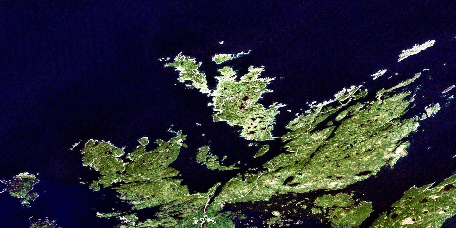
© Department of Natural Resources Canada. All rights reserved.
002E Related Maps:
002E Botwood002E01 Weir's Pond
002E02 Gander River
002E03 Botwood
002E04 Hodges Hill
002E05 Robert's Arm
002E06 Point Leamington
002E07 Comfort Cove-Newstead
002E08 Carmanville
002E09 Fogo
002E10 Twillingate
002E11 Exploits
002E12 Little Bay Island
002E13 Nippers Harbour
002E14 Cape St. John
002E16 Little Fogo Islands
