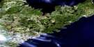
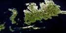
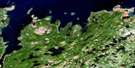
Robert's Arm Satellite Image Map
Download Free Aerial Photo 002E05 at 1:50,000 scale
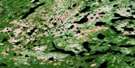
Robert's Arm Satellite Imagery
To view this satellite map, mouse over the air photo on the right.
You can also download this satellite image map for free:
002E05 Robert's Arm high-resolution satellite image map.
Maps for the Robert's Arm aerial map sheet 002E05 at 1:50,000 scale are also available in these versions:
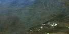
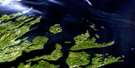
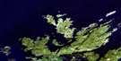
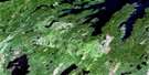
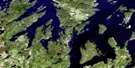
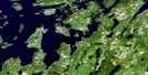
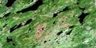
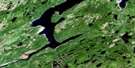
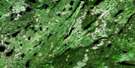
Robert's Arm Surrounding Area Aerial Photo Maps
 |
 |
 |
|
 |
 |
 |
 |
 |
 |
 |
 |
 |
 |
 |
 |
© Department of Natural Resources Canada. All rights reserved.
Robert's Arm Gazetteer
The following places can be found on satellite image map 002E05 Robert's Arm:
Robert's Arm Satellite Image: Bays
Badger BayBear Cove
Beaver Bight
Big Cove
Birchy Cove
Bird Island Cove
Black Duck Cove
Burton's Harbour
Guys Cove
Halls Bay
Hammer Cove
Head Harbour
Herring Cove
Husseys Cove
Indian Cove
Jims Cove
Julies Harbour
Kelly Cove
Kettle Cove
Little Cove
Little Harbour
Locks Cove
Locks Harbour
Locks Harbour
Lower Sparrow Cove
Mansfield Cove
Measles Cove
Mill Cove
Penns Cove
Pretty Island Harbour
Robert's Arm
Seal Bay
Shoal Arm
Side Harbour
Sops Arm
Tilley Cove
Tommy's Arm
Upper Sparrow Cove
Wild Bight
Wild Bight
Robert's Arm Satellite Image: Capes
Bluff PointBurton's Head
Cannon Head
Corner Point
Green Point
Hook Point
Inner Seal Head
Kelly Head
Nose Point
Omega Point
Raft Head
Ragged Point
Salmon Point
Seal Bay Head
Servier Point
Sops Head
Sparrow Cove Point
Thimble Head
Tilley Head
White Point
White Point
Woody Point
Robert's Arm Satellite Image: Channels
Flat Rock TicklePilley's Tickle
Pretty Tickle
Raft Tickle
Robert's Arm Satellite Image: Islands
Bridges IslandDouble Island
Duck Island
Fox Island
Goat Island
Gull Island
Gull Island
Harbour Island
Haywards Gull Island
Kay Island
Margesson Island
Picnic Island
Pretty Island
Raft Island
Sugarloaf Island
The Brandies
Turtle Island
Robert's Arm Satellite Image: Lakes
Anthony PondBologna Pond
Boot Harbour (Second) Pond
Boot Harbour First Pond
Camp Pond
Clearys Pond
Crescent Lake
Deer Pond
Extremity Pond
Fawn Pond
Ferry Pond
Fifields Pond
First Beaver Pond
First Pond
Five Island Pond
Flat Rock Pond
Fourth Pond
Fox Pond
Ghost Pond
Goose Pond
Grave Pond
Gummy Pond
Hammer Cove Pond
Horse Feeder Pond
Husseys Cove Pond
Indian Arm Pond
Island Pond
Joes Ponds
Julies Harbour Pond
Kippins Pond
Lewis Lake
Little Beaver Pond
Little Sandy Pond
Loadabats Pond
Long Lake
Looking Glass Pond
Marks Lake
Martin Pond
Middle Beaver Pond
Mud Pond
Muskrat Steady
Nipper Cove Pond
North Twin Lake
Robert's Arm Pond
Rocky Pond
Rowsells Pond
Rushy Pond
Sandy Pond
Second Pond
Shoal Arm Pond
Side Pond
Ski Pond
Sops Lake
South Twin Lake
South West Pond
Southern Lake
Spot Pond
Spruce Pond
Third Pond
Three Island Pond
Tommy's Arm Long Pond
Triton Pond
Trout Pond
Robert's Arm Satellite Image: Rivers
Badger Bay BrookBlack Brook
Boot Harbour Brook
Five Island Pond Brook
Gummy Brook
Island Pond Brook
Pennys Brook
Seal Bay Brook
Shoal Arm Brook
Silver Brook
Sops Arm Brook
South Brook
Tommy's Arm River
Wellmans Brook
Wells Brook
West Arm Brook
Robert's Arm Satellite Image: Shoals
Bar RockBuzzard Shoal
Callaghans Ground
Flat Rock
Fox Shoal
Georgies Rock
Hogs Nose Rocks
Ledrew Rock
Reynolds Shoal
Robert's Arm Satellite Image: Towns
Robert's ArmRobert's Arm Satellite Image: Unincorporated areas
Head HarbourLockport
Locks Harbour
Locks Harbour

© Department of Natural Resources Canada. All rights reserved.
002E Related Maps:
002E Botwood002E01 Weir's Pond
002E02 Gander River
002E03 Botwood
002E04 Hodges Hill
002E05 Robert's Arm
002E06 Point Leamington
002E07 Comfort Cove-Newstead
002E08 Carmanville
002E09 Fogo
002E10 Twillingate
002E11 Exploits
002E12 Little Bay Island
002E13 Nippers Harbour
002E14 Cape St. John
002E16 Little Fogo Islands
