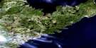
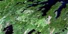
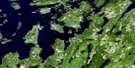
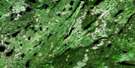
Hodges Hill Satellite Image Map
Download Free Aerial Photo 002E04 at 1:50,000 scale
Hodges Hill Satellite Imagery
To view this satellite map, mouse over the air photo on the right.
You can also download this satellite image map for free:
002E04 Hodges Hill high-resolution satellite image map.
Maps for the Hodges Hill aerial map sheet 002E04 at 1:50,000 scale are also available in these versions:
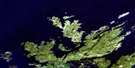
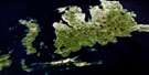
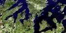
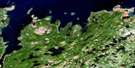
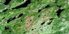
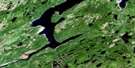
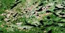
Hodges Hill Surrounding Area Aerial Photo Maps
 |
 |
 |
|
 |
 |
 |
 |
 |
 |
 |
 |
 |
 |
 |
 |
© Department of Natural Resources Canada. All rights reserved.
Hodges Hill Gazetteer
The following places can be found on satellite image map 002E04 Hodges Hill:
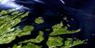
Hodges Hill Satellite Image: Bays
Greenspond HarbourHodges Hill Satellite Image: Channels
Puffin Island TickleHodges Hill Satellite Image: Lakes
Aspen PondBarrens Pond
Boyd's Pond
Cornfield Pond
Frozen Ocean Lake
Goose Lake
Mary Ann Lake
Middleton Lake
Monica Lake
Moose Pond
New Bay Pond
North Twin Lake
Peace Pond
Rocky Pond
South Twin Lake
Trouble Pond
Hodges Hill Satellite Image: Mountains
Bob's HillHodges Hill
Hodges Hill Satellite Image: Conservation areas
Newfoundland T'Railway Provincial ParkHodges Hill Satellite Image: Rivers
Exploits RiverLeech Brook
Monica Brook
New Bay River
North Twin Brook
Northern Arm Brook
Peters River
Thunder Brook
West Arm Brook
Hodges Hill Satellite Image: Towns
Bishop's FallsHodges Hill Satellite Image: Unincorporated areas
Wooddale
© Department of Natural Resources Canada. All rights reserved.
002E Related Maps:
002E Botwood002E01 Weir's Pond
002E02 Gander River
002E03 Botwood
002E04 Hodges Hill
002E05 Robert's Arm
002E06 Point Leamington
002E07 Comfort Cove-Newstead
002E08 Carmanville
002E09 Fogo
002E10 Twillingate
002E11 Exploits
002E12 Little Bay Island
002E13 Nippers Harbour
002E14 Cape St. John
002E16 Little Fogo Islands
