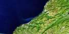
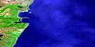
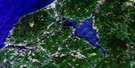
Port Hood Satellite Image Map
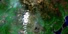
Download Free Aerial Photo 011K04 at 1:50,000 scale
Port Hood Satellite Imagery
To view this satellite map, mouse over the air photo on the right.
You can also download this satellite image map for free:
011K04 Port Hood high-resolution satellite image map.
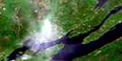
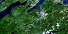
Maps for the Port Hood aerial map sheet 011K04 at 1:50,000 scale are also available in these versions:
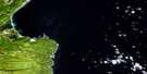
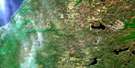
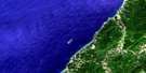
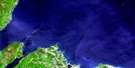
Port Hood Surrounding Area Aerial Photo Maps
 |
 |
||
 |
 |
 |
|
 |
 |
 |
|
 |
 |
 |
 |
© Department of Natural Resources Canada. All rights reserved.
Port Hood Gazetteer
The following places can be found on satellite image map 011K04 Port Hood:
Port Hood Satellite Image: Bays
Bear CoveBruces Cove
Golfe du Saint-Laurent
Gulf of St. Lawrence
MacLeans Cove
Mill Creek
Port Hood
Smith Cove
St. Georges Bay
Sutherlands Cove
Port Hood Satellite Image: Beaches
Colindale BeachMacQuarries Beach
Port Hood Beach
Port Hood Station Beach
Port Hood Satellite Image: Capes
Bald HeadBlack Point
Cape Linzee
Isthmus Point
Murphys Point
Point Vertical
Shag Rock Point
Shipping Point
Smith Point
Susannah Point
Port Hood Satellite Image: Channels
Détroit de NorthumberlandNorthumberland Strait
Port Hood Satellite Image: Cliffs
Hogs BackPort Hood Satellite Image: Geographical areas
InvernessJuste au Corps
Port Hood Satellite Image: Islands
Cape Breton IslandÎle du Cap-Breton
Port Hood Island
Port Hood Satellite Image: Lakes
Murphy PondMurphys Pond
Sutherlands Pond
Port Hood Satellite Image: Mountains
Green HillPort Hood Satellite Image: Major municipal/district area - major agglomerations
InvernessPort Hood Satellite Image: Rivers
Burkes BrookBurkes Brook
Dorseys Brook
Little River
Mill Creek
Schoolhouse Brook
Port Hood Satellite Image: Shoals
Dean ShoalHenry Island Bank
Margarets Reef
Shag Rock
Port Hood Satellite Image: Unincorporated areas
ColindaleDungarry
Dunmore
Little Mabou
Marble Hill
Port Hood
Port Hood Island
Port Hood Station

© Department of Natural Resources Canada. All rights reserved.
