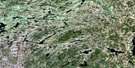
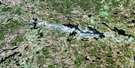
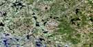
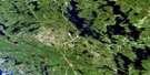
Tom Thomson Lake Satellite Image Map
Download Free Aerial Photo 031E10 at 1:50,000 scale
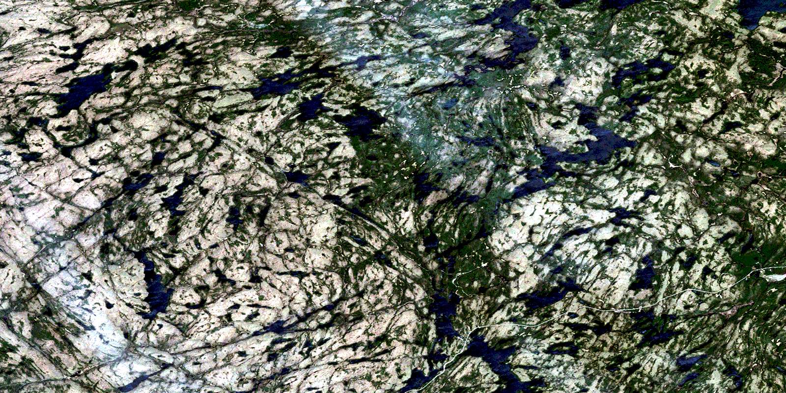
Tom Thomson Lake Satellite Imagery
To view this satellite map, mouse over the air photo on the right.
You can also download this satellite image map for free:
031E10 Tom Thomson Lake high-resolution satellite image map.
Maps for the Tom Thomson Lake aerial map sheet 031E10 at 1:50,000 scale are also available in these versions:
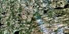
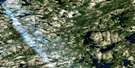
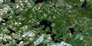
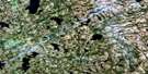
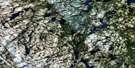
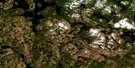
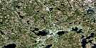
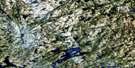
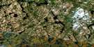
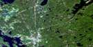
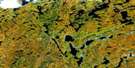
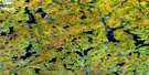
Tom Thomson Lake Surrounding Area Aerial Photo Maps
 |
 |
 |
 |
 |
 |
 |
 |
 |
 |
 |
 |
 |
 |
 |
 |
© Department of Natural Resources Canada. All rights reserved.
Tom Thomson Lake Gazetteer
The following places can be found on satellite image map 031E10 Tom Thomson Lake:
Tom Thomson Lake Satellite Image: Bays
East ArmGrassy Bay
Tom Thomson Lake Satellite Image: Capes
Red Pine PointTom Thomson Lake Satellite Image: Channels
Western GapTom Thomson Lake Satellite Image: Geographical areas
BishopBower
Butt
Canisbay
Devine
Finlayson
Haliburton
Hunter
Lawrence
McCraney
McLaughlin
Muskoka
Nipissing
Peck
Tom Thomson Lake Satellite Image: Islands
Big IslandCaroline Island
Cook Island
Delano Island
Gilmour Island
Joe Island
Little Wapomeo Island
Molly Island
Pathfinder Island
Pines Island
Treasure Island
Wabeno Island
Wahbahmini Island
Wapomeo Island
Tom Thomson Lake Satellite Image: Lakes
Acme LakeAdrienne Lake
Ahme Lake
Alder Lake
Amyoa Lake
Aster Pond
Baby Joe Lake
Baden-Powell Lake
Bandit Lake
Banshee Lake
Barkley Lake
Bartlett Lake
Bat Lake
Beanpod Lake
Bear Lake
Beth Lake
Big Trout Lake
Bijou Lake
Birdie Lake
Bluejay Lake
Bonasa Lake
Bonita Lake
Bonito Lake
Bower Lake
Brown Lake
Brownie Lake
Bruce Lake
Brûlé Lake
Burnt Island Lake
Butt Lake
Cache Lake
Canada Jay Lake
Canisbay Lake
Canoe Lake
Casey Lake
Cashel Lake
Castor Lake
Ceres Lake
Chit Lake
Clara Lake
Clyde Lake
Coot Lake
Cranebill Lake
Crossbill Lake
Croy Lake
Curlew Lake
Dace Lake
Daisy Lake
Dan Lake
David Lake
Delano Lake
Dick Lake
Dizzy Lake
Dolly Lake
Drummer Lake
Dry Lake
Dusk Lake
East End Lake
Eel Lake
Error Lake
Eu Lake
Falcon Lake
Fauquier Lake
Favovier Lake
Fawn Lake
Faya Lake
Fern Lake
Floss Lake
Fools Lake
Forlorn Lake
Found Lake
Furrow Lake
Gill Lake
Gnat Lake
Grant Lake
Grape Lake
Groundhog Lake
Guide Lake
Hailstorm Lake
Hambone Lake
Hanes Lake
Happy Isle Lake
Happyisle Lake
Harness Lake
Hawkins Lake
He Lake
Head Lake
Hilliard Lake
Hood Lake
Hope Lake
Hot Lake
Hunter Lake
Iagoo Lake
Ink Lake
Iris Lake
Ishkuday Lake
Islet Lake
Jack Lake
Jake Lake
Jay Lake
Joe Lake
Juan Lake
Jubilee Lake
Kagh Lake
Kathlyn Lake
Kenneth Lake
Kingfisher Lake
Kite Lake
Kootchie Lake
Lady-slipper
Lark Lake
Larry Lake
Lay Lake
Lilypond Lake
Linda Lake
Little Drummer Lake
Little Eagle Lake
Little Eastend Lake
Little Island Lake
Little Joe Lake
Little McCraney Lake
Little Misty Lake
Little Otterslide Lake
Little Pugawagun Lake
Little Trout Lake
Littledoe Lake
Loft Lake
Long Thin Lake
Longspur Lake
Lulu Lake
Lupus Lake
Mack Lake
Mackinaw Lake
Maggie Lake
Magnetawan Lake
Magpie Lake
Maiden Lake
March Hare Lake
Margaret Lake
Marion Lake
McCraney Lake
McIntosh Lake
McLachlin Depot Lake
McLaughlin Depot Lake
Mermaid Lake
Mew Lake
Midget Lake
Minnow Lake
Misty Lake
Mizzy Lake
Moccasin Lake
Moray Lake
Mosquito Lake
Mossy Lake
Mubwayaka Lake
Muslim Lake
Namakootchie Lake
Nightfall Lake
Norah Lake
North Clyde Lake
North Oak Lake
Nosa Lake
Notagan Lake
Oak Lake
O'Gorman Lake
Olive Lake
Omemei Lake
Onaway Lake
Otterpaw Lake
Otterslide Lake
Ouse Lake
Owl Lake
Paddy Lake
Pandion Pond
Panther Lake
Papukiwis Lake
Pathfinder Lake
Peck Lake
Pewee Lake
Pezheki Lake
Pinay Lake
Pincher Lake
Pocket Lake
Polly Lake
Pond Lake
Ponemah Lake
Potter Lake
Provoking Lake
Pugawagun Lake
Queer Lake
Rain Lake
Rainbow Lake
Ralph Bice Lake
Raven Lake
Red Lake
Red Wing Lake
Rose Lake
Rosswood Lake
Salvelinus Lake
Sam Lake
Samos Lake
Sasajewun Lake
Sawyer Lake
Secret Lake
Shah Lake
Sheriff Pond
Shiner Lake
Sims Lake
Smoke Lake
Snowbird Lake
Snowshoe Lake
Source Lake
South Canisbay Lake
South Snowbird Lake
South Tea Lake
Southworth Lake
Splash Lake
Stammer Lake
Starling Lake
Straight Shore Lake
Stutter Lake
Sunbeam Lake
Sundance Lake
Sunny Lake
Sunset Lake
Suntan Lake
Swallow Lake
Swan Lake
Tanamakoon Lake
Tea Lake
Telma Lake
Tepee Lake
Tern Lake
Thunder Lake
Timberwolf Lake
Tom Thomson Lake
Tonakela Lake
Tony Lake
Trail Lake
Treefrog Lake
Trout Lake
Vanishing Pond
Wabasso Lake
Washa Lake
Way Lake
Wee Lake
Weed Lake
Weir Lake
Wenona Lake
West Dolly Lake
West Harry Lake
West Otterpaw Lake
West Rose Lake
White Lake
White Lake
Whitecat Lake
Whitespruce Lake
White-throat Lake
Willow Lake
Wolf Howl Pond
Wry Lake
Wye Lake
Tom Thomson Lake Satellite Image: Mountains
Gibraltar RockTom Thomson Lake Satellite Image: Major municipal/district area - major agglomerations
HaliburtonMuskoka
Tom Thomson Lake Satellite Image: Other municipal/district area - miscellaneous
Algonquin HighlandsLake of Bays
Sherborne, McClintock and Livingstone
Sherborne, McClintock, Livingstone, Lawrence and Nightingale
Sherborne, Stanhope, McClintock, Livingstone, Lawrence and Nightingale
Stanhope
Tom Thomson Lake Satellite Image: Conservation areas
Algonquin Provincial ParkBig East River Provincial Park
Tom Thomson Lake Satellite Image: Rivers
Ahme CreekAmyoa Creek
Beanpod Creek
Big East River
Brown Creek
Canisbay Creek
Casey Creek
Coot Creek
Cranebill Creek
Cripple Creek
Dan Creek
David Creek
Delano Creek
Dizzy Creek
Dolly Creek
Dusk Creek
East River
Edwin Creek
Error Creek
Fern Creek
Greenish Creek
Hailstorm Creek
Hambone Creek
Head Creek
Hickory Creek
Hilliard Creek
Iagoo Creek
Iris Creek
Jack Creek
Jubilee Creek
Kenneth Creek
Kingfisher Creek
Linda Creek
Little East River
Little Oxtongue River
Little Trout Creek
Longspur Creek
Lulu Creek
Lupus Creek
Mack Creek
Mackinaw Creek
Madawaska River
Marion Creek
McCraney Creek
McIntosh Creek
Mink Creek
Mosquito Creek
Namakootchie Creek
Nightfall Creek
North Madawaska River
Nosa Creek
Oak Creek
Otterpaw Creek
Otterslide Creek
Oxtongue River
Penaish Creek
Petawawa River
Pezheki Creek
Pincher Creek
Ponemah Creek
Potter Creek
Rainbow Creek
Red Fox Creek
Shah Creek
She Creek
Sims Creek
Smoke Creek
Splash Creek
Straight Shore Creek
Stutter Creek
Swan Creek
Tasso Creek
Tea Creek
Tim River
Timberwolf Creek
Tonakela Creek
Tony Creek
Wenona Creek
Tom Thomson Lake Satellite Image: Towns
KearneyTom Thomson Lake Satellite Image: Unincorporated areas
Algonquin ParkBrûlé Lake
Cache Lake
Camp Arowhon
Camp Pathfinder
Canoe Lake
Eagle Lake Landing
Joe Lake
McCraney
Taylor Statten
© Department of Natural Resources Canada. All rights reserved.
031E Related Maps:
031E Huntsville031E01 Wilberforce
031E02 Haliburton
031E03 Bracebridge
031E04 Lake Joseph
031E05 Orrville
031E06 Huntsville
031E07 Kawagama Lake
031E08 Whitney
031E09 Opeongo Lake
031E10 Tom Thomson Lake
031E11 Burk's Falls
031E12 Magnetawan
031E13 Golden Valley
031E14 South River
031E15 Burntroot Lake
031E16 Lake Lavieille
