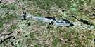
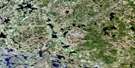
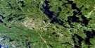
Kawagama Lake Satellite Image Map
Download Free Aerial Photo 031E07 at 1:50,000 scale
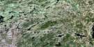
Kawagama Lake Satellite Imagery
To view this satellite map, mouse over the air photo on the right.
You can also download this satellite image map for free:
031E07 Kawagama Lake high-resolution satellite image map.
Maps for the Kawagama Lake aerial map sheet 031E07 at 1:50,000 scale are also available in these versions:
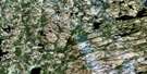
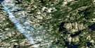
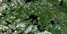
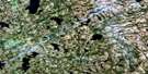
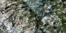
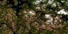
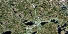
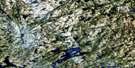
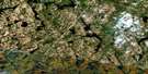
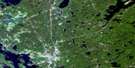
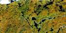
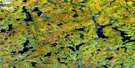
Kawagama Lake Surrounding Area Aerial Photo Maps
 |
 |
 |
 |
 |
 |
 |
 |
 |
 |
 |
 |
 |
 |
 |
 |
© Department of Natural Resources Canada. All rights reserved.
Kawagama Lake Gazetteer
The following places can be found on satellite image map 031E07 Kawagama Lake:
Kawagama Lake Satellite Image: Bays
Archer BayChurch Bay
Colonel's Bay
Crown Bay
Echo Bay
Emerald Bay
Fletcher Bay
Jean Bay
Loon Bay
Minden Bay
Parkside Bay
Rabbit Bay
River Bay
South Bay
Ten Mile Bay
Trading Bay
West Bay
White Trout Bay
Kawagama Lake Satellite Image: Capes
Birch PointChevalier Point
Elizabeth Point
Ronville Point
Kawagama Lake Satellite Image: Channels
The NarrowsKawagama Lake Satellite Image: Falls
Gravel FallsMarsh Falls
Marshs Falls
Ragged Falls
Tea Falls
Upper Twin Falls
Whiskey Falls
Kawagama Lake Satellite Image: Geographical areas
CanisbayEyre
Finlayson
Franklin
Haliburton
Havelock
Lawrence
Livingstone
McClintock
Muskoka
Nipissing
Peck
Ridout
Sherborne
Sinclair
Kawagama Lake Satellite Image: Islands
Aubrey IslandBear Island
Big Trout Island
Clarke Island
Dennison Island
Eagle Island
East Long Island
Echo Island
Gent Island
Haserot Island
Janey Island
Little Trout Island
Long Island
Pancake Island
Raynor Island
Reuben Island
Rock Island
Trout Island
Turners Island
Tyrell Island
Wolf Island
Kawagama Lake Satellite Image: Lakes
Ahme LakeArbuckle Lake
Art Lake
Ashball Lake
Bear Lake
Beast Lake
Beetle Lake
Bena Lake
Bertie Lake
Big Hoover Lake
Big Porcupine Lake
Bivouac Lake
Blackwell Lake
Bloody Lake
Bluebell Lake
Bonnechere Lake
Bright Lake
Brooks Lake
Buchanan Lake
Buck Lake
Burns Lake
Camp Lake
Campcot Lake
Charcoal Lake
Claude Lake
Clayton Lake
Clean Lake
Clinto Lake
Cod Lake
Coot Lake
Corbett Lake
Cotter Lake
Cradle Lake
Cross Corner Lake
Crotch Lake
Crown Lake
Crumby Lake
Crystalline Lake
Dagger Lake
Dale Lake
Depot Lake
Dividing Lake
Docker Lake
Dot Lake
Dotty Lake
Doughnut Lake
Duplicate Lakes
East Jeannie Lakes
Eighteen Mile Lake
Eiler Lake
Ermine Lake
Eyre Lake
Feline Lake
Fen Lake
Fifteen Mile Lake
Fisher Lake
Fitzell Lake
Fletcher Lake
Flossie Lake
Founders Lake
Frog Lake
Goodwin Lake
Gosling Lake
Greenwood Lake
Guskewau Lake
Hardup Lake
Hare Lake
Harness Lake
Harvey Lake
Havelock Lake
Helve Lake
Heron Lake
Hickory Lake
Hilly Lake
Hinterland Lake
Hobo Lake
Hosiery Lake
Ingrams Lake
Jeannie Lake
Johnson Lake
Kawagama Lake
Kelly Lake
Kimball Lake
Kingfisher Lake
Kirkwood Lake
Lake Louisa
Lake of Bays
Lawrence Lake
Leach Lake
Lemon Lake
Limburner Lake
Ling Lake
Little Buckhorn Lake
Little Coon Lake
Little Dotty Lake
Little Hardy Lake
Little Hoover Lake
Little Kennisis Lake
Little Louie Lake
Little Mohawk Lake
Little Nelson Lake
Little Oxbow Lake
Little Rookery Lake
Little Smoke Lake
Little Spaniel Lake
Little Troutspawn Lake
Livingstone Lake
Loader Lake
Longline Lake
Loon Lake
Louie Lake
Lower Fletcher Lake
Luck Lake
Lucy Lake
Lumber Lake
Maggie Lake
Maple Leaf Lake
Martencamp Lake
McCann Lake
McFadden Lake
McGarvey Lake
Merdie Lake
Middle Pond
Midget Lake
Mikado Lake
Millichamp Lake
Minkey Lake
Minnow Lake
Minto Lake
Miry Lake
Mohawk Lake
Mooney Lake
Nelson Lake
Niger Lake
Norman Lake
North Dotty Lake
North Grace Lake
North Havelock Lake
North Lemon Lake
Notsobig Lake
Otter Lake
Oxbow Lake
Oxtongue Lake
Paddy Lake
Pardee Lake
Park Lake
Phipps Lake
Pinfeather Lake
Pipio Lake
Plough Lake
Poorhouse Lake
Porridge Lake
Powderhorn Lake
Pup Lake
Quiver Lake
Ragged Lake
Roadline Lake
Rockaway Lake
Rod and Gun Lake
Roger Lake
Rookery Lake
Samlet Lake
Scott Lake
Seventeen Mile Lake
Shawandasee Lake
Shier Lake
Sixteen Mile Lake
Skunk Lake
Slim Lake
Slipper Lake
Sly Lake
Small Lake
Smoke Lake
Snap Lake
Snow Lake
South Nelson Lake
South Tasso Lake
South Tea Lake
South Wildcat Lake
Spaniel Lake
Split Rock Lake
Steeple Lake
Steeprise Lake
Stocking Lake
Stringer Lake
Sunken Lake
Sunrise Lake
Swan Lake
Sward Lake
Tasso Lake
Tea Lake
Teardrop Lake
Thinbeaver Lake
Thumb Lake
Toad Lake
Tock Lake
Troutspawn Lake
Upper Head Lake
Upper Oxbow Lake
Victory Lake
Wells Lake
West Frog Lake
Westward Lake
Whatnot Lakes
White Lake
Wilbur Lake
Wildcat Lake
Wilson Lake
Wisp Lake
Wolf Lake
Wolfish Lake
Wolfsbane Lake
Kawagama Lake Satellite Image: Mountains
Ball MountainManitou Mountain
Kawagama Lake Satellite Image: Major municipal/district area - major agglomerations
HaliburtonMuskoka
Kawagama Lake Satellite Image: Other municipal/district area - miscellaneous
Algonquin HighlandsDysart, Dudley, Harcourt, Guilford, Harburn, Bruton, Havelock, Eyre and Clyde
Franklin
Lake of Bays
McLean
Ridout
Sherborne, McClintock and Livingstone
Sherborne, McClintock, Livingstone, Lawrence and Nightingale
Sherborne, Stanhope, McClintock, Livingstone, Lawrence and Nightingale
Stanhope
Kawagama Lake Satellite Image: Conservation areas
Algonquin Provincial ParkBig East River Provincial Park
Dividing Lake Provincial Nature Reserve
Dividing Lake Provincial Park
Oxtongue River-Ragged Falls Provincial Park
Kawagama Lake Satellite Image: Rapids
Little Twin FallsWhiskey Rapids
Kawagama Lake Satellite Image: Rivers
Ahme CreekBig East River
Black River
Bravender Creek
Bright Creek
Buchanan Creek
Buckhorn Creek
Butter Ball Creek
Clinto Creek
Cod Creek
Crown Creek
East River
Ermine Creek
Eyre Creek
Fletcher Creek
Gateway Creek
Guskewau Creek
Hardy Creek
Head Creek
Hinterland Creek
Hollow River
Hoover Creek
Kenneth Creek
Kennisis River
Kimball Creek
Little Kennisis River
Little Oxbow Creek
Livingstone Creek
Louisa Creek
Maggie Creek
Maple Leaf Creek
Marion Creek
Merdie Creek
Midget Creek
Mohawk Creek
North Lemon Creek
Oxbow Creek
Oxtongue River
Parkside Creek
Pipio Creek
Quiver Creek
Rebecca Creek
Rookery Creek
Sixteen Mile Creek
Slipper Creek
Smoke Creek
South Nelson Creek
Spaniel Creek
Swan Creek
Tasso Creek
Tea Creek
Ten Mile Creek
Thumb Creek
Toad Creek
Troutspawn Creek
Wildcat Creek
Kawagama Lake Satellite Image: Shoals
Raynor ShoalTurners Rock
Kawagama Lake Satellite Image: Unincorporated areas
AntiochBirkendale
Fox Point
Limberlost Lodge
Oxtongue Lake
Russell Landing
Sea Breeze
Kawagama Lake Satellite Image: Low vegetation
Reservoir Marsh
© Department of Natural Resources Canada. All rights reserved.
031E Related Maps:
031E Huntsville031E01 Wilberforce
031E02 Haliburton
031E03 Bracebridge
031E04 Lake Joseph
031E05 Orrville
031E06 Huntsville
031E07 Kawagama Lake
031E08 Whitney
031E09 Opeongo Lake
031E10 Tom Thomson Lake
031E11 Burk's Falls
031E12 Magnetawan
031E13 Golden Valley
031E14 South River
031E15 Burntroot Lake
031E16 Lake Lavieille
