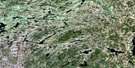
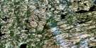
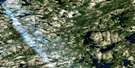
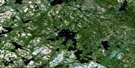
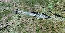
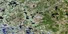
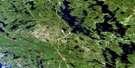
Burntroot Lake Satellite Image Map
Download Free Aerial Photo 031E15 at 1:50,000 scale
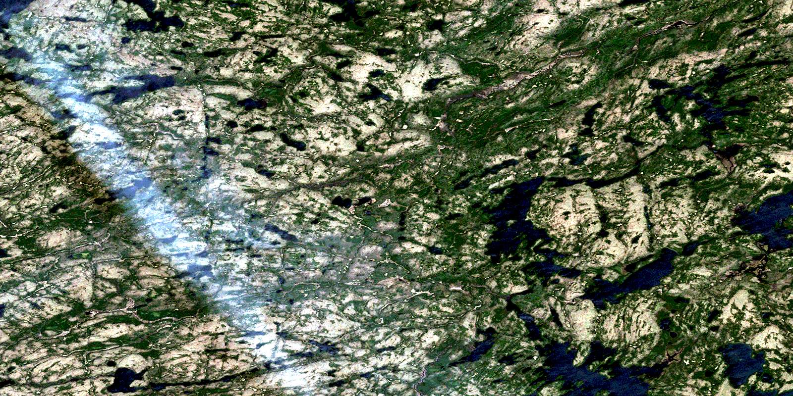
Burntroot Lake Satellite Imagery
To view this satellite map, mouse over the air photo on the right.
You can also download this satellite image map for free:
031E15 Burntroot Lake high-resolution satellite image map.
Maps for the Burntroot Lake aerial map sheet 031E15 at 1:50,000 scale are also available in these versions:
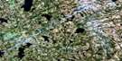
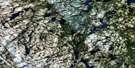
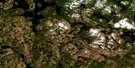
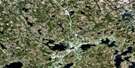
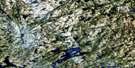
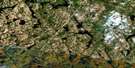
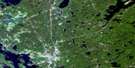
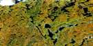
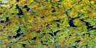
Burntroot Lake Surrounding Area Aerial Photo Maps
 |
 |
 |
 |
 |
 |
 |
 |
 |
 |
 |
 |
 |
 |
 |
 |
© Department of Natural Resources Canada. All rights reserved.
Burntroot Lake Gazetteer
The following places can be found on satellite image map 031E15 Burntroot Lake:
Burntroot Lake Satellite Image: Bays
Birch BayPresqu'île Bay
Redpine Bay
Whistle Bay
Burntroot Lake Satellite Image: Falls
High FallsBurntroot Lake Satellite Image: Geographical areas
BiggarBishop
Bower
Butt
Devine
Freswick
Lister
McLaughlin
Nipissing
Osler
Paxton
Pentland
Wilkes
Burntroot Lake Satellite Image: Lakes
Arrow LakeBad Lake
Barred Owl Lake
Beau Lake
Beaverly Lake
Beaverpaw Lake
Behan Lake
Belle Lake
Big Thunder Lake
Big Trout Lake
Biggar Lake
Birchcliffe Lake
Bird Lake
Bishop Lake
Blowdown Lake
Blue Lake
Bog Pond
Bouillon Lake
Browse Lake
Burntroot Lake
Burt Lake
Calm Lake
Calumet Lake
Carl Wilson Lake
Casque Lake
Catfish Lake
Chemung Lake
Chickaree Lake
Chippy Lake
Coldspring Lake
Cop Lake
Coral-root Lake
CreationLake
Cuckoo Lake
Deer Yard Lake
Devil Lake
Devine Lake
Diver Lake
Dymond Lake
Elsie Lake
Erables Lake
Ewayea Lake
Floating Heart Lake
Gash Lake
Gibson Lake
Gormire Lake
Grass Lake
Grey Owl Lake
Grosbeak Lake
Ground Lizard Lake
Hag Lake
Happy Isle Lake
Happyisle Lake
Hayes Lake
Hemlock Lake
Hiah Lake
Hiawatha Lake
Highdam Pond
Hogan Lake
Hornbeam Lake
Inez Lake
J.E.H. MacDonald Lake
Jolly Lake
Judy Lake
Junco Lake
Kabevun Lake
Kagagee Lake
Kawa Lake
Kelly Lake
Kennedy Lake
Lake Isis
Lake La Muir
Lantern Lake
Lawren Harris Lake
Linnet Lake
Little Butt Lake
Little Nadine Lake
Little Osler Lake
Little Redhead Lake
Lonely Lake
Longbow Lake
Longer Lake
Loontail Lake
Loughrin Lake
Luckless Lake
Lynx Lake
Macoun Lake
Manabezi Lake
Mangotasi Lake
Manitou Lake
Manta Lake
Meda Lake
Merchant Lake
Minnehaha Lake
Minnewawa Lake
Mire Lake
Mowat Lake
Nadine Lake
Namea Lake
Narrowbag Lake
Nid Lake
Nod Lake
Nokomis Lake
North Cuckoo Lake
North Raven Lake
North Sylvia Lake
North Tea Lake
One Mile Lake
Onemile Lake
Osler Lake
Ozawabrek Lake
Pauwatine Lake
Peace Lake
Perley Lake
Plumb Lake
Portal (Burntroot) Lake
Pugwa Lake
Punch Lake
Ranger Lake
Raven Lake
Ravenau Lake
Redhead Lake
Redpine Lake
Remona Lake
Robinson Lake
Rosebary Lake
Sally Lake
Sandfly Lake
Sawbill Lake
Saw-whet Lake
Shag Lake
Shippagew Lake
Sinclair Lake
Sittingman Lake
Skuce Lake
Snowbird Lake
Sorrel Lake
South Osler Lake
South Vanity Lake
Spa Lake
Spatterdock Pond
Spiza Lake
Squaw Lake
Squawk Lake
Stag Lake
Sunfish Lake
Sylvia Lake
Tamarack Lake
Three Mile Lake
Threemile Lake
Thunder Lake
Tillie Lake
Totem Lake
Towinee Lake
Trout Lake
Upper Kawa Lake
Vanity Lake
Varley Lake
Vulture Lake
Wabanah Lake
Wabewa Lake
Wahwahtaysee Lake
Wapiti Lake
Warbler Lake
Wasp Lake
Waterthrush Lake
Wehawe Lake
Whiskyjack Lake
Whistle Lake
White Lake
Wib Lake
Wilkes Lake
Winifred Lake
Wolfland Lake
Woodpecker Lake
Yellow Birch Lake
Yellowbird Lake
Zema Lake
Burntroot Lake Satellite Image: Conservation areas
Algonquin Provincial ParkBurntroot Lake Satellite Image: Rapids
Allen RapidsCatfish Rapids
Cedar Rapids
Portal Rapids
Snowshoe Rapids
Burntroot Lake Satellite Image: Rivers
Alder CreekAmable du Fond River
Beaverpaw Creek
Belle Creek
Birchcliffe Creek
Blue Creek
Bopeep Creek
Bouillon Creek
Chemung Creek
Coldspring Creek
Craig Creek
Crow River
Cuckoo Creek
Devine Creek
Diver Creek
Ewayea Creek
Gibson Creek
Grosbeak Creek
Hayes Creek
Hemlock Creek
Hiawatha Creek
Judy Creek
Kawa Creek
Kelly Creek
Lantern Creek
Latour Creek
Little Madawaska River
Loontail Creek
Loughrin Creek
Manabezi Creek
Manta Creek
Maple Creek
Meda Creek
Mink Creek
Minnehaha Creek
Minnewawa Creek
Mire Creek
Nadine Creek
Namea Creek
Nipissing River
Nod Creek
Nokomis Creek
North Sylvia Creek
Osler Creek
Ozawabrek Creek
Petawawa River
Pezheki Creek
Plumb Creek
Pugwa Creek
Raven Creek
Robinson Creek
Shag Creek
Skuce Creek
South Osler Creek
Spa Creek
Spiza Creek
Squawk Creek
Stag Creek
Sunfish Creek
Tim River
Totem Creek
Upper Nadine Creek
Vanity Creek
Vulture Creek
Wabanah Creek
Wapiti Creek
Warbler Creek
Waymuk Creek
Wib Creek
Wolfland Creek
Burntroot Lake Satellite Image: Road features
Allen Rapids PortageAnglers Portage
© Department of Natural Resources Canada. All rights reserved.
031E Related Maps:
031E Huntsville031E01 Wilberforce
031E02 Haliburton
031E03 Bracebridge
031E04 Lake Joseph
031E05 Orrville
031E06 Huntsville
031E07 Kawagama Lake
031E08 Whitney
031E09 Opeongo Lake
031E10 Tom Thomson Lake
031E11 Burk's Falls
031E12 Magnetawan
031E13 Golden Valley
031E14 South River
031E15 Burntroot Lake
031E16 Lake Lavieille
