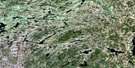
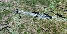
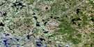
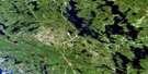
Golden Valley Satellite Image Map
Download Free Aerial Photo 031E13 at 1:50,000 scale
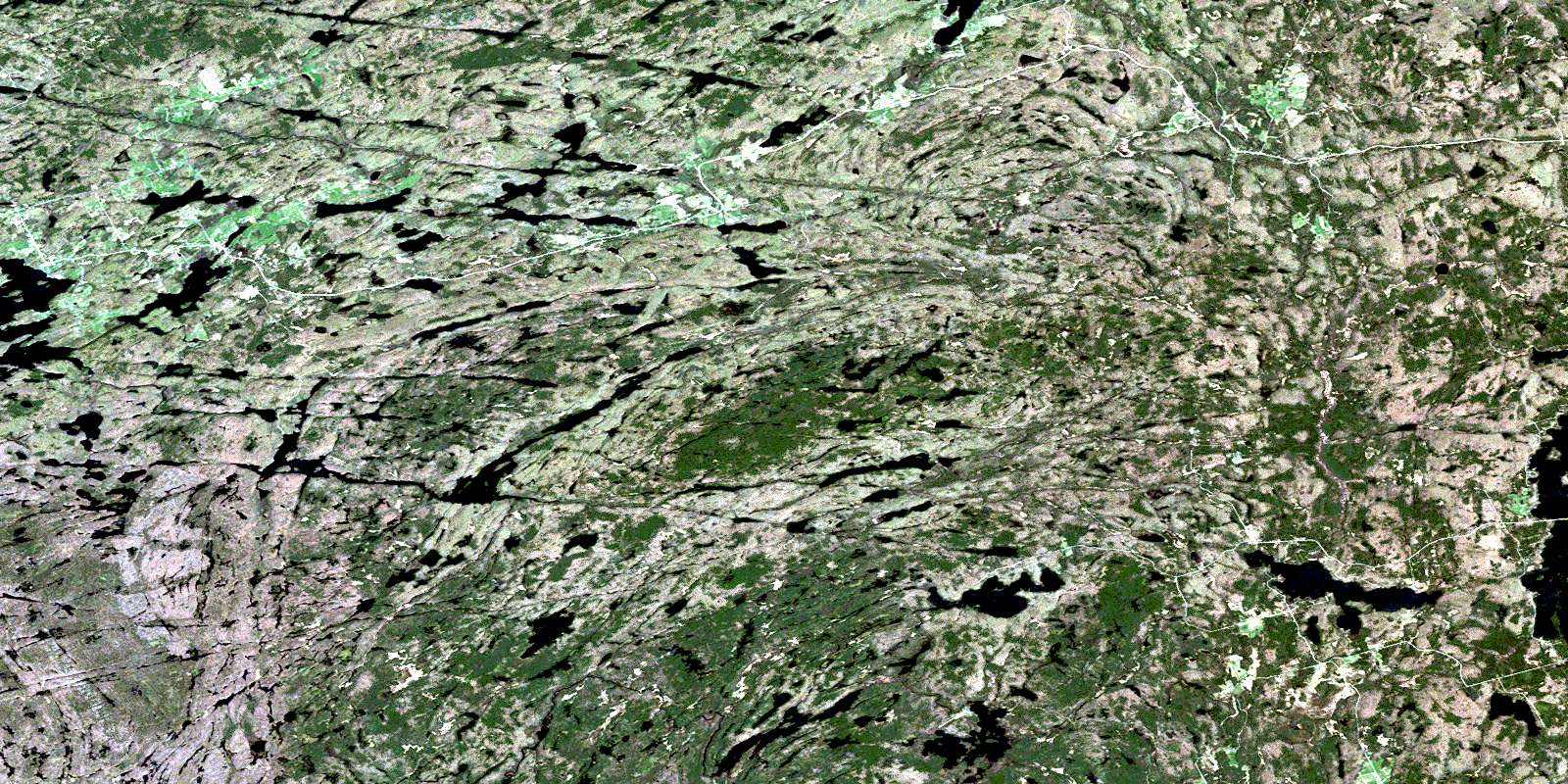
Golden Valley Satellite Imagery
To view this satellite map, mouse over the air photo on the right.
You can also download this satellite image map for free:
031E13 Golden Valley high-resolution satellite image map.
Maps for the Golden Valley aerial map sheet 031E13 at 1:50,000 scale are also available in these versions:
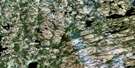
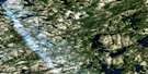
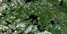
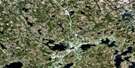
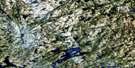
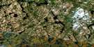
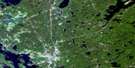
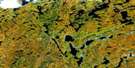
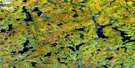
Golden Valley Surrounding Area Aerial Photo Maps
 |
 |
 |
 |
 |
 |
 |
 |
 |
 |
 |
 |
 |
 |
 |
 |
© Department of Natural Resources Canada. All rights reserved.
Golden Valley Gazetteer
The following places can be found on satellite image map 031E13 Golden Valley:
Golden Valley Satellite Image: Bays
Brunne BayMcNeil Bay
Phillips Bay
Pigeon Bay
Smith Bay
Sunny Bay
Golden Valley Satellite Image: Channels
Lee's NarrowsLong Narrows
McKee's Narrows
Golden Valley Satellite Image: Falls
Dutchman ChutesGolden Valley Satellite Image: Geographical areas
ChapmanEast Mills
Ferrie
Gurd
Hardy
Lount
Machar
McConkey
McKenzie
Mills
Nipissing
Parry Sound
Patterson
Pringle
Strong
Wilson
Golden Valley Satellite Image: Islands
Amulet IslandBig Chief Island
Birds Eye Island
Blueberry Island
Broderick Island
Burnt Island
Burnt Island
Centre Island
Christy Island
Cranberry Island
Crystal Island
Eby Island
Edgar Island
Edwards Island
Fowke Island
Hall Island
King Island
Long Island
Mickiebish Island
Netawanda Island
North Island
Roxy Island
Schmeler Island
Walton Island
Golden Valley Satellite Image: Lakes
Arthurs LakeBain Lake
Barney Lake
Big Deer Lake
Big Hungry Lake
Billy Lake
Bob Lake
Boss Lake
Bray Lake
Broadwell Lake
Brunner Lake
Cadden Lake
Chartier Lake
Cheer Lake
Clear Lake
Commanda Lake
Cranberry Lake
Crotch Lake
Culin Lake
De Bernard Lake
Deer Lake
Dobb Lake
Dobbs Lake
Dog Lake
Driver Lake
Duck Lake
Duck Lake
Durrell Lake
Dutchman Lake
Eagle Lake
Ell Lake
Empy Lake
Fairplay Lake
Fowke Lake
Garton Lake
Georgeen Lake
George's Lake
Halfpenny Lake
Hammond Lake
Hampel Lake
Harry May Lake
Hesman Lake
Holly Pond
Illfed Lake
Irish Lake
Jack's Lake
Jerry Lake
Julius Lake
King Lake
L Lake
Lake of Many Islands
Lawson Lake
Le Grou Lake
Little Harris Lake
Little Hungry Lake
Little Partridge Lake
Long Lake
Loon Lake
Lower Merrick Lake
Machar Lake
Maeck Lake
Mandeville Lake
May Lake
McLean Lake
McNeil Lake
Memesagamesing Lake
Merrick Lake
Milton Lake
Mountain Lake
Mud Lake
North Boundary Lake
Patterford Lake
Perch Lake
Pickerel Lake
Pine Lake
Porter Lake
Pringle Lake
Pup Lake
Raganooter Lake
Ragged Lake
Rausch Lake
Red Pine Lake
Reinhold Lake
Roaring Lake
Round Lake
Rye Lake
Schell Lake
Seagull Lake
Shorrow Lake
Sill Lake
Simms Lake
Slush Lake
Slush Lakes
Snowshoe Lake
Solwell Lakes
South Boundary Lake
Spring Lake
Stanly Lake
Stewart Lake
Stickland Lake
Sturdies Lake
Swale Lake
Sweet Lake
Theodolite Lake
Tilles Lake
Timber Lake
Tough Lake
Twisty Lake
Upper Merrick Lake
Wattenwyl Lake
Wauquimakog Lake
Weller Lake
West Deer Lake
Whitehead Lake
Whitehead Lake
Wing Lake
Wing Lake
Wolf Lake
Golden Valley Satellite Image: Mountains
Jack's RidgeTricky Hill
Golden Valley Satellite Image: Other municipal/district area - miscellaneous
ChapmanHagerman
Machar
Magnetawan
Magnetawan
Nipissing
Strong
Whitestone
Golden Valley Satellite Image: Conservation areas
Big Deer Lake Conservation ReserveCommanda Creek Conservation Reserve
Ferrie Township Forest Conservation Reserve
Island Lake Forest and Barrens Conservation Reserve
Mikisew Provincial Park
Raganooter Lake Conservation Reserve
Golden Valley Satellite Image: Rapids
Big EddyBig Slide
Long Slide
Golden Valley Satellite Image: Rivers
Cedar CreekCommanda Creek
Cramadog Creek
Distress River
Dog Creek
Farm Creek
Ferrie River
Fivemile River
Gee Creek
Harry May Creek
Kimikong River
King Creek
Little Pickerel River
Martin Creek
Murphy Creek
Peevers Creek
Pickerel River
Rainy Creek
Rivière des Rosiers
Rochette Creek
Rye Creek
Sturdies Creek
Truax Creek
Wauby Creek
Wolf River
Golden Valley Satellite Image: Unincorporated areas
ArnsteinBear Valley
Bummers' Roost
Commanda
Farleys Corners
Golden Valley
Loring
Mecunoma
Port Loring
Rye
Spring Creek
Stewart Bay
Wattenwyle
© Department of Natural Resources Canada. All rights reserved.
031E Related Maps:
031E Huntsville031E01 Wilberforce
031E02 Haliburton
031E03 Bracebridge
031E04 Lake Joseph
031E05 Orrville
031E06 Huntsville
031E07 Kawagama Lake
031E08 Whitney
031E09 Opeongo Lake
031E10 Tom Thomson Lake
031E11 Burk's Falls
031E12 Magnetawan
031E13 Golden Valley
031E14 South River
031E15 Burntroot Lake
031E16 Lake Lavieille
