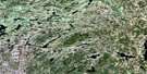
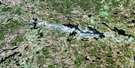
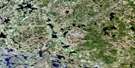
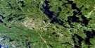
Haliburton Satellite Image Map
Download Free Aerial Photo 031E02 at 1:50,000 scale
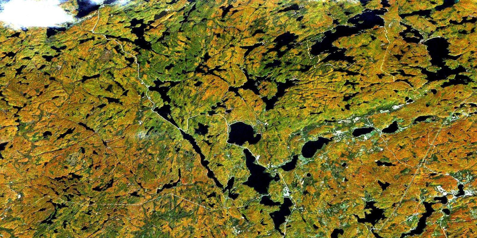
Haliburton Satellite Imagery
To view this satellite map, mouse over the air photo on the right.
You can also download this satellite image map for free:
031E02 Haliburton high-resolution satellite image map.
Maps for the Haliburton aerial map sheet 031E02 at 1:50,000 scale are also available in these versions:
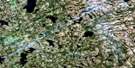
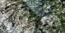
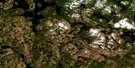
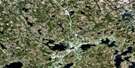
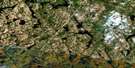
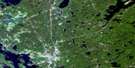
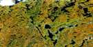
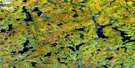
Haliburton Surrounding Area Aerial Photo Maps
 |
 |
 |
 |
 |
 |
 |
 |
 |
 |
 |
 |
 |
 |
 |
 |
© Department of Natural Resources Canada. All rights reserved.
Haliburton Gazetteer
The following places can be found on satellite image map 031E02 Haliburton:
Haliburton Satellite Image: Bays
Dummitt BayDunnett Bay
Echo Bay
Five Mile Bay
Little Girl Bay
Minden Bay
Trading Bay
White Trout Bay
Haliburton Satellite Image: Channels
Dorset NarrowsOx Narrows
The Narrows
Haliburton Satellite Image: Geographical areas
AnsonDysart
Eyre
Guilford
Haliburton
Havelock
Hindon
Minden
Muskoka
Ridout
Sherborne
Stanhope
Haliburton Satellite Image: Islands
Brown IslandConstance Island
Crozier Island
Deer Island
Elstone Island
Goat Island
Harper Island
Kirkwood Island
Norah's Island
Reuben Island
St. Margaret Island
Haliburton Satellite Image: Lakes
Amaleen LakeAnson Lake
Austin Lake
Avery Lake
Baker Lake
Barnum Lake
Bat Lake
Beech Lake
Bentarm Lake
Bentshoe Lakes
Berrycan Lake
Big Brother Lake
Big East Lake
Big Hawk Lake
Big Orillia Lake
Bitter Lake
Black Lake
Blackberry Lake
Blackcat Lake
Blotter Lake
Blue Chalk Lake
Blueglass Lake
Bone Lake
Boshkung Lake
Brady Lake
Bridge Pond
Browns Lake
Buckhorn Lake
Buckskin Lake
Burdock Lake
Campstool Lake
Carcass Lake
Cat Lake
Chub Lake
Cinder Lake
Circular Lake
Claypack Lake
Clean Lake
Clear Lake
Coleman Lake
Coulter Lake
Cow Lake
Cranberry Lake
Cream Lake
Cruiser Lake
Dan Lake
Dawson Ponds
Duck Lake
Eagle Lake
East Paint Lake
Ernest Lake
Fagan Ponds
Fly Lake
Grant Lake
Grass Lake
Green Lake
Grindstone Lake
Grouse Lake
Guilford Lake
Gun Lake
Halls Lake
Head Lake
Herb Lake
Hindon Lake
Horse Lake
Hurricane Lake
Insula Lake
Jean Lake
Jill Lake
Kabakwa Lake
Kashagawigamog Lake
Kawagama Lake
Kelly Lake
Kennisis Lake
Ketch Lake
Klaxon Lake
Knife Lake
Kushog Lake
Lake of Bays
Lipsy Lake
Little Avery Lake
Little Boshkung Lake
Little Brother Lake
Little Cruiser Lake
Little East Lake
Little Elsie Lake
Little Hawk Lake
Little Hindon Lake
Little Jean Lake
Little Kennisis Lake
Little Margaret Lake
Little Orillia Lake
Little Paul Lake
Little Redstone Lake
Little Shoe Lake
Little Soyers Lake
Little Sunken Lake
Little Wren Lake
Longline Lake
Lower Crane Lake
Lower Welch Lake
Macdonald Lake
Maple Lake
Margaret Lake
Marsden Lake
Martin Lake
McDonald Lake
McEwen Lake
McKeown Lake
Michabo Lake
Mink Lake
Mirror Lake
Mooney Lake
Moosetrack Lake
Mountain Lake
Mouse Lake
Mug Lake
Nehemiah Lake
Nunikani Lake
Orley Lake
Otterhead Lake
Paint Lake
Paint Lake
Pairo Lakes
Partridge Lake
Paul Lake
Pauper Lake
Pelaw Lake
Pine Lake
Pivot Lake
Plastic Lake
Poker Lake
Porcupine Lake
Ranger Lake
Raven Lake
Red Chalk Lake
Red Pine Lake
Redstone Lake
Ridout Lake
Ril Lake
Ronald Lake
Roundabout Lake
Sand Lake
Saskatchewan Lake
Saucer Lake
Second Lake
Sherborne Lake
Shoe Lake
Shoelace Lake
Silver Buck Lake
Silver Doe Lake
Silverlynn Lake
South Jean Lake
South McDonald Lake
Soyers Lake
Splatter Lake
Sprat Lake
St. Mary Lake
St. Nora Lake
String Lake
Sugarbowl Lake
Sunken Lake
Teapot Lake
Tedious Lake
Three Brothers Lakes
Three Island Lake
Tingey Lake
Tom Lake
Twelve Mile Lake
Twisty Lake
Upper Crane Lake
Welch Lake
Wildgoose Lake
Wolfden Lake
Wolfkin Lake
Wren Lake
Haliburton Satellite Image: Major municipal/district area - major agglomerations
HaliburtonMuskoka
Haliburton Satellite Image: Other municipal/district area - miscellaneous
Algonquin HighlandsAnson, Hindon and Minden
Dysart, Dudley, Harcourt, Guilford, Harburn, Bruton, Havelock, Eyre and Clyde
Franklin
Lake of Bays
Lutterworth
McLean
Minden Hills
Ridout
Sherborne, McClintock and Livingstone
Sherborne, McClintock, Livingstone, Lawrence and Nightingale
Sherborne, Stanhope, McClintock, Livingstone, Lawrence and Nightingale
Snowdon
Stanhope
Haliburton Satellite Image: Conservation areas
Bigwind Lake Provincial ParkClear Lake Conservation Reserve
Plastic Lake and Dawson Ponds Conservation Reserve
Haliburton Satellite Image: Rivers
Anson CreekAustin Creek
Avery Creek
Barnum Creek
Black River
Blackberry Creek
Blackcat Creek
Boshkung River
Buckhorn Creek
Cache Creek
Cat Creek
Chalk Creek
Cinder Creek
Clear Creek
Drag River
East Redstone River
Elsie Creek
Eyre Creek
Gull River
Harburn Creek
Hawk Creek
Hindon Creek
Hollow River
Horse Creek
Hurricane Creek
Kennisis River
Ketch Creek
Klaxon Creek
Little Kennisis River
Margaret Creek
Martin Creek
McDonald Creek
Orillia Creek
Paul Creek
Pauper Creek
Poker Creek
Redstone Brook
Redstone River
Ridout Creek
Saskatchewan Creek
Shoelace Creek
Sickle Creek
Silver Buck Creek
South Jean Creek
Soyers Creek
St. Mary Creek
Welch Creek
Haliburton Satellite Image: Towns
BracebridgeHaliburton Satellite Image: Unincorporated areas
BlairhamptonBoskung
Brady Lake
Buttermilk Falls
Carnarvon
Dorset
Eagle Lake
Goulds
Gould's
Grove Park
Grove Park Lodge
Haliburton
Halls Lake
Hindon Hill
Kennisis Lake
Little Hawk Lake
Maple Lake
Maple Ridge
Peterson Corner
Pine Springs
West Guilford
© Department of Natural Resources Canada. All rights reserved.
031E Related Maps:
031E Huntsville031E01 Wilberforce
031E02 Haliburton
031E03 Bracebridge
031E04 Lake Joseph
031E05 Orrville
031E06 Huntsville
031E07 Kawagama Lake
031E08 Whitney
031E09 Opeongo Lake
031E10 Tom Thomson Lake
031E11 Burk's Falls
031E12 Magnetawan
031E13 Golden Valley
031E14 South River
031E15 Burntroot Lake
031E16 Lake Lavieille
