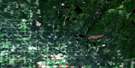
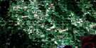
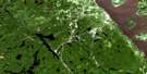
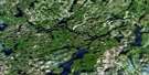
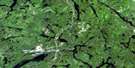
Temagami Satellite Image Map
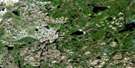
Download Free Aerial Photo 031M04 at 1:50,000 scale
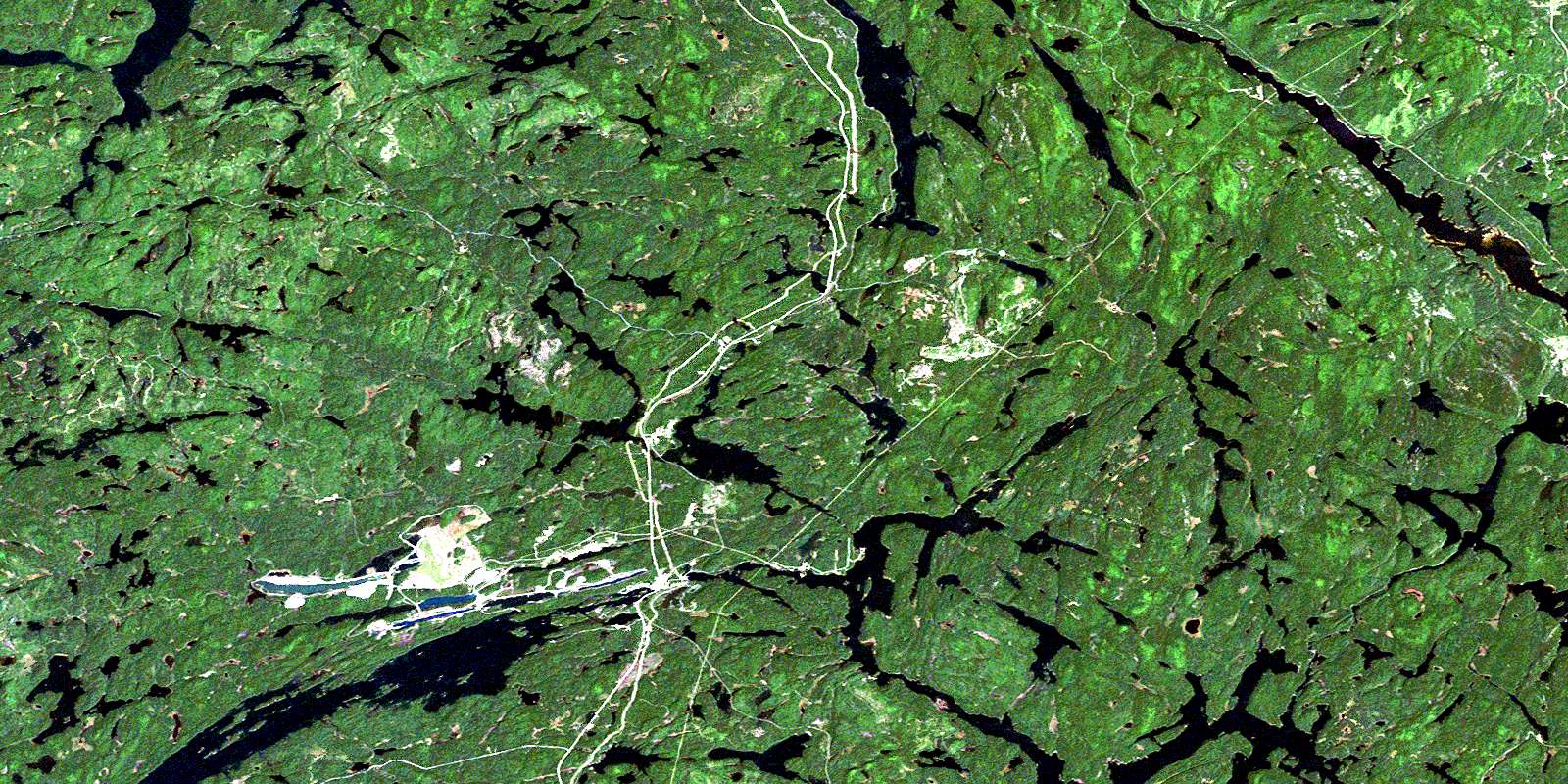
Temagami Satellite Imagery
To view this satellite map, mouse over the air photo on the right.
You can also download this satellite image map for free:
031M04 Temagami high-resolution satellite image map.
Maps for the Temagami aerial map sheet 031M04 at 1:50,000 scale are also available in these versions:
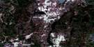
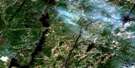
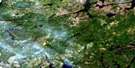
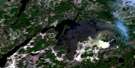
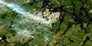
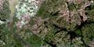
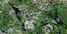
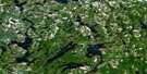
Temagami Surrounding Area Aerial Photo Maps
 |
 |
 |
 |
 |
 |
 |
 |
 |
 |
 |
 |
 |
 |
 |
 |
© Department of Natural Resources Canada. All rights reserved.
Temagami Gazetteer
The following places can be found on satellite image map 031M04 Temagami:
Temagami Satellite Image: Bays
Boot BayBreeches Bay
Dart's Bay
Inlet Bay
Kingston's Bay
Mannajigama Bay
Muddy Water Bay
Murphy's Bay
Northeast Arm
Northeast Bay
Northwest Bay
Outlet Bay
Outlet Bay
Portage Bay
Snare Bay
Southeast Bay
Spawning Bay
Temagami Satellite Image: Capes
Ferguson PointTemagami Satellite Image: Channels
Axe NarrowsTemagami Satellite Image: Falls
Rabbit ChuteTemagami Satellite Image: Geographical areas
BantingBest
Briggs
Brigstocke
Cassels
Chambers
Eldridge
Gillies Limit
Hebert
Lorrain
Nipissing
Riddell
South Lorrain
Strathcona
Strathy
Timiskaming
Temagami Satellite Image: Islands
Babcock IslandBell Island
Broom Island
Caldwell Island
Campfire Island (39)
Ferguson Island
Forestry Island
Horr Island
Newcomb Island
O'Connor Island
Sans Souci Island
Temagami Satellite Image: Lakes
Alfreda LakeAnima Nipissing Lake
Arsenic Lake
Bernice Lake
Best Lake
Black Duck Lake
Blueberry Lake
Bogie Lake
Boulton Lake
Breeches Lake
Broom Lake
Bryan Lake
Business Lake
Caribou Lake
Carrying Lake
Cassels Lake
Caswell Lake
Chambers Lake
Charley Lake
Cliff Lake
Collins Lake
Command Lake
Contact Lake
Cooke Lake
Cooper Lake
Copper Lake
Crash Lake
Doris Lake
Duncan Lake
Fat Lake
Ferguson Lake
Foley Lake
Fourbass Lake
Fourclaim Lake
Francis Lake
Friday Lake
Geoffrey Lake
Gilbert Lake
Glasford Lake
Goethe Lake
Golden Lake
Gorrie Lake
Gosselin Lake
Goward Lake
Granite Lake
Guppy Lake
Hansen Lake
Hardwood Lake
Hay Lake
Hermit Lake
Hidden Lake
Hook Lake
Iceland Lake
Ingersoll Lake
Iron Lake
Jackpine Lake
James Lake
Jamieson Lake
Jessie Lake
Kanichee Lake
Karol Lake
Lake Temagami
Lake Timagami
Latour Lake
Lenore Lake
Leroy Lake
Link Lake
Little Hardwood Lake
Little Mountain Lake
Little Mud Lake
Little Trout Lake
Lorrain Lake
Lowell Lake
Lundy Lake
Maille Lake
Mannajigama Lake
Maureen Lake
McLaren Lake
McLean Lake
McNab Lake
Monty Lake
Mountain Lake
Mud Lake
Myth Lake
Nellem Lake
Net Lake
Obashkong Lake
O'Connor Lake
Owaissa Lake
Petraut Lake
Pigot Lake
Pike Lake
Pineview Lake
Pingue Lake
Pishabo Lake
Pleasant Lake
Price's Lake
Prud'homme Lake
Rabbit Lake
Rib Lake
Roosevelt Lake
Rory Lake
Sauvé Lake
Slim Lake
Snake Island Lake
Snare Lake
Spawning Lake
Spruce Lake
Stewart Lake
Summit Lakes
Sunrise Lake
Sutton Lake
Tasse Lake
Tetapaga Lake
The Three Sisters
Thieving Bear Lake
Tooth Lake
Turtle Lake
Tyndall Lake
Upper Twin Lake
Vermilion Lake
Wagkich Lake
Watson's Lake
Whitewater Lake
Whitney Lake
Wilson Lake
Windy Lake
Young Lake
Temagami Satellite Image: Conservation areas
Cliff Lake Conservation ReserveFinlayson Point Provincial Park
Rabbit Lake West Conservation Reserve
White Bear Forest Conservation Reserve
Temagami Satellite Image: Rapids
Paugan RapidsTemagami Satellite Image: Rivers
Alfreda CreekAnima Nipissing River
Friday Creek
Guppy Creek
Herridge Creek
Jessie Creek
Johnny Creek
Lorrain Creek
Matabitchuan River
McDonald Creek
Montreal River
Net Creek
Sandstone Creek
Snare Creek
South Tetapaga River
Sucker Gut Creek
Tetapaga River
Temagami Satellite Image: Road features
Many PortageTemagami Satellite Image: Towns
TemagamiTemagami Satellite Image: Unincorporated areas
FreemanGoward
Owaissa
Rib Lake
Roxboro
Silver Centre
Temagami
Temagami North
Timagami
© Department of Natural Resources Canada. All rights reserved.
031M Related Maps:
031M Ville-Marie031M01 Lac Ogascanane
031M02 Lac Ostaboningue
031M03 Fabre
031M04 Temagami
031M05 Cobalt
031M06 Ville-Marie
031M07 Belleterre
031M08 Lac Winawiash
031M09 Lac Nodier
031M10 Lac Simard
031M11 Angliers
031M12 New Liskeard
031M13 Englehart
031M14 Lac Barriere
031M15 Lac Roger
031M16 Lac Mourier
