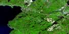
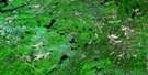
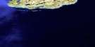
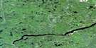
Kinniwabi Lake Satellite Image Map
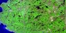
Download Free Aerial Photo 041N16 at 1:50,000 scale
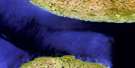
Kinniwabi Lake Satellite Imagery
To view this satellite map, mouse over the air photo on the right.
You can also download this satellite image map for free:
041N16 Kinniwabi Lake high-resolution satellite image map.
Maps for the Kinniwabi Lake aerial map sheet 041N16 at 1:50,000 scale are also available in these versions:
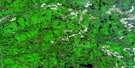
Kinniwabi Lake Surrounding Area Aerial Photo Maps
 |
 |
 |
 |
 |
 |
 |
|
 |
 |
 |
|
 |
 |
© Department of Natural Resources Canada. All rights reserved.
Kinniwabi Lake Gazetteer
The following places can be found on satellite image map 041N16 Kinniwabi Lake:
Kinniwabi Lake Satellite Image: Falls
Canyon FallsDona Falls
Kinniwabi Lake Satellite Image: Geographical areas
23,2324,21
24,22
24,23
25,21
25,22
25,23
26,21
26,22
26,23
27,21
27,22
27,23
28,21
28,22
Algoma
D'Avaugour
Maness
Michano
Miskokomon
Nadjiwon
Nebonaionquet
Noganosh
Pawis
Quill
Recollet
Restoule
Roy
Sampson
Saunders
Shawkence
Sudbury
Kinniwabi Lake Satellite Image: Lakes
Agawa LakeAtik Lake
Barney Lake
Bluff Lake
Breck Lake
Budd Lake
Budworm Lake
Bukwaskeagog Lake
Burr Lake
Bush Lake
Chicobi Lake
Chip Lake
Chokio Lake
Crab Lake
Curry Lake
Dave Lake
Dillon Lake
Duke Lake
Eider Lake
Fern Lake
Finn Lake
Flagg Lake
Fulcher Lake
Glassy Lake
Gould Lake
Gypsy Lake
Hay Lake
Irma Lake
Kennedy Lake
Kinniwabi Lake
Koski Lake
Lonesome Lake
Long Lake
Loubert Lake
Middle Lake
One Eye Lake
Otis Lake
Oyakun Lake
Perry Lake
Pinto Lake
Question Lake
Ripple Lake
Sane Lake
Scaup Lake
Scow Lake
Shakashi Lake
Side Lake
Spencer Lake
Sponge Lake
Still Lake
String Lake
Torpid Lake
Wasp Lake
Whitefish Lake
Woodside Lake
Zola Lake
Kinniwabi Lake Satellite Image: Conservation areas
Potholes Provincial Nature ReserveKinniwabi Lake Satellite Image: Rivers
Agawa RiverBudd Creek
Hayes Creek
Jackpine River
Kennedy Creek
Kinniwabi River
Little Jackpine River
Michipicoten River
Perry Creek
Regan River
Sand Creek
Sane Creek
Shakashi River
Shikwamkwa River
Sponge Creek
Tabor Creek
Kinniwabi Lake Satellite Image: Valleys
Dona Gorge
© Department of Natural Resources Canada. All rights reserved.
