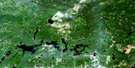
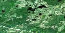
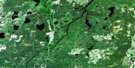
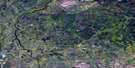
Opasatika Satellite Image Map
Download Free Aerial Photo 042G10 at 1:50,000 scale
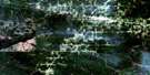
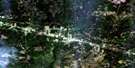
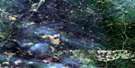
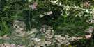
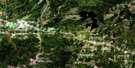
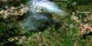
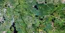
Opasatika Satellite Imagery
To view this satellite map, mouse over the air photo on the right.
You can also download this satellite image map for free:
042G10 Opasatika high-resolution satellite image map.
Maps for the Opasatika aerial map sheet 042G10 at 1:50,000 scale are also available in these versions:
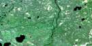
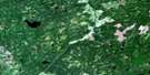
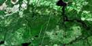
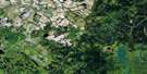
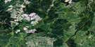
Opasatika Surrounding Area Aerial Photo Maps
 |
 |
 |
 |
 |
 |
 |
 |
 |
 |
 |
 |
 |
 |
 |
 |
© Department of Natural Resources Canada. All rights reserved.
Opasatika Gazetteer
The following places can be found on satellite image map 042G10 Opasatika:
Opasatika Satellite Image: Geographical areas
BurrittFleck
Idington
McCowan
McCrea
Neely
Nixon
Weichel
Williamson
Opasatika Satellite Image: Lakes
Allan LakeBear Tooth Lake
Bears Tooth Lake
Bergsma Lake
Bush Lake
Canna Lake
Dunne Lake
East Neely Lake
Eleanor Lake
Fleck Lake
Francklyn Lake
Jacob Lake
Kidney Lake
Lemon Lake
Little Weichel Lake
Lyons Lake
Mather Lake
McCowan Lake
Mine Lake
Neely Lake
Niven Lake
Rabbit Lake
Raft Lake
Socket Lake
St. Amand Lake
Theo Lake
Tracy Lake
Waxatike Lake
West Neely Lake
Zadi Lake
Opasatika Satellite Image: Other municipal/district area - miscellaneous
Idington and McCraeOpasatika
Owens, Williamson and Idington
Val Rita-Harty
Opasatika Satellite Image: Rapids
Lower Philip RapidsMiddle Philip Rapids
Upper Philip Rapids
Opasatika Satellite Image: Rivers
Bear Tooth CreekBears Tooth Creek
Blier Creek
Canna Creek
Crow Creek
Duclos Creek
Eighty Four Creek
Five Mile Creek
Fleck Creek
Francklyn Creek
Hull Creek
Jacob Creek
Lambert Creek
Lemon Creek
Lost River
McCowan Creek
Montcalm Creek
Muskrat Creek
Neely Creek
Nixon Creek
North Raft Creek
Opasatika River
Opazatika River
Raft Creek
Raft Creek
Rivière Opasatika
Socket Creek
Solomon Creek
Teetzel Creek
Ten Mile Creek
Waxatike Creek
Weichel Creek
West Waxatike Creek
Wolfe Creek
Opasatika Satellite Image: Road features
Philip PortageOpasatika Satellite Image: Unincorporated areas
OpasatikaOpasatika Satellite Image: Low vegetation
La Marsh du Village
© Department of Natural Resources Canada. All rights reserved.
042G Related Maps:
042G Kapuskasing042G01 Wakusimi River
042G02 Woman Falls
042G03 Opasatika Lake
042G04 Roche Lake
042G05 Mead
042G06 Rock River
042G07 Val Rita
042G08 Kapuskasing
042G09 Pearce Lake
042G10 Opasatika
042G11 Mattice
042G12 Hearst
042G13 Hanlan Lake
042G14 Shannon Lake
042G15 Hillmer Lake
042G16 Bennet Lake
