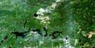
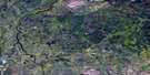
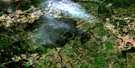
Roche Lake Satellite Image Map
Download Free Aerial Photo 042G04 at 1:50,000 scale
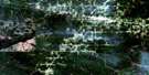
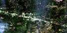
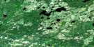
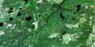
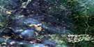
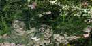
Roche Lake Satellite Imagery
To view this satellite map, mouse over the air photo on the right.
You can also download this satellite image map for free:
042G04 Roche Lake high-resolution satellite image map.
Maps for the Roche Lake aerial map sheet 042G04 at 1:50,000 scale are also available in these versions:
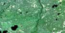
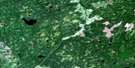
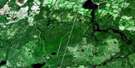
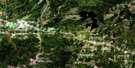
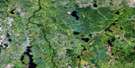
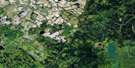
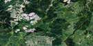
Roche Lake Surrounding Area Aerial Photo Maps
 |
 |
 |
 |
 |
 |
 |
 |
 |
 |
 |
 |
 |
 |
 |
 |
© Department of Natural Resources Canada. All rights reserved.
Roche Lake Gazetteer
The following places can be found on satellite image map 042G04 Roche Lake:
Roche Lake Satellite Image: Falls
Mitchell ChutesRoche Lake Satellite Image: Geographical areas
ByngCaithness
Doherty
Minnipuka
Pelletier
Roche
Scholfield
Talbott
Walls
Roche Lake Satellite Image: Lakes
Caithness LakeDoherty Lake
Kalsas Lake
Little Kalsas Lake
North Roche Lake
Pelletier Lake
Roche Lake
Walls Lake
Roche Lake Satellite Image: Rivers
Caithness CreekCulbert Creek
Doherty Creek
Goat River
Mattawishkwia River
Mattawitchewan River
North Roche Creek
Pelletier Creek
Pichogen River
Roche Creek
Swanson Creek
Walls Creek
Roche Lake Satellite Image: River features
Beaver Forks
© Department of Natural Resources Canada. All rights reserved.
042G Related Maps:
042G Kapuskasing042G01 Wakusimi River
042G02 Woman Falls
042G03 Opasatika Lake
042G04 Roche Lake
042G05 Mead
042G06 Rock River
042G07 Val Rita
042G08 Kapuskasing
042G09 Pearce Lake
042G10 Opasatika
042G11 Mattice
042G12 Hearst
042G13 Hanlan Lake
042G14 Shannon Lake
042G15 Hillmer Lake
042G16 Bennet Lake
