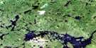
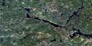
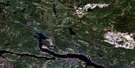
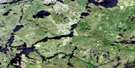
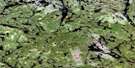
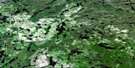
Pikitigushi Lake Satellite Image Map
Download Free Aerial Photo 052I07 at 1:50,000 scale
Pikitigushi Lake Satellite Imagery
To view this satellite map, mouse over the air photo on the right.
You can also download this satellite image map for free:
052I07 Pikitigushi Lake high-resolution satellite image map.
Maps for the Pikitigushi Lake aerial map sheet 052I07 at 1:50,000 scale are also available in these versions:
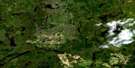
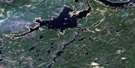
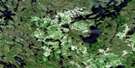
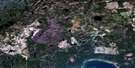
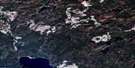
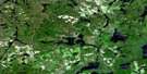
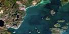
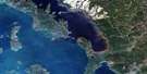
Pikitigushi Lake Surrounding Area Aerial Photo Maps
 |
 |
 |
 |
 |
 |
 |
 |
 |
 |
 |
 |
 |
 |
 |
 |
© Department of Natural Resources Canada. All rights reserved.
Pikitigushi Lake Gazetteer
The following places can be found on satellite image map 052I07 Pikitigushi Lake:
Pikitigushi Lake Satellite Image: Bays
Windigo BayPikitigushi Lake Satellite Image: Lakes
Armstrong LakeArmstrong Lake
Big Lake
Blackett Lake
Blue Lake
Bovin Lake
Brush Lake
D'Alton Lake
Derraugh Lake
Flat Lake
Gort Lake
Haile Lake
Holland Lake
Jojo Lake
Kenna Lake
Keyhole Lake
Lac Nipigon
Lake Nipigon
Lower Pawshowconk Lake
Michell Lake
Moonshine Lake
Nicholls Lake
Pavella Lake
Pawshowconk Lake
Pawshowconk Lake
Pikitigushi Lake
Randolph Lake
Rapid Lake
Red Granite Lake
Reef Lake
Ruxton Lake
Secret Lake
Selassie Lake
Shoal Lake
Upper Pawshowconk Lake
Wash Lake
Whiddon Lake
Whitesand Lake
Pikitigushi Lake Satellite Image: Mountains
Haystack MountainPikitigushi Lake Satellite Image: Conservation areas
Windigo Bay Provincial Nature ReservePikitigushi Lake Satellite Image: Rapids
Gooseneck RapidsPikitigushi Lake Satellite Image: Rivers
Big RiverBlackett Creek
Cumaway Creek
Forsyth Creek
Hoodoo Creek
Kenna Creek
Lee Creek
Linklater Creek
Pikitigushi River
Rapid Creek
Whitesand River
Pikitigushi Lake Satellite Image: Unincorporated areas
GreenMud River
Wagaming
Willet

© Department of Natural Resources Canada. All rights reserved.
052I Related Maps:
052I Armstrong052I01 Ombabika Bay
052I02 Castle Lake
052I03 Wigwasan Lake
052I04 Aldridge Lake
052I05 Onamakawash Lake
052I06 Armstrong
052I07 Pikitigushi Lake
052I08 Little Jackfish River
052I09 Mojikit Lake
052I10 Linklater Lake
052I11 Goldsborough Lake
052I12 Wabakimi Lake
052I13 Burntrock Lake
052I14 Grayson Lake
052I15 Whiteclay Lake
052I16 D'Orsonnens Lake
