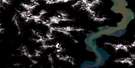
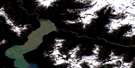
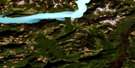
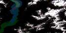
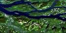
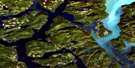
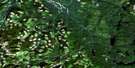
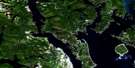
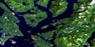
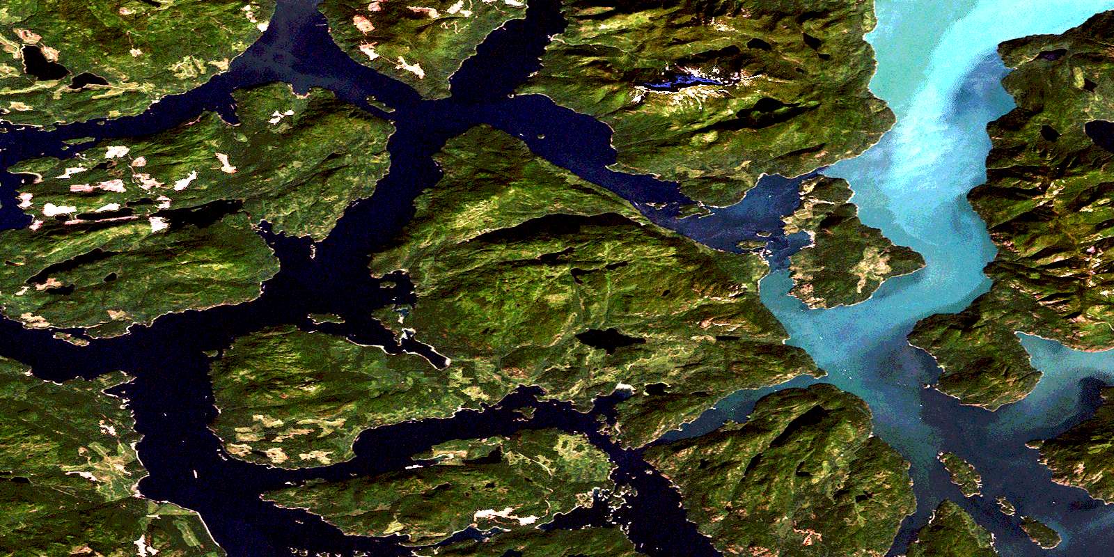
Sonora Island Satellite Image Map
Download Free Aerial Photo 092K06 at 1:50,000 scale
Sonora Island Satellite Imagery
To view this satellite map, mouse over the air photo on the right.
You can also download this satellite image map for free:
092K06 Sonora Island high-resolution satellite image map.
Maps for the Sonora Island aerial map sheet 092K06 at 1:50,000 scale are also available in these versions:
Sonora Island Surrounding Area Aerial Photo Maps
 |
 |
 |
 |
 |
 |
 |
 |
 |
 |
 |
 |
 |
 |
 |
 |
© Department of Natural Resources Canada. All rights reserved.
Sonora Island Gazetteer
The following places can be found on satellite image map 092K06 Sonora Island:
Sonora Island Satellite Image: Bays
Ashlar CoveAsman Bay
Barnes Bay
Bells Bay
Bickley Bay
Big Bay
Binnington Bay
Bodega Anchorage
Bute Inlet
Cameleon Harbour
Charles Bay
Chonat Bay
Crawford Anchorage
Diamond Bay
Eastwest Bay
Elk Bay
Fanny Bay
Florence Cove
Frances Bay
Frederick Arm
Handfield Bay
Hemming Bay
Horn Bay
Kanish Bay
Mermaid Bay
Nutcracker Bay
Otter Cove
Owen Bay
Phillips Arm
Piddell Bay
Pulton Bay
Ramsay Arm
Rock Bay
Shoal Bay
Small Inlet
Tallac Bay
Thurston Bay
Turn Bay
Vancouver Bay
Waiatt Bay
Woods Bay
Sonora Island Satellite Image: Capes
Arran PointAsman Point
Bassett Point
Bernard Point
Brougham Point
Bruce Point
Chatham Point
Chonat Point
Cooper Point
Davis Point
Edward Point
Elk Point
Etta Point
Godwin Point
Granite Point
Greetham Point
Hall Point
Harbott Point
Henrietta Point
Hesler Point
Horn Point
Islet Point
Jackson Point
Johns Point
Kellsey Point
Lawrence Point
Mayes Point
Moriarty Point
Owen Point
Parrott Point
Picton Point
Pulton Point
Raza Point
Richard Point
Shell Point
Slab Point
Sonora Point
Springer Point
Suffolk Point
Thurlow Point
Turnback Point
Venture Point
Walters Point
Whirlpool Point
Wilson Point
Sonora Island Satellite Image: Channels
Barber PassageBurgess Passage
Calm Channel
Channe Passage
Discovery Passage
Drew Passage
Gillard Passage
Hole in the Wall
Innes Passage
Johnstone Strait
Mayne Passage
Nodales Channel
Okisollo Channel
Raza Passage
Tugboat Passage
Whiterock Passage
Young Passage
Sonora Island Satellite Image: Cliffs
Burnt BluffFawn Bluff
Johnstone Bluff
Sonora Island Satellite Image: Glaciers
Pembroke RangeSonora Island Satellite Image: Indian Reserves
Aupe Indian Reserve 6Aupe Indian Reserve 6A
Bartlett Island Indian Reserve 7
Mushkin Indian Reserve 5
Mushkin Indian Reserve 5A
Réserve indienne Aupe 6
Réserve indienne Aupe 6A
Réserve indienne Bartlett Island 7
Réserve indienne Mushkin 5
Réserve indienne Mushkin 5A
Réserve indienne Saaiyouck 6
Saaiyouck Indian Reserve 6
Sonora Island Satellite Image: Islands
Bartlett IslandBartlett Islet
Block Island
Brent Island
Chain Islands
Chained Islands
Channe Island
Chasina Island
Cinque Islands
Cordero Islands
Denham Islet
Dent Island
East Thurlow Island
Eclipse Island
Eclipse Islet
Edsall Islands
Edsall Islets
Erasmus Island
Francisco Island
Gillard Island
Gillard Islands
Gomer Island
Grant Island
Hardinge Island
Haro Island
Howe Island
Jimmy Judd Island
Lee Islands
Limestone Island
Little Dent Island
Lorte Island
Maurelle Island
Metcalf Islands
Mink Island
Nixon Island
Noel Islet
Octopus Islands
Okis Islands
Pinhorn Islet
Quadra Island
Raza Island
Read Island
Rendezvous Islands
Rocky Islets
Rowland Island
Sonora Island
Stuart Island
Thurlow Islands
Tully Island
Turn Island
Vancouver Island
West Thurlow Island
Sonora Island Satellite Image: Lakes
Artificial LakeAshlar Lake
Caesar Lake
Caroline Lake
Chonat Lake
Dorr Lake
Edith Lake
Egerton Lake
Elephant Lake
Florence Lake
Heidrick Lake
Hemming Lake
Hyacinth Lake
Jap Lake
Leask Lake
Max Lake
May Lake
Mellin Lake
Mitchell Lake
Newton Lake
Ricardo Lake
Simmons Lake
St. Aubyn Lake
Stella Lake
Stokes Lake
Storey Lake
Vera Lake
Sonora Island Satellite Image: Mountains
Chaîne CôtièreCoast Mountains
Discovery Mountain
Downie Range
Elephant Mountain
Estero Peak
Mount Brougham
Mount Eldon
Mount Muehle
Mount Stokes
Mount Tucker
Mount Turnbull
Pacific Ranges
San Josef Mountain
Toba Mountain
Treble Mountain
Sonora Island Satellite Image: Major municipal/district area - major agglomerations
Regional District of Comox-StrathconaSonora Island Satellite Image: Conservation areas
Octopus Islands Marine ParkOctopus Islands Recreation Area
Rendezvous Island South Park
Rock Bay Marine Park
Small Inlet Marine Park
Small Inlet Park
Thurston Bay Marine Park
Sonora Island Satellite Image: Rapids
Arran RapidsDevils Hole
Lower Rapids
Upper Rapids
Yuculta Rapids
Sonora Island Satellite Image: Rivers
Ashlar CreekDon Creek
Egerton Creek
Grassy Creek
Leask Creek
St. Aubyn Creek
Sonora Island Satellite Image: Sea features
Dent RapidsSonora Island Satellite Image: Shoals
Barnsley ShoalBeaver Rock
Bentley Rock
Bjerre Rock
Crook Rock
Cyrus Rocks
Denham Rock
Douglas Rock
Engels Rock
Entry Ledge
Gypsy Shoal
Jimmy Judd Reef
Maycock Rock
Menace Rock
Min Rock
Nixon Rock
Peel Rocks
Sea Lion Rock
Secord Rock
Siwash Rock
Snag Rock
Sonora Island Satellite Image: Unincorporated areas
Big BayChurch House
Elk Bay
Owen Bay
Rock Bay
Shoal Bay
Stuart Island
Thurlow
Thurston Bay
Yuculta Landing
© Department of Natural Resources Canada. All rights reserved.
092K Related Maps:
092K Bute Inlet092K01 Powell Lake
092K02 Desolation Sound
092K03 Quadra Island
092K04 Brewster Lake
092K05 Sayward
092K06 Sonora Island
092K07 Toba Inlet
092K08 Little Toba River
092K09 Mount Argyll
092K10 Orford River
092K11 Phillips River
092K12 Glendale Cove
092K13 Knight Inlet
092K14 Stafford River
092K15 Southgate River
092K16 Mount Gilbert
