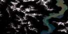
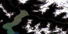
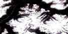
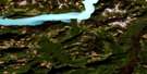
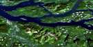
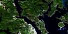
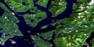
Quadra Island Satellite Image Map
Download Free Aerial Photo 092K03 at 1:50,000 scale
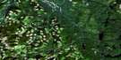
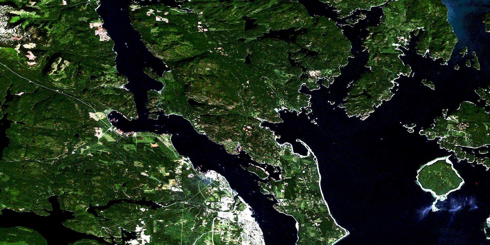
Quadra Island Satellite Imagery
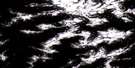
To view this satellite map, mouse over the air photo on the right.
You can also download this satellite image map for free:
092K03 Quadra Island high-resolution satellite image map.
Maps for the Quadra Island aerial map sheet 092K03 at 1:50,000 scale are also available in these versions:
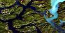
Quadra Island Surrounding Area Aerial Photo Maps
 |
 |
 |
 |
 |
 |
 |
 |
 |
 |
 |
 |
 |
 |
 |
 |
© Department of Natural Resources Canada. All rights reserved.
Quadra Island Gazetteer
The following places can be found on satellite image map 092K03 Quadra Island:
Quadra Island Satellite Image: Bays
Bird CoveBrown Bay
Burdwood Bay
Carrington Bay
Conville Bay
Coulter Bay
Deepwater Bay
Drew Harbour
Duncan Bay
Evans Bay
Gorge Harbour
Gowlland Harbour
Granite Bay
Heriot Bay
Hjorth Bay
Hoskyn Inlet
Hyacinthe Bay
Kanish Bay
Lake Bay
Loveland Bay
McIvor Lake
Menzies Bay
Moulds Bay
Nymphe Cove
Open Bay
Plumper Bay
Quartz Bay
Quathiaski Cove
Totem Bay
Twin Bay
Unkak Cove
Village Bay
Whaletown Bay
Yeatman Bay
Quadra Island Satellite Image: Capes
Antonio PointApril Point
Bodega Point
Bold Point
Conville Point
Dunsterville Point
Francisco Point
Frederic Point
Huntingford Point
Hyacinthe Point
McMullen Point
Middle Point
Orange Point
Plumper Point
Race Point
Read Point
Rebecca Spit
Separation Head
Shark Spit
Sheer Point
Stephenson Point
Surge Point
Tyee Spit
Viner Point
Wilfred Point
Quadra Island Satellite Image: Channels
Beazley PassageCrescent Channel
Discovery Passage
Hoskyn Channel
Okisollo Channel
Plunger Passage
Seymour Narrows
Surge Narrows
Sutil Channel
The Gorge
Uganda Passage
Whale Passage
Whiterock Passage
Quadra Island Satellite Image: City
Campbell RiverQuadra Island Satellite Image: Cliffs
Bullock BluffCopper Cliffs
North Bluff
Puget Bluff
Quadra Island Satellite Image: Falls
Deer FallsElk Falls
Moose Falls
Quadra Island Satellite Image: Geographical areas
Comox Land DistrictSayward Land District
Quadra Island Satellite Image: Indian Reserves
Campbell River Indian Reserve 11Cape Mudge Indian Reserve 10
Drew Harbour Indian Reserve 9
Open Bay Indian Reserve 8
Quinsam Indian Reserve 12
Réserve indienne Campbell River 11
Réserve indienne Cape Mudge 10
Réserve indienne Drew Harbour 9
Réserve indienne Open Bay 8
Réserve indienne Quinsam 12
Réserve indienne Tatpo-oose 10
Réserve indienne Village Bay 7
Tatpo-oose Indian Reserve 10
Village Bay Indian Reserve 7
Quadra Island Satellite Image: Islands
Bee IsletsBold Island
Breton Islands
Brown Island
Centre Islet
Chain Islands
Chained Islands
Cortes Island
Coulter Island
Crow Islet
Deadman Island
Doe Islet
Dunsterville Islet
Fawn Islet
Goepel Island
Gowlland Island
Grouse Island
Guide Islets
Heather Islets
Heriot Island
Hill Island
Île de Vancouver
Jane Island
Jane Islet
King Islets
Marina Island
Maud Island
Maurelle Island
May Island
Mouse Islets
Peck Island
Penn Islands
Quadra Island
Read Island
Settlers Group
Settlers Group Islands
Stag Island
Steep Island
Stove Islet
Stove Islets
Sturt Island
Subtle Islands
Tan Island
Tide Islet
Vancouver Island
Vigilant Islets
Welsford Islands
Wesley Island
Wren Islet
Yellow Island
Quadra Island Satellite Image: Lakes
Baikie SloughCampbell Lake
Clear Lake
Crane Lake
Darkwater Lake
Gosling Lake
Jasper Lake
John Hart Lake
Kelly Lake
Little Lake
Little Main Lake
Lost Lake
Main Lake
Mary Lake
Mohun Lake
Morte Lake
Morton Lake
Newton Lake
Nugedzi Lake
Rosen Lake
Saltwater Lagoon
Saxon Lake
September Lake
Stramberg Lake
Village Bay Lake
Quadra Island Satellite Image: Mountains
Evening MountainMount Lolo
Mount Menzies
Mount Seymour
Mount William
Quadra Island Satellite Image: Major municipal/district area - major agglomerations
Regional District of Comox-StrathconaStrathcona Regional District
Quadra Island Satellite Image: Conservation areas
Blenkin Memorial ParkElk Falls Park
Loveland Bay Park
Loveland Bay Recreation Area
Main Lake Park
Main Lakes Chain Park
Morton Lake Park
Read Island Park
Rebecca Spit Marine Park
Rebecca Spit Park
Small Inlet Marine Park
Surge Narrows Park
Quadra Island Satellite Image: Plains
Josephine FlatQuadra Island Satellite Image: Rivers
Barron CreekBennett Creek
Campbell River
Canyon Creek
Casey Creek
Clear Creek
Drew Creek
Flintoff Creek
Haig-Brown Kingfisher Creek
Luoma Creek
McKercher Creek
Menzies Creek
Mohun Creek
Mohun River
Nunns Creek
Pidcock Creek
Quinsam River
SaxonCreek
Shadow Brook
Snowdon Creek
Stramberg Creek
Unkak Creek
Welch Creek
Quadra Island Satellite Image: Shoals
Defender ShoalEntrance Bank
Entrance Rock
Hoskyn Rock
Marina Reef
Ripple Rock
Spoil Rock
Tusko Rock
Warspite Rock
Yaculta Bank
Quadra Island Satellite Image: Unincorporated areas
BloedelBold Point
Campbellton
Duncan Bay
Granite Bay
Heriot Bay
North Campbell River
Quathiaski Cove
Quinsam
Read Island
Surge Narrows
Whaletown
Yaculta
© Department of Natural Resources Canada. All rights reserved.
092K Related Maps:
092K Bute Inlet092K01 Powell Lake
092K02 Desolation Sound
092K03 Quadra Island
092K04 Brewster Lake
092K05 Sayward
092K06 Sonora Island
092K07 Toba Inlet
092K08 Little Toba River
092K09 Mount Argyll
092K10 Orford River
092K11 Phillips River
092K12 Glendale Cove
092K13 Knight Inlet
092K14 Stafford River
092K15 Southgate River
092K16 Mount Gilbert
