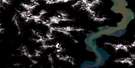
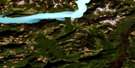
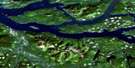
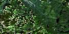
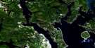
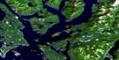
Desolation Sound Satellite Image Map
Download Free Aerial Photo 092K02 at 1:50,000 scale
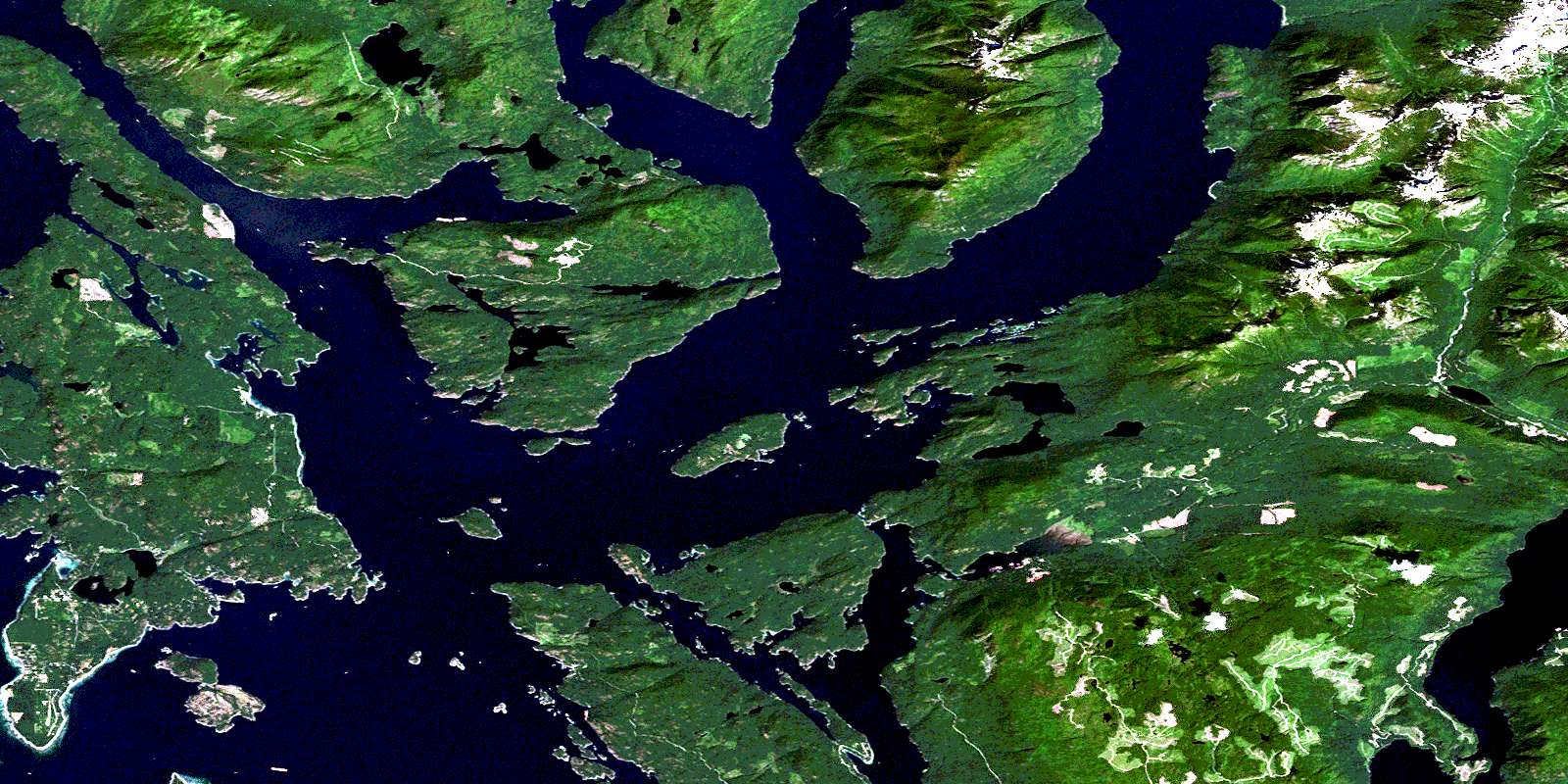
Desolation Sound Satellite Imagery
To view this satellite map, mouse over the air photo on the right.
You can also download this satellite image map for free:
092K02 Desolation Sound high-resolution satellite image map.
Maps for the Desolation Sound aerial map sheet 092K02 at 1:50,000 scale are also available in these versions:
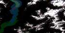
Desolation Sound Surrounding Area Aerial Photo Maps
 |
 |
 |
 |
 |
 |
 |
 |
 |
 |
 |
 |
 |
 |
 |
 |
© Department of Natural Resources Canada. All rights reserved.
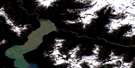
Desolation Sound Gazetteer
The following places can be found on satellite image map 092K02 Desolation Sound:
Desolation Sound Satellite Image: Bays
Blind CreekCall Bight
Carrington Bay
Chippewa Bay
Cortes Bay
Desolation Sound
Doctor Bay
Echo Bay
Eveleigh Anchorage
Forbes Bay
Galley Bay
Gorge Harbour
Grace Harbour
Isabel Bay
Lancelot Inlet
Laura Cove
Malaspina Inlet
Manson Bay
Melanie Cove
Okeover Arm
Okeover Inlet
Parker Harbour
Pendrell Sound
Penrose Bay
Portage Cove
Prideaux Haven
Quartz Bay
Refuge Cove
Roscoe Bay
Salubrious Bay
Smelt Bay
Squirrel Cove
Talbot Cove
Teakerne Arm
Tenedos Bay
Theodosia Inlet
Thors Cove
Tiber Bay
Trevenen Bay
Turner Bay
Von Donop Inlet
Wootton Bay
Desolation Sound Satellite Image: Capes
Bastion PointBishop Point
Bohn Point
Bold Head
Booker Point
Boulder Point
Bunster Point
Church Point
Coode Peninsula
Copplestone Point
Durham Point
Ellen Point
Ellen Point
Galahad Point
Gifford Peninsula
Grail Point
Hare Point
Hillingdon Point
Hope Point
Horace Head
Horace Point
Iron Point
Joyce Point
Junction Point
Kakaekae Point
Lloyd Point
Lucy Point
Malaspina Peninsula
Mary Point
Marylebone Point
Melanie Point
Moss Point
Myrmidon Point
Price Point
Sarah Point
Scott Point
Selina Point
Shirley Point
Spilsbury Point
Stop Point
Stopford Point
Sutil Point
Tongue Point
Walter Point
Zephine Head
Desolation Sound Satellite Image: Channels
Baker PassageHomfray Channel
Lewis Channel
Strait of Georgia
Sutil Channel
Thulin Passage
Waddington Channel
Desolation Sound Satellite Image: Indian Reserves
Ahpokum Indian Reserve 9Kahkaykay Indian Reserve 6
Paukeanum Indian Reserve 3
Quequa Indian Reserve 6
Réserve indienne Ahpokum 9
Réserve indienne Kahkaykay 6
Réserve indienne Paukeanum 3
Réserve indienne Quequa 6
Réserve indienne Squirrel Cove 8
Réserve indienne Toquana 4
Réserve indienne Tork 7
Réserve indienne Tsun Tine Ah 37
Squirrel Cove Indian Reserve 8
Toquana Indian Reserve 4
Tork Indian Reserve 7
Desolation Sound Satellite Image: Islands
Allies IslandBeulah Island
Broken Island
Cochrane Islands
Coode Island
Copeland Islands
Copplestone Island
Cortes Island
Cross Islet
Curme Islands
Deadman Island
Double Islands
East Redonda Island
Edith Island
Elworthy Island
Eveleigh Island
Goat Island
Grass Islet
Hernando Island
Isbister Islands
Jean Island
Josephine Islands
Kinghorn Island
Little Island
Lucy Islet
Madge Island
Martin Island
Martin Islands
Mary Islands
Melville Island
Mink Island
Morgan Island
Neck Islet
Neville Islet
Otter Island
Paige Islets
Pill Islets
Polly Island
Powell Islands
Powell Islets
Protection Island
Redonda Islands
Repulse Island
Ring Island
Roffey Island
Scobell Island
Station Island
Susan Islets
Talbot Islet
Thorp Island
Three Islets
Thynne Island
Tory Islands
Townley Islands
Twin Islands
Ulloa Islands
West Redonda Island
William Islands
Desolation Sound Satellite Image: Lakes
Anvil LakeBaile Lake
Black Lake
Carrington Lagoon
Cassel Lake
Cloud Lake
Cork Lake
Ellis Lake
Gunflint Lake
Hague Lake
Hinder Lake
Isle Lake
Olsen Lake
Powell Lake
Refuge Lagoon
Robertson Lake
Thompson Lake
Unwin Lake
Wiley Lake
Desolation Sound Satellite Image: Mountains
Bunster HillsBunster Range
Chaîne Côtière
Cliff Peak
Coast Mountains
Dudley Cone
Green Mountain
Llanover Mountain
Mount Addenbroke
Mount Crawshay
Mount Pardoe
Mount Spooner
Mount Weaver
Nipple Summit
Pacific Ranges
Unwin Range
Desolation Sound Satellite Image: Major municipal/district area - major agglomerations
Powell River Regional DistrictRegional District of Comox-Strathcona
Desolation Sound Satellite Image: Conservation areas
Copeland Islands Marine ParkDesolation Sound Marine Park
Desolation Sound Marine Recreation Area
Háthayim Marine Park
Háthayim Park
Malaspina Park
Mansons Landing Marine Park
Mansons Landing Marine Recreation Area
Mansons Landing Park
Mansons Landing Recreation Area
Roscoe Bay Park
Smelt Bay Park
Teakerne Arm Park
Von Donop Marine Park
Desolation Sound Satellite Image: Rivers
Appleton CreekBryden Creek
Ellis Creek
Forbes Creek
Hinder Creek
Lloyd Creek
Olsen Creek
Theodosia River
Desolation Sound Satellite Image: Shoals
Boundary RockCavendish Rock
Central Rock
Kinghorn Rocks
Lion Rock
Little Rock
Oriel Rock
Oriel Rocks
Pringle Rock
Ray Rock
Rosetta Rock
Sky Pilot Rock
Stacey Rock
Desolation Sound Satellite Image: Unincorporated areas
Bliss LandingCortes Bay
Foch
Mansons Landing
Refuge Cove
Seaford
Squirrel Cove
Teakerne Arm
Theodosia Arm
© Department of Natural Resources Canada. All rights reserved.
092K Related Maps:
092K Bute Inlet092K01 Powell Lake
092K02 Desolation Sound
092K03 Quadra Island
092K04 Brewster Lake
092K05 Sayward
092K06 Sonora Island
092K07 Toba Inlet
092K08 Little Toba River
092K09 Mount Argyll
092K10 Orford River
092K11 Phillips River
092K12 Glendale Cove
092K13 Knight Inlet
092K14 Stafford River
092K15 Southgate River
092K16 Mount Gilbert
