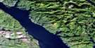
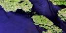
Devastation Channel Satellite Image Map
Download Free Aerial Photo 103H10 at 1:50,000 scale
Devastation Channel Satellite Imagery
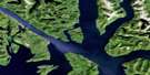
To view this satellite map, mouse over the air photo on the right.
You can also download this satellite image map for free:
103H10 Devastation Channel high-resolution satellite image map.
Maps for the Devastation Channel aerial map sheet 103H10 at 1:50,000 scale are also available in these versions:
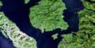
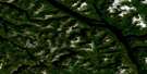
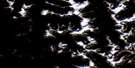
Devastation Channel Surrounding Area Aerial Photo Maps
 |
 |
 |
 |
 |
 |
 |
 |
 |
 |
 |
 |
 |
 |
 |
 |
© Department of Natural Resources Canada. All rights reserved.
Devastation Channel Gazetteer
The following places can be found on satellite image map 103H10 Devastation Channel:
Devastation Channel Satellite Image: Bays
Collins BayDanube Bay
Kitsaway Anchorage
Ochwe Bay
Devastation Channel Satellite Image: Capes
Anderson PointBarker Point
Collins Point
Eva Point
Gaudin Point
Mary Point
Moody Point
Staniforth Point
Devastation Channel Satellite Image: Channels
Devastation ChannelDorothy Narrows
Douglas Channel
Gardner Canal
Loretta Channel
Sue Channel
Ursula Channel
Verney Passage
Devastation Channel Satellite Image: Indian Reserves
Crab River (Crab Harbour) Indian Reserve 18Crab River Indian Reserve 4
Réserve indienne Crab River (Crab Harbour) 18
Réserve indienne Crab River 4
Devastation Channel Satellite Image: Islands
Channel IslandDorothy Island
Gribbell Island
Hawkesbury Island
Kitsaway Island
Loretta Island
Maitland Island
Rix Island
Devastation Channel Satellite Image: Lakes
Crab LakeEvelyn Lake
Devastation Channel Satellite Image: Mountains
Chaîne CôtièreCoast Mountains
Kitimat Ranges
Devastation Channel Satellite Image: Major municipal/district area - major agglomerations
Regional District of Kitimat-StikineDevastation Channel Satellite Image: Rivers
Alder CreekCrab River
Deer Creek
Evelyn Creek
Heysham Creek
Hugh Creek
Kitsaway Channel
Owyacumish Creek
Pike Creek
Pine Creek
Singer Creek
Sleeman Creek
Weewanie Creek
Yeast Creek
Devastation Channel Satellite Image: River features
Alan ReachBoxer Reach
Devastation Channel Satellite Image: Shoals
Staniforth BankDevastation Channel Satellite Image: Springs
Weewanie Hot SpringsDevastation Channel Satellite Image: Unincorporated areas
Weewanie
© Department of Natural Resources Canada. All rights reserved.
103H Related Maps:
103H Douglas Channel103H01 Khutze River
103H02 Butedale
103H03 Gil Island
103H04 Trutch Island
103H05 Port Stephens
103H06 Hartley Bay
103H07 Ursula Channel
103H08 Gardner Canal
103H09 Brim River
103H10 Devastation Channel
103H11 Kitkiata Inlet
103H12 Lowe Inlet
103H13 Kumealon Lake
103H14 Foch Lagoon
103H15 Kitimat Arm
103H16 Kildala Arm
