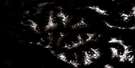
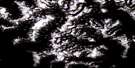
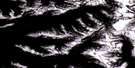
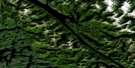
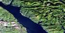
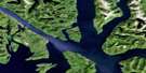
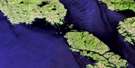
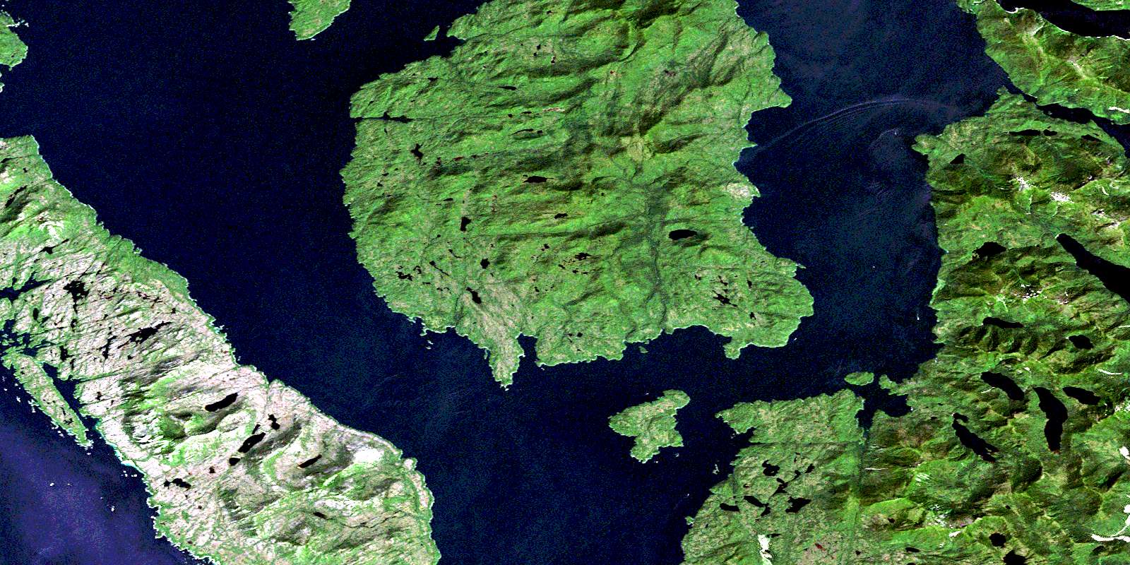
Gil Island Satellite Image Map
Download Free Aerial Photo 103H03 at 1:50,000 scale
Gil Island Satellite Imagery
To view this satellite map, mouse over the air photo on the right.
You can also download this satellite image map for free:
103H03 Gil Island high-resolution satellite image map.
Maps for the Gil Island aerial map sheet 103H03 at 1:50,000 scale are also available in these versions:
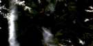
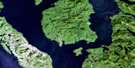
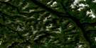
Gil Island Surrounding Area Aerial Photo Maps
 |
 |
 |
 |
 |
 |
 |
 |
 |
 |
 |
 |
 |
 |
 |
 |
© Department of Natural Resources Canada. All rights reserved.
Gil Island Gazetteer
The following places can be found on satellite image map 103H03 Gil Island:
Gil Island Satellite Image: Bays
Barnard HarbourBetteridge Inlet
Cameron Cove
Cornwall Inlet
Crane Bay
Dillon Bay
Drummond Bay
Fish Bay
MacDonald Bay
McMicking Inlet
River Bight
Rivers Bight
Taylor Bight
Weinberg Inlet
Gil Island Satellite Image: Capes
Allatt PointBarlow Point
Blackrock Point
Claudet Point
Dougan Point
Fanny Point
Fawcett Point
Fernyhough Point
Flett Point
Goodfellow Point
Jewsbury Peninsula
Keld Point
Leading Point
Leighton Point
Levy Point
McNeill Point
Molly Point
Redfern Point
Salmon Point
Seabrook Point
Shrub Point
Uren Point
York Point
Gil Island Satellite Image: Channels
Aikman PassageBurnes Passage
Campania Sound
Casanave Passage
Estevan Sound
Lewis Passage
Otter Channel
Squally Channel
Whale Channel
Gil Island Satellite Image: Indian Reserves
Citeyats Indian Reserve 9Kahas Indian Reserve 7
Kayel Indian Reserve 8
Kunhunoan Indian Reserve 13
Maple Point Indian Reserve 11
Réserve indienne Citeyats 9
Réserve indienne Kahas 7
Réserve indienne Kayel 8
Réserve indienne Kunhunoan 13
Réserve indienne Maple Point 11
Gil Island Satellite Image: Islands
Ashdown IslandBorde Island
Camp Islet
Campania Island
Cherry Islets
Fin Island
Gil Island
Hale Islet
Pitt Island
Princess Royal Island
Skinner Islands
Williams Islet
Gil Island Satellite Image: Lakes
Deer LakeWaterfall Lake
Whalen Lake
Gil Island Satellite Image: Mountains
Eberts RangeKitimat Ranges
Mount Cardin
Mount Pender
Murphy Range
Gil Island Satellite Image: Major municipal/district area - major agglomerations
Regional District of Kitimat-StikineGil Island Satellite Image: Rivers
Barnard CreekCurtis Creek
Surf River
Waterfall Creek
Whalen Creek
Gil Island Satellite Image: Sea features
Clement RapidsGil Island Satellite Image: Shoals
Betton RocksCartwright Rocks
Fin Rock
Logan Rock
© Department of Natural Resources Canada. All rights reserved.
103H Related Maps:
103H Douglas Channel103H01 Khutze River
103H02 Butedale
103H03 Gil Island
103H04 Trutch Island
103H05 Port Stephens
103H06 Hartley Bay
103H07 Ursula Channel
103H08 Gardner Canal
103H09 Brim River
103H10 Devastation Channel
103H11 Kitkiata Inlet
103H12 Lowe Inlet
103H13 Kumealon Lake
103H14 Foch Lagoon
103H15 Kitimat Arm
103H16 Kildala Arm
