Musgrave Harbour Topo Map Online
Download Free Topo Map Sheet 002F05 at 1:50,000 scale
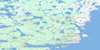
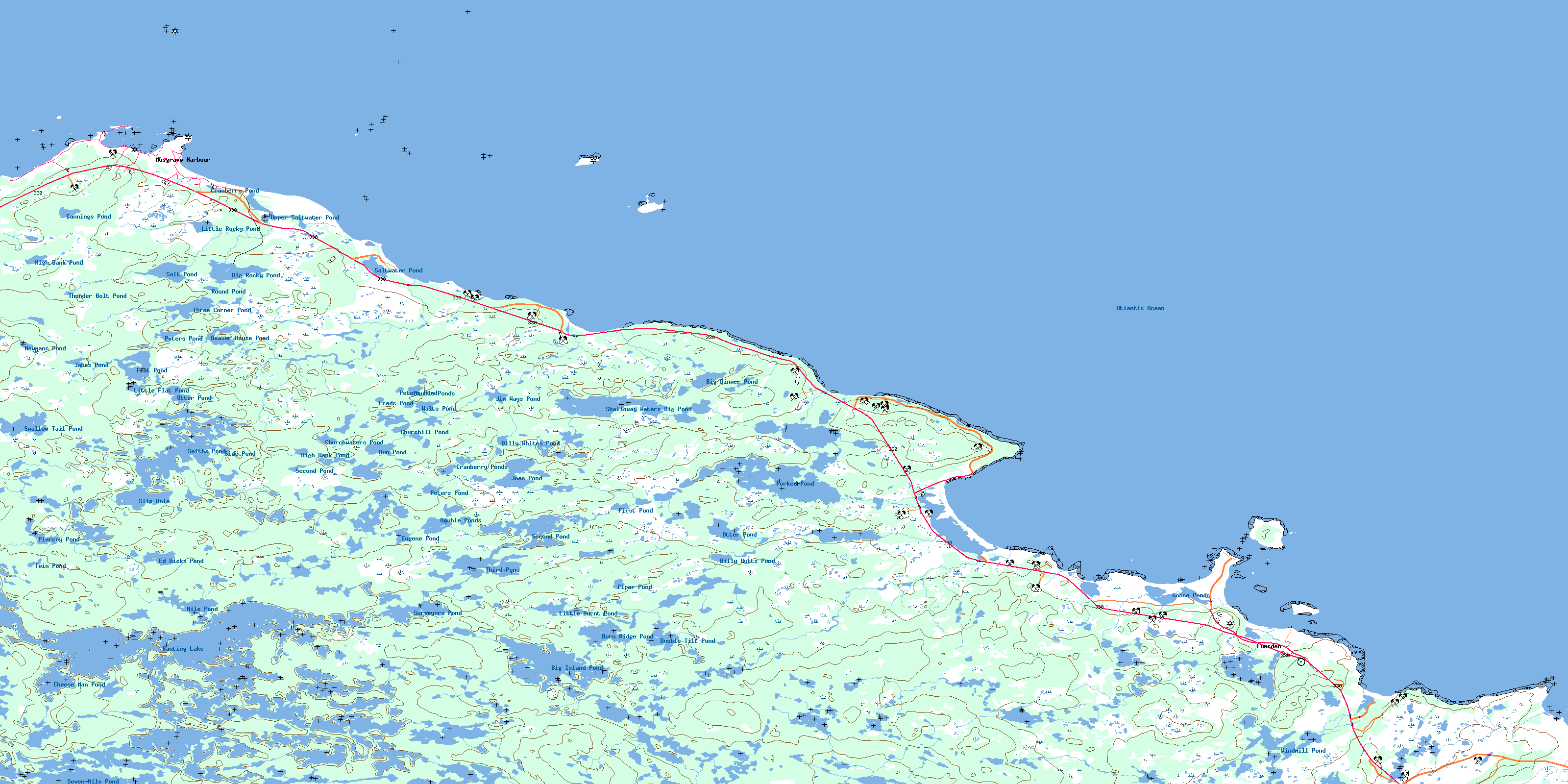
002F05 Musgrave Harbour Topo Map
To view this map, mouse over the map preview on the right.
You can also download this topo map for free:
002F05 Musgrave Harbour high-resolution topo map image.
Maps for the Musgrave Harbour topo map sheet 002F05 at 1:50,000 scale are also available in these versions:
Musgrave Harbour Surrounding Area Topo Maps
 |
|||
 |
|||
 |
 |
© Department of Natural Resources Canada. All rights reserved.
Musgrave Harbour Gazetteer
The following places can be found on topographic map sheet 002F05 Musgrave Harbour:
Musgrave Harbour Topo Map: Bays
Adams HarbourAnchor Brook Bight
Brandy Cove
Cellar Beach Cove
Deadman's Bay
Dog Cove
Doting Cove
Lumsden Harbour
Middle Bill Cove
Muddy Hole
North Bill Cove
Ragged Harbour
Rocky Cove
Shalloway Cove
Windmill Bight
Musgrave Harbour Topo Map: Beaches
Deadmans Bay BeachLong Beach
Straight Shore
Musgrave Harbour Topo Map: Capes
Burn HeadBurnt Head
Cape Freels
Deadmans Bay Point
Deadman's Point
Gunning Point
Long Point
Lumsden Head
Man Point
Muddy Hole Point
Muddy Point
Muddy Pond Point
North Bill
Queens Head
Rocky Cove Point
Salmon Point
South Bill
Southern Point
Windmill Head
Musgrave Harbour Topo Map: Channels
Deadman Bay GutNorth Tickle
Ships Run
South Tickle
Musgrave Harbour Topo Map: Islands
Gull IslandInner Cat Island
Man Island
Muddy Shag Island
North Penguin Island
Northern Cat Island
Outer Cat Island
Penguin Islands
Red Island
Scrub Island
South Penguin Island
Southern Cat Island
Sugar Loaf
Musgrave Harbour Topo Map: Lakes
Abe Goodyears PondAnchor Brook Pond
Anchor Brook Waters
Banting Lake
Beaver House Long Steady
Beaver House Pond
Beaver Steadies
Big Anchor Pond
Big Dinner Pond
Big Island Pond
Big Rocky Pond
Big Steady
Big Steady
Billy Butts Pond
Billy Butts Steady
Billy Whites Pond
Black Duck Steady
Black Pond
Black Spruce Pond
Bobcat Pond
Brandy Cove Pond
Bun Pond
Burn Ridge Pond
Burn Ridge Pond
Butts Pond
Cannings Pond
Cape Pond
Carey Pond
Cat Harbour Pond
Cheese Man Pond
Churchill Pond
Churchwaters Pond
Cranberry Pond
Cranberry Pond
Cranberry Ponds
Deadman's Pond
Dolphs Pond
Double Pond
Double Ponds
Double Ponds
Double Tilt Pond
Duck Pond
Eagle Steady
Ed Hicks Pond
Eugene Pond
First Pond
Flat Fish Pond
Flat Pond
Foolish Pond
Forked Pond
Freds Pond
Golden Cup
Goose Pond
Goose Ponds
Green Grub Pond
Gull Pond
Gull Pond
Gull Steady
High Bank Pond
High Bank Pond
Hill Pond
Humphries Pond
Inside Stag Pond
Jabes Pond
Jim Ways Pond
Joes Pond
Joes Steady
L Steady
Laddys Pond
Little Anchor Pond
Little Burnt Pond
Little Flat Pond
Little Island Pond
Little Rocky Pond
LittleBirchy Pond
Long Pond
Long Pond
Long Steady
Long Steady
Meeting House Pond
Mile Pond
Millennial Steady
Newmans Pond
Otter Pond
Otter Pond
Paddys Pond
Parlour Ponds
Peters Pond
Peters Pond
Peters Pond
Piercey Pond
Piper Pond
Rocky Pond
Rocky Pond
Rocky Pond
Rocky Steady
Round Pond
Round Pond
Salt Pond
Saltwater Pond
Schooner Ponds
Second Pond
Second Pond
Seven-Mile Pond
Shalloway Waters Big Pond
Side Pond
Slip Hole
Smith Pond
Smiths Pond
Southwest Waters
Stag Pond
Stock Pond
Surveyors Pond
Swallow Tail Pond
Teal Pond
Third Pond
Three Corner Pond
Three Corner Pond
Thunder Bolt Pond
Tobys Pond
Twin Pond
Upper Saltwater Pond
Walts Pond
Windmill Pond
Windmill Pond
Musgrave Harbour Topo Map: Mountains
Black Pond RidgeCape Ridge
Elias Hill
Red Hill
Stock Pond Ridge
Musgrave Harbour Topo Map: Other municipal/district area - miscellaneous
Musgrave Harbour-Doting CoveMusgrave Harbour Topo Map: Conservation areas
Deadman's Bay Provincial ParkWindmill Bight Provincial Park
Musgrave Harbour Topo Map: Rivers
Anchor BrookBig Brook
Birchy Drook
Burrys Brook
Cat Harbour Brook
Cellar Beach Cove Brook
Deadman's Brook
Long Pond Brook
Middle Brook
Pardys Brook
Second Brook
Shalloway Brook
Southern Brook
Straight Shore Brook
Windmill Brook
Musgrave Harbour Topo Map: Shoals
Bolden RockDeadmans Rock
Edwards Reef
Golden Rock
Gull Rock
Gull Rocks
Hadmo Rock
Halfway Rocks
Halfway Rocks
Hancock Rocks
Hennessy Rock
Horns Rock
Johnnys Rock
Johnsons Ground
Lynch Ground
Mad Moa Rock
Moores Rock
Motion Rock
Mussel Shoal
North Sister
Northeast Skerries
Northern Bank
Pike Rock
Pouks Rock
Saddle Rock
Seal Rock
Snows Rock
South Rock
South Sister
Southern Bank
Swell Rock
Tago Rock
The Admiral
The Knob
The Plains
Willow Rock
Musgrave Harbour Topo Map: Towns
LumsdenMusgrave Harbour
Musgrave Harbour Topo Map: Unincorporated areas
Cape Freels NorthCape Freels North
Deadman's Bay
Doting Cove
Lumsden South
Musgrave Harbour Topo Map: Low vegetation
Barbours MarshBig Marsh
Cuffs Marsh
Fridays Marsh
High Marsh
High Marsh
High Marsh
Howell Hill Marsh
Inside Stag Horn Marshes
Morley Marsh
Otter Marsh
Outside Stag Horn Marshes
Philips Marsh
Stag Horn Marshes
Steady Marsh
© Department of Natural Resources Canada. All rights reserved.
