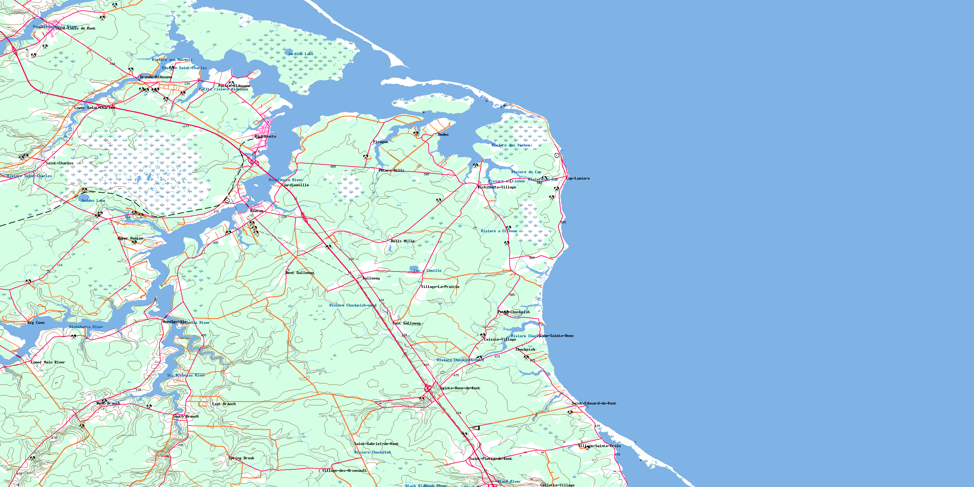
Richibucto Topo Map Online
Download Free Topo Map Sheet 021I10 at 1:50,000 scale
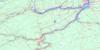
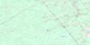
021I10 Richibucto Topo Map
To view this map, mouse over the map preview on the right.
You can also download this topo map for free:
021I10 Richibucto high-resolution topo map image.
Maps for the Richibucto topo map sheet 021I10 at 1:50,000 scale are also available in these versions:
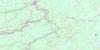
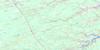
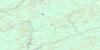
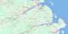
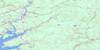
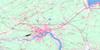
Richibucto Surrounding Area Topo Maps
 |
 |
 |
 |
 |
 |
 |
 |
 |
 |
 |
 |
 |
 |
 |
 |
© Department of Natural Resources Canada. All rights reserved.
Richibucto Gazetteer
The following places can be found on topographic map sheet 021I10 Richibucto:
Richibucto Topo Map: Bays
Anse à FidèleBaie de Buctouche
Baie de Saint-Louis
Baie du Village
Birchbark Creek
Blanchard Creek
Buctouche Harbour
Church Cove
Daigles Creek
Fond de la Baie
Grande Anse
Gulf of St. Lawrence
McAlmon Creek
Mooneys Creek
North Cove
Northwest Arm
Northwest Branch
Richibucto Harbour
Ruisseau à Clorice-Legere
Ruisseau à Jos-Allain
Ruisseau des Richard
Richibucto Topo Map: Beaches
Buctouche BarBuctouche Sand Bar
Dune de Chockpish
North Beach
North Richibucto Beach
North Richibucto Dune
South Beach
South Richibucto Beach
Richibucto Topo Map: Capes
Chapel PointChurch Point
Fagan Point
Gros Cap
Jardine Point
McGuires Point
Pagan Point
Point Bess
Pointe à la Gadèle
Pointe de Forgeron
Pointe de l'Eglise
Pointe de l'Église
Pointe de Violon
Pointe des Allain
Pointe des Georges
Pointe des Mares
Pointe des Richard
Pointe Le Vielle
Pointe Sec
Pratts Point
Richibucto Cape
Richibucto Head
Richibucto Point
Sock Point
York Point
Richibucto Topo Map: Channels
Détroit de NorthumberlandLittle Gully
Northumberland Strait
Passe de l'Ile
Richibucto Gully
Richibucto Topo Map: Geographical areas
KentRichibucto
Saint Mary
Saint-Charles
Saint-Louis
Weldford
Wellington
Richibucto Topo Map: Indian Reserves
Indian Island 28Richibucto 15
Richibucto Topo Map: Islands
Almond IslandFrench (Richibucto) Island
Indian Island
McAlmon Island
Richibucto Topo Map: Lakes
Aldouane LakeGeddes Lake
Jardine Lake
Kouchibouguacis Lagoon
Lac à Camille
Le Barachois
Loggie Pond
Richibucto Topo Map: Mountains
Dune de BuctoucheGalloway Hill
McIntosh Hill
Richibucto Topo Map: Conservation areas
Bonar Law HouseÉglise Sainte-Anne-de-Kent
Kouchibouguac National Park of Canada
Maison de Bonar Law
Parc national du Canada Kouchibouguac
Richibucto Topo Map: Rivers
Aldouane RiverBeatties Creek
Big Brook
Big Cove Creek
Black Brook
Black River
Childs Creek
Chockpish River
East Branch
East Branch St. Nicholas River
East St. Nicholas River
Gaspereau Creek
Gaspereau Creek
Gaspereau River
Kouchibouguacis River
Mazerall Creek
McKays Creek
Mill Creek
Petite rivière Aldouane
Petite Rivière Aldouane
Richibucto River
Rivière à Étienne
Rivière aux Masquis
Rivière Chockpish
Rivière Chockpish-nord
Rivière des Vaches
Rivière du Cap
Rivière Française
Rivière Saint-Charles
Rivière Saint-Louis
Ruisseau à Baptiste
Ruisseau à Petit-Pierre
South Branch
South Branch St. Nicholas River
South St. Nicholas River
Spring Brook
St. Nicholas River
St. Nicholas River
Thomas Brook
Watering Creek
Weldon Creek
West Branch
West Branch St. Nicholas River
West St. Nicholas River
Richibucto Topo Map: Shoals
McGuires Middle GroundRichibucto Bar
Richibucto Topo Map: Towns
RichibuctoRichibucto Topo Map: Unincorporated areas
BabineauBedec
Bells Mills
Big Cove
Caissie-Village
Cap Lumière
Cap-Lumière
Chockpish
Collette Village
Collette-Village
Côte Ste. Anne
Côte-Sainte-Anne
Côte-Ste-Anne
East Branch
East Galloway
Galloway
Galloway
Grande Aldouane
Grande-Aldouane
Jardineville
Little Aldouane
Lower Main River
Lower Saint-Charles
Lower St. Charles
Lower St-Charles
Main River
Marquant
Mundleville
Peters Mills
Petit-Chockpish
Petite Chockpish
Petite-Aldouane
Petite-Chockpish
Pirogue
Richibucto Village
Richibucto-Village
Saint-Charles
Saint-Charles Station
Sainte-Anne-de-Kent
Saint-Edouard-de-Kent
Saint-Édouard-de-Kent
Saint-Gabriel-de-Kent
Saint-Pierre-de-Kent
South Branch
South Branch St. Nicholas River
Spring Brook
St. Charles
St. Edouard de Kent
St. Gabriel de Kent
St. Louis de Kent
St. Pierre
Ste. Anne de Kent
Ste-Anne-de-Kent
St-Edouard-de-Kent
St-Gabriel-de-Kent
St-Louis-de-Kent
St-Pierre
Upper Rexton
Village La Prairie
Village Ste. Croix
Village-des-Arsenault
Village-La-Prairie
Village-Sainte-Croix
Village-Ste-Croix
West Branch
West Branch St. Nicholas River
West Galloway
Richibucto Topo Map: Low vegetation
Caribou PlainMocauque du Cap
Plaine de Saint-Charles
Richibucto Topo Map: Villages
RextonSaint-Louis de Kent
Saint-Louis-de-Kent
© Department of Natural Resources Canada. All rights reserved.
021I Related Maps:
021I Moncton021I01 Port Elgin
021I02 Moncton
021I03 Salisbury
021I04 Chipman
021I05 Salmon River Road
021I06 Harcourt
021I07 Buctouche
021I08 Cape Egmont
021I09 O'Leary
021I10 Richibucto
021I11 Rogersville
021I12 Blackville
021I13 Newcastle
021I14 Kouchibouguac
021I15 Pointe-Sapin
021I16 Tignish
