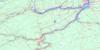
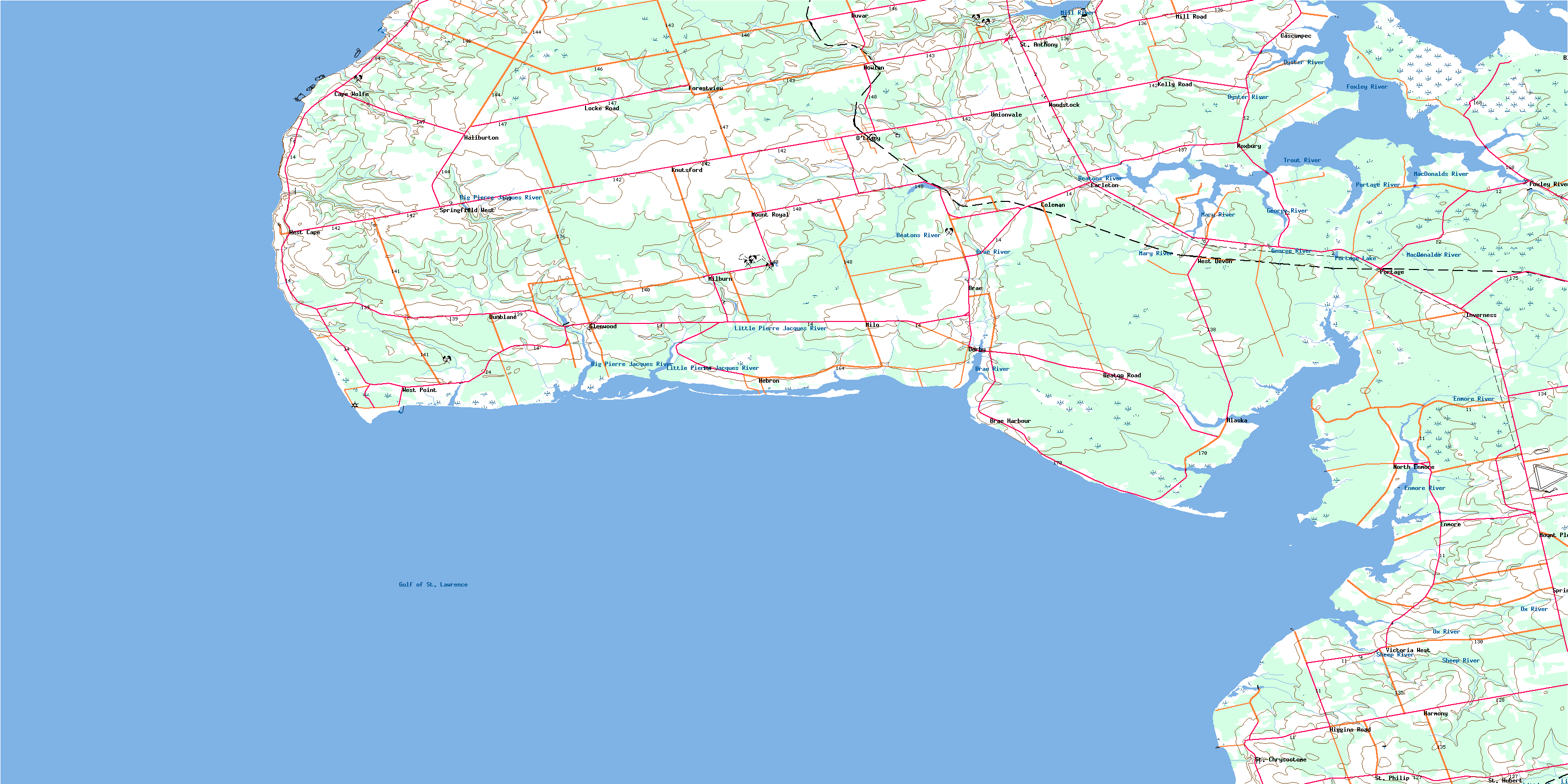
O'Leary Topo Map Online
Download Free Topo Map Sheet 021I09 at 1:50,000 scale
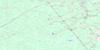
021I09 O'Leary Topo Map
To view this map, mouse over the map preview on the right.
You can also download this topo map for free:
021I09 O'Leary high-resolution topo map image.
Maps for the O'Leary topo map sheet 021I09 at 1:50,000 scale are also available in these versions:
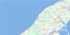
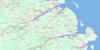
O'Leary Surrounding Area Topo Maps
 |
 |
 |
 |
 |
 |
 |
 |
 |
 |
 |
 |
 |
 |
 |
 |
© Department of Natural Resources Canada. All rights reserved.
O'Leary Gazetteer
The following places can be found on topographic map sheet 021I09 O'Leary:
O'Leary Topo Map: Bays
Black Banks CoveBrae Harbour
Cascumpec Bay
Cascumpeque Bay
Dog Cove
Egmont Bay
Foxley Bay
Foxley Cove
Golfe du Saint-Laurent
Goose Harbour
Gordon Creek
Gordons Creek
Gulf of St. Lawrence
Howard Cove
Howards Cove
MacWilliams Cove
McWilliams Cove
Percival Bay
Stephen Cove
Wolfe Inlet
O'Leary Topo Map: Beaches
Enman ShoreGrande Digue Shore
MacWilliams Shore
McKies Shore
Portage Shore
Reillys Shore
Yeos Shore
O'Leary Topo Map: Capes
Baptiste PointBells Point
Black Point
Black Point
Cape Wolfe
Carey Point
Elm Point
Gordons Point
Grande Digue Point
Hardy Point
Indian Point
Kellys Point
Lot 6 Point
McIsaac Cape
McNallys Point
Moores Point
Mossy Point
Poudre Point
Rock Point
Rocky Point
Sandy Point
Seal Point
Seal Point
West Point
West Spit
O'Leary Topo Map: Channels
Détroit de NorthumberlandNorthumberland Strait
O'Leary Topo Map: Geographical areas
Lot 10Lot 11
Lot 12
Lot 13
Lot 14
Lot 15
Lot 5
Lot 6
Lot 7
Lot 8
Lot 9
Prince
O'Leary Topo Map: Islands
Ballems IslandBird Island
Brae Island
Prince Edward Island
O'Leary Topo Map: Lakes
Big BarachoisFoxley Pond
Frizzells Pond
Getsons Pond
Glenwood Pond
Leards Pond
MacWilliams Pond
McWilliams Pond
Milligans Pond
Portage Lake
Richards Pond
The Barachois
O'Leary Topo Map: Marine navigation features
Higgins WharfO'Leary Topo Map: Mountains
Conway Sand HillsIndian Point Sand Hills
O'Leary Topo Map: Conservation areas
Bloomfield Provincial ParkCedar Dunes Provincial Park
Higgins Wharf Provincial Park
Mill River Provincial Park
Vanier Provincial Park
O'Leary Topo Map: Provinces
Île-du-Prince-ÉdouardPrince Edward Island
O'Leary Topo Map: Rapids
Barachois RunO'Leary Topo Map: Rivers
Baptiste CreekBeatons Creek
Beatons River
Big Pierre Jacques River
Brae River
Canadian Creek
Carruthers Brook
Cross Creek
Cross River
Crossmans Brook
Daltons Brook
Dog Creek
Duck Creek
Enmore River
Foxley River
Freshwater River
George River
Little Duck Creek
Little Pierre Jacques River
Little Trout River
MacDonalds River
MacLaurins Creek
MacLeans Brook
MacWilliams Brook
Mary River
Maxime Creek
Mill River
Ox River
Oyster River
Perceval River
Percival River
Pierre Jacques River
Platt River
Pollard Brook
Portage River
Raphael River
Robb Creek
Robbs Creek
Sheep River
Stewarts Creek
Trout River
O'Leary Topo Map: Shoals
Cape Wolfe RockWest Reef
O'Leary Topo Map: Unincorporated areas
AlaskaBeaton
Beaton Road
Beaton Road
Bethel
Black Banks
Brae
Brae Harbour
Cape Wolfe
Carleton
Cascumpec
Cascumpeque
Coleman
Derby
Dunblane
Duvar
Enmore
Forestview
Foxley River
Glenwood
Greenhill
Haliburton
Harmony
Hawthorne
Hebron
Higgins Road
Howlan
Inverness
Kelly Road
Knutsford
Little Pierre Jacques
Locke Road
Locke Road
Lot 10
Lot 6
Milburn
Mill Road
Milo
Mount Pleasant
Mount Royal
North Enmore
O'Leary Station
Portage
Roxbury
Springfield
Springfield West
Springhill
St. Anthony
St. Chrysostom
St. Chrysostome
St. Hubert
St. Philip
St-Hubert
St-Philippe
Unionvale
Victoria West
West Cape
West Devon
West Point
Woodbrook
Woodstock
O'Leary Topo Map: Low vegetation
Black BankWolfe Marshes
O'Leary Topo Map: Villages
Lady SlipperLot 11 and Area
O'Leary
Richmond
© Department of Natural Resources Canada. All rights reserved.
021I Related Maps:
021I Moncton021I01 Port Elgin
021I02 Moncton
021I03 Salisbury
021I04 Chipman
021I05 Salmon River Road
021I06 Harcourt
021I07 Buctouche
021I08 Cape Egmont
021I09 O'Leary
021I10 Richibucto
021I11 Rogersville
021I12 Blackville
021I13 Newcastle
021I14 Kouchibouguac
021I15 Pointe-Sapin
021I16 Tignish
