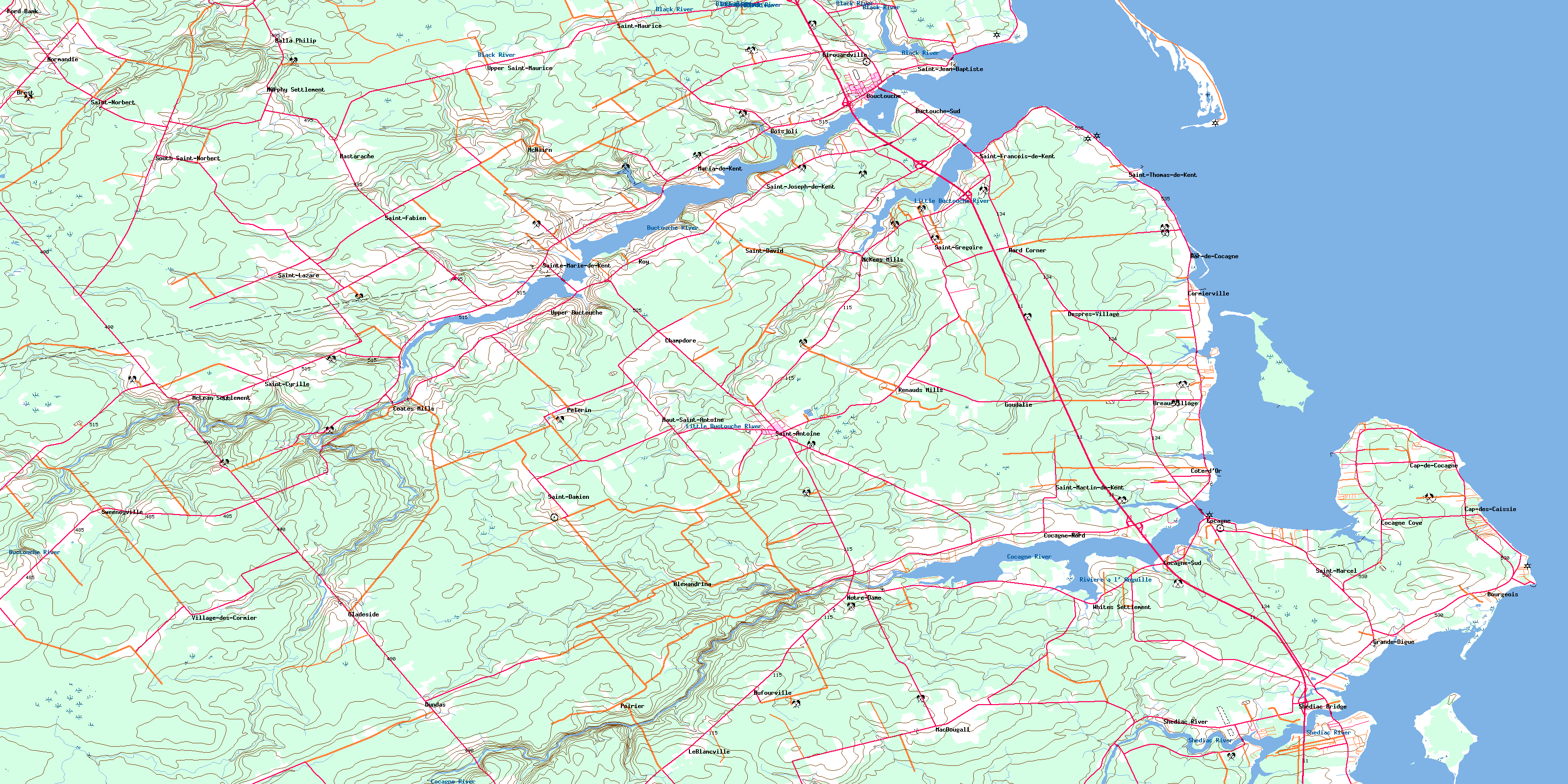
Buctouche Topo Map Online
Download Free Topo Map Sheet 021I07 at 1:50,000 scale
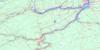
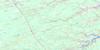
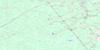
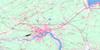
021I07 Buctouche Topo Map
To view this map, mouse over the map preview on the right.
You can also download this topo map for free:
021I07 Buctouche high-resolution topo map image.
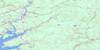
Maps for the Buctouche topo map sheet 021I07 at 1:50,000 scale are also available in these versions:
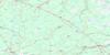
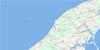
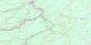
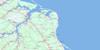
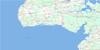
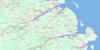
Buctouche Surrounding Area Topo Maps
 |
 |
 |
 |
 |
 |
 |
 |
 |
 |
 |
 |
 |
 |
 |
 |
© Department of Natural Resources Canada. All rights reserved.
Buctouche Gazetteer
The following places can be found on topographic map sheet 021I07 Buctouche:
Buctouche Topo Map: Bays
Baie de BuctoucheBuctouche Harbour
Buctouche Harbour
Buctouche Road
Cocagne Cove
Cocagne Harbour
Gulf of St. Lawrence
Shediac Bay
Shediac Harbour
Buctouche Topo Map: Beaches
Bar de CocagneBuctouche Bar
Buctouche Sand Bar
Buctouche Topo Map: Capes
Big CapeBowzer Point
Caissie Point
Cap de Caissie
Cap de Cocagne
Cocagne Head
Cook Point
Crossman Point
Dixon Point
Giddis Point
Grande-Digue Point
Grandigue Point
Gulnare Point
Indian Point
Indian Point
Pacquet Point
Pointe à Jérôme
Pointe aux Renards
Pointe Grande-Digue
Poirier Point
Priest Point
Renouard Point
Sandy Point
Sandy Point
Shediac Point
Buctouche Topo Map: Channels
Détroit de NorthumberlandLa Passe
Northumberland Strait
The Pass
Buctouche Topo Map: Geographical areas
DundasMoncton
Saint Mary
Saint-Paul
Shediac
Weldford
Wellington
Westmorland
Buctouche Topo Map: Indian Reserves
Buctouche 16Buctouche Topo Map: Islands
Cocagne IslandIndian Island
Shediac Island
Skull Island
Surette Island
The Bluff
Buctouche Topo Map: Mountains
Dune de BuctoucheFisher Hill
McIntosh Hill
Buctouche Topo Map: Conservation areas
Église anglicane Saint LawrenceSaint Lawrence Anglican Church
Buctouche Topo Map: Rivers
Albert BrookAlbert Gallant Brook
Bailey Brook
Bastarache Brook
Basterache Brook
Bateman Brook
Batemans Brook
Big Brook
Biggs Brook
Black River
Breau Brook
Buctouche River
Butler Creek
Cocagne River
East Branch
East Branch St. Nicholas River
East St. Nicholas River
George Collett Brook
Gueguen Brook
Howard Brook
Irving Brook
Johnson Brook
Little Buctouche River
Luke Brook
Mahalawodiac River
McLean Brook
McNairn Brook
Meadow Brook
Meadow Brook
Middle North Branch
Mill Creek
Millers Brook
Murphy Brook
Murray Brook
Noel Creek
Norman Bridge Brook
Northwest Branch Cocagne River
Northwest Cocagne River
Petit Ruisseau Goguen
Rivière à l'Anguille
Rivière des Malcontents
Robin Creek
Ruisseau Albert-Gallant
Ruisseau Babineau
Ruisseau Cormier
Ruisseau des Goguen
Ruisseau des Malcontents
Ruisseau des Ormeaux
Ruisseau Dupuis
Ruisseau François
Ruisseau Georges-Collette
Rushcove Brook
Shediac River
Smelt Brook
South Branch
South Branch Buctouche River
South Branch St. Nicholas River
South Buctouche River
South St. Nicholas River
St. Nicholas River
Trout Brook
West Branch
West Branch St. Nicholas River
West St. Nicholas River
Yankee Brook
Buctouche Topo Map: Shoals
Buctouche Outer BarChêne Bank
Mussel Bank
North Bank
North Patch
Outer Bar
Oyster Shoal
Zephyr Rock
Buctouche Topo Map: Towns
BouctoucheBuctouche Topo Map: Unincorporated areas
AlexandrinaBalla Philip
Bar-de-Cocagne
Bastarache
Boisjoli
Bourgeois
Breau Village
Breau-Village
Brest
Buctouche-Sud
Caissie Cape
Cap-Caissie
Cap-Cassie
Cap-de-Cocagne
Cap-des-Caissie
Champdore
Champdoré
Coates Mills
Cocagne
Cocagne Cape
Cocagne Cove
Cocagne River
Cocagne-Nord
Cocagne-Sud
Collette Village
Collette-Village
Cormierville
Côte d'Or
Côte-d'Or
Després-Village
Dufourville
Dundas
Ford Bank
Girouardville
Gladeside
Goudalie
Grande-Digue
Grandigue
Gueguen
Haut St. Antoine
Haut-Saint-Antoine
Haut-St-Antoine
Hébert
Kent Boom
LeBlancville
Leblancville
Légerville
Lower Gueguen
MacDougall
Macdougall
Maria de Kent
Maria-de-Kent
McKee Mills
McKees Mills
McLean
McLean Settlement
McNairn
Mount Carmel
Murphy Settlement
Normandie
Notre-Dame
Pelerin
Poirier
Renaud Mills
Renauds Mills
Richardville
Roy
Saint-Cyrille
Saint-Damien
Saint-David
Sainte-Marie-de-Kent
Saint-Fabien
Saint-François-de-Kent
Saint-Grégoire
Saint-Jean-Baptiste
Saint-Joseph-de-Kent
Saint-Lazare
Saint-Marcel
Saint-Martin-de-Kent
Saint-Maurice
Saint-Norbert
Saint-Paul
Saint-Thomas-de-Kent
Shediac Bridge
Shediac Island
Shediac River
South Saint-Norbert
South St. Norbert
St. Cyrille
St. Damien
St. Fabien
St. Francois de Kent
St. Grégoire
St. Jean Baptiste
St. Jean-Baptiste
St. Joseph de Kent
St. Lazare
St. Marcel
St. Maurice
St. Norbert
St. Thomas de Kent
St-Antoine-de-Kent
St-Cyrille
St-Damien
Ste-Marie-de-Kent
St-Fabien
St-François-de-Kent
St-Grégoire
St-Jean-Baptiste
St-Joseph-de-Kent
St-Lazare
St-Marcel
St-Martin-de-Kent
St-Maurice
St-Norbert
St-Thomas-de-Kent
Sweeneyville
Upper Buctouche
Upper Saint-Maurice
Upper St. Maurice
Upper St-Maurice
Val-Richard
Village-des-Cormier
Village-Saint-Irénée
Village-St-Irénée
Ward Corner
White Settlement
Whites Settlement
Buctouche Topo Map: Villages
BuctoucheSaint-Antoine
St. Anthony
© Department of Natural Resources Canada. All rights reserved.
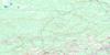
021I Related Maps:
021I Moncton021I01 Port Elgin
021I02 Moncton
021I03 Salisbury
021I04 Chipman
021I05 Salmon River Road
021I06 Harcourt
021I07 Buctouche
021I08 Cape Egmont
021I09 O'Leary
021I10 Richibucto
021I11 Rogersville
021I12 Blackville
021I13 Newcastle
021I14 Kouchibouguac
021I15 Pointe-Sapin
021I16 Tignish
