Ryley Topo Map Online
Download Free Topo Map Sheet 083H08 at 1:50,000 scale
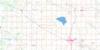
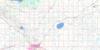
083H08 Ryley Topo Map
To view this map, mouse over the map preview on the right.
You can also download this topo map for free:
083H08 Ryley high-resolution topo map image.
Maps for the Ryley topo map sheet 083H08 at 1:50,000 scale are also available in these versions:
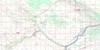
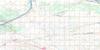
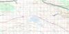
Ryley Surrounding Area Topo Maps
 |
 |
 |
 |
 |
 |
 |
 |
 |
 |
 |
 |
 |
 |
 |
 |
© Department of Natural Resources Canada. All rights reserved.
Ryley Gazetteer
The following places can be found on topographic map sheet 083H08 Ryley:
Ryley Topo Map: Lakes
Beaverhill LakeRyley Topo Map: Major municipal/district area - major agglomerations
Beaver CountyCounty of Beaver No. 9
County of Lamont No. 30
County of Minburn No. 27
Lamont County
Ryley Topo Map: Rivers
Vermilion RiverWaskwei Creek
Ryley Topo Map: Towns
VegrevilleRyley Topo Map: Unincorporated areas
HaightInland
Poe
Vegreville Junction
Yelger
Ryley Topo Map: Villages
Ryley
© Department of Natural Resources Canada. All rights reserved.
