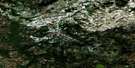
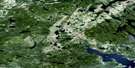
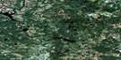
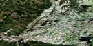
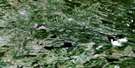
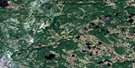
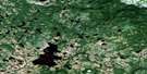
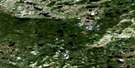
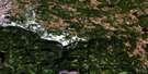
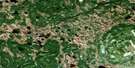
St Lewis Inlet Satellite Image Map
Download Free Aerial Photo 013A08 at 1:50,000 scale
St Lewis Inlet Satellite Imagery
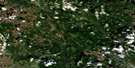
To view this satellite map, mouse over the air photo on the right.
You can also download this satellite image map for free:
013A08 St Lewis Inlet high-resolution satellite image map.
Maps for the St Lewis Inlet aerial map sheet 013A08 at 1:50,000 scale are also available in these versions:
St Lewis Inlet Surrounding Area Aerial Photo Maps
 |
 |
 |
 |
 |
 |
 |
 |
 |
 |
 |
 |
 |
 |
 |
 |
© Department of Natural Resources Canada. All rights reserved.
St Lewis Inlet Gazetteer
The following places can be found on satellite image map 013A08 St Lewis Inlet:
St Lewis Inlet Satellite Image: Bays
St. Lewis InletSt Lewis Inlet Satellite Image: Beaches
SandbanksSt Lewis Inlet Satellite Image: Islands
Black Fly IslandLower Island
Upper Island
Wood Island
St Lewis Inlet Satellite Image: Lakes
Big PondCurls Pond
Five Island Pond
Hatters Cove Pond
Hatters Cove Second Pond
Mangrove Big Pond
Mangrove Pond
Marys Harbour First Pond
Marys Harbour Second Pond
Middle Creek Pond
Northeast Pond
Riggs Pond
Rocky Pond
Sandy Creek Pond
Seven Island Pond
Southwest Ponds
Tom Thoms Pond
Upper Creek First Pond
Upper Creek Second Pond
St Lewis Inlet Satellite Image: Mountains
Charlies KnobSouthwest Hill
The Pig
Wallmans Hill
White Nuggets
St Lewis Inlet Satellite Image: Rivers
Beaver BrookBig Blackwater
Colleroon River
Northeast Brook
Notleys Brook
St. Lewis River
St. Marys River
St Lewis Inlet Satellite Image: Unincorporated areas
Wallmans
© Department of Natural Resources Canada. All rights reserved.
013A Related Maps:
013A Battle Harbour013A01 Chateau Pond
013A02 No Title
013A03 No Title
013A04 No Title
013A05 No Title
013A06 No Title
013A07 No Title
013A08 St Lewis Inlet
013A09 Port Hope Simpson
013A10 No Title
013A11 No Title
013A12 No Title
013A13 No Title
013A14 No Title
013A15 Jeffries Pond
013A16 White Bear Arm
