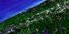
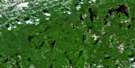
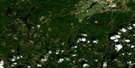
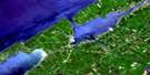
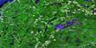
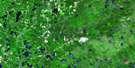
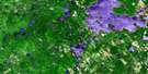
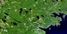
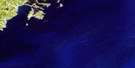
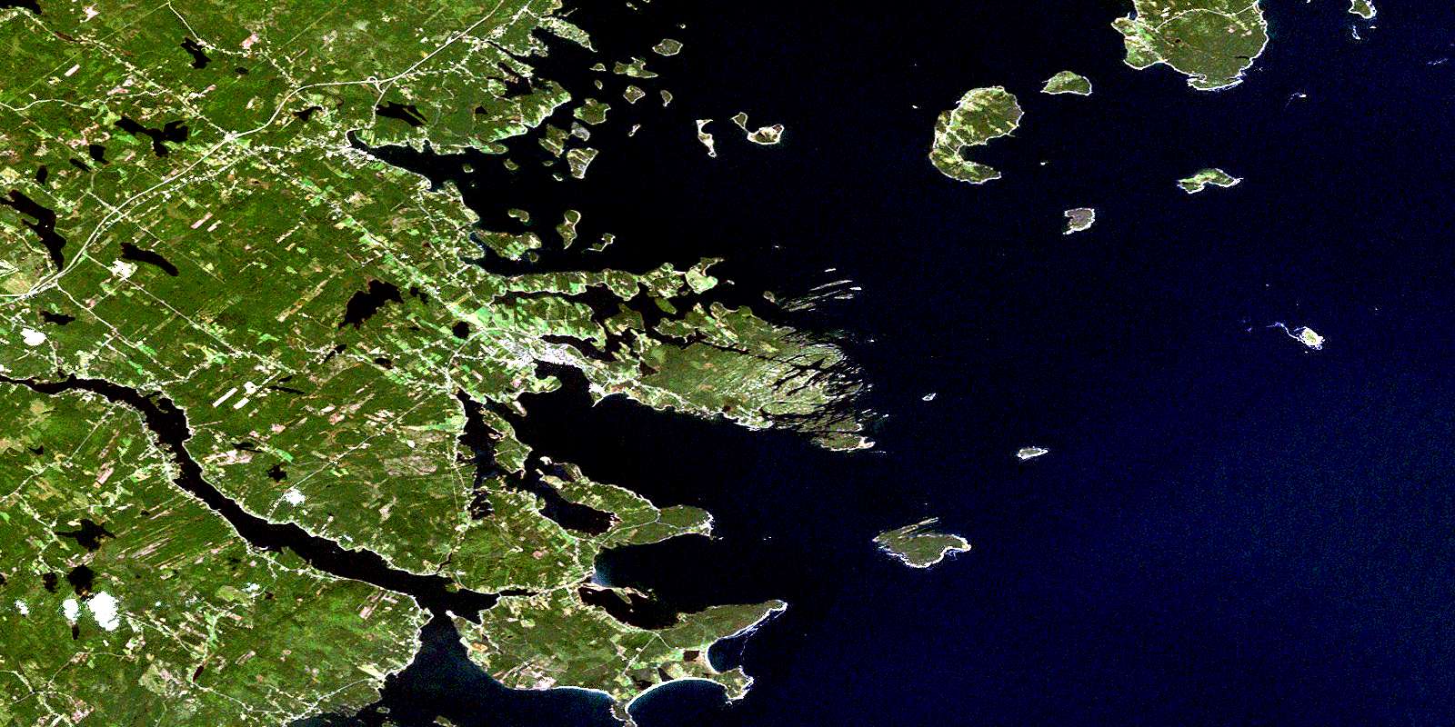
Lunenburg Satellite Image Map
Download Free Aerial Photo 021A08 at 1:50,000 scale
Lunenburg Satellite Imagery
To view this satellite map, mouse over the air photo on the right.
You can also download this satellite image map for free:
021A08 Lunenburg high-resolution satellite image map.
Maps for the Lunenburg aerial map sheet 021A08 at 1:50,000 scale are also available in these versions:
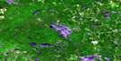
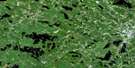
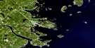
Lunenburg Surrounding Area Aerial Photo Maps
 |
 |
 |
 |
 |
 |
 |
 |
 |
 |
 |
 |
 |
 |
 |
 |
© Department of Natural Resources Canada. All rights reserved.
Lunenburg Gazetteer
The following places can be found on satellite image map 021A08 Lunenburg:
Lunenburg Satellite Image: Bays
Agen CoveAndrews Cove
Back Cove
Back Harbour
Backmans Cove
Bell Cove
Bells Cove
Blue Rocks Harbour
Broad Cove
Broad Cove
Bucks Cove
Bull Cove
Burns Cove
Cooks Cove
Creaser Cove
Cross Island Harbour
Crow Cove
Cunard Cove
Currie Cove
Deep Cove
Deep Hole
Devils Cove
Dublin Bay
Eastern Cove
Eel Cove
Fire Cove
Fralig Cove
Garretts Cove
Getson Cove
Grabble Cove
Grandmothers Cove
Guilfoyle Cove
Hansons Cove
Hartling Bay
Heckman Anchorage
Heckmans Anchorage
Heckmans Back Harbour
Herring Cove
Hieslers Harbour
Hirtle Cove
Hirtles Bay
Horseshoe Cove
Host Cove
Hutts Cove
Indian Cove
Indian Path Harbour
Indian Point Cove
Kings Bay
Knickles Cove
Levy Cove
Levys Cove
Lime Kiln Cove
Little Long Cove
Little Tanners Cove
Long Cove
Long Cove
Lower South Cove
Lunenburg Bay
Lunenburg Harbour
Mader Cove
Maders Cove
Mahone Bay
Mahone Harbour
Marsh Cove
Martin Cove
Mason Island Cove
McKean Cove
Meiseners Cove
Mosher Cove
Moshers Bay
Moshers Cove
Mountain Cove
Mud Cove
Mud Cove
Narrows Basin
New Harbour
Northwest Cove
Oil Cove
Otter Cove
Parks Cove
Parks Creek
Pernette Cove
Prince Inlet
Princes Inlet
Puffeycup Cove
Ritcey Cove
Robs Cove
Rocker Cove
Rose Bay
Rudolf Cove
Sand Bay
Sand Cove
Sand Cove
Sand Cove
Sandy Cove
Sandy Cove
Schoolhouse Cove
Schooner Cove
Shankle Cove
Sheep Pound Cove
Shoal Cove
Smelt Cove
Snug Harbour
Southeast Bay
Southeast Cove
Southeast Cove
Southeast Cove
Southwest Cove
Southwest Cove
Sperry Cove
Sperry Cove
Spindler Cove
Sweet Pond
Tanner Cove
Tanners Cove
The Big Kaffel
The Farley
The Gutter
The Ovens
Trails Cove
Upper South Cove
Walters Cove
Weagle Cove
Weihnacht Cove
Western Harbour
Western Harbour
Whynachts Cove
Wilkies Cove
Youngs Cove
Zwicker Cove
Lunenburg Satellite Image: Beaches
Back ShoreBackhouse Shore
Backman Beach
Backmans Beach
Battery Point Beach
Bayswater Beach
Hirtles Beach
Long Pond Beach
Lucys Bar
Mason Beach
Masons Beach
Meisners Beach
Moshers Beach
Moshers Beach
Moshers Head Beach
Oxner Beach
Oxners Beach
Southwest Beach
Southwest Breaker
Westhaver Beach
Lunenburg Satellite Image: Capes
Agen PointAndrews Point
Andrews Spit
Aspotogan Peninsula
Atlantic Seaside
Battery Point
Bell Point
Bella Spit
Bells Point
Birch Point
Blandford Head
Bluff Head
Bulls Point
Bushy Point
Clam Point
Cleverseys Point
Cook Point
Cooks Point
Creaser Point
Cropper Point
Cross Head
Cross Island Head
Dares Point
Deadman Point
Distinguishing Point
East Point
East Spit
Eastern Battery Point
Eastern Head
Eisenhauers Point
First Peninsula
Fort Point
Front Rum Point
Goreham Point
Grandmothers Cove Point
Green Head
Green Point
Greenwich Point
Hebb Point
Heckmans Head
Hell Point
Herring Point
Horseshoe Point
Huckleberry Point
Hutts Point
Hyson Point
Indian Point
Jacks Point
Kaufmans Point
Kaulback Head
Kaulbacks Head
Kraut Point
Krout Point
Lee Point
Leg Point
Levy Point
Lime Kiln Head
Marsh Point
Martin Point
Martins Point
Mason Point
Mason Spit
Masons Point
McKean Point
Miller Head
Millers Point
Monk Point
Moreau Point
Moses Nose
Mosher Head
Mosher Point
Moshers Head
Moshers Point
Naas Head
New Harbour Point
Nichols Point
Ovens Point
Oxner Head
Oxners Head
Point Enragé
Red Head
Reef Point
Romkey Head
Rose Point
Round Point
Sandy Cove Point
Second Peninsula
Sheep Point
Shoal Cove Head
Silver Point
Silver Point
Smith Point
South Head
Southern Head
Stevens Head
The Long Rock
Trails Point
Weagle Point
West Head
Western Point
Zinck Head
Zincks Point
Zincks Point
Lunenburg Satellite Image: Caves
The Bake OvensThe Cave
Lunenburg Satellite Image: Channels
Back PassageBack Passage
Big Gut
East Point Gut
Ernst Gut
Gunalow Channel
Hebb Narrows
Indian Island Gut
Indian Pass
Indian Passage
Little Gut
Little Silvers Narrows
Long Island Run
Middle Pass
Millers Pass
Ships Channel
Silvers Narrows
Sweat Channel
Tanner Pass
Tanners Pass
The Chops
The Farley Narrows
The Gut
The Narrows
The Narrows
The Narrows
The Tidehole
Wilneff Passage
Wilneffs Pass
Lunenburg Satellite Image: Cliffs
Felsen KapRed Bank
The Shoughbac
Lunenburg Satellite Image: Geographical areas
LunenburgLunenburg Satellite Image: Islands
Andrews IslandArenburg Island
Backman Island
Backmans Island
Bella Island
Big Chain Island
Big Crow Island
Big Duck Island
Big Sweat Island
Big Tancook Island
Birch Island
Blue Rock Island
Blue Rocks Island
Bowl Island
Breakfast Island
Bushen Island
Chain Islands
Chockle Cap
Conrad Island
Cooks Island
Corkum Island
Corkums Island
Covey Island
Covey Island
Coveys Island
Coveys Island
Cross Island
Crow Island
Crow Islands
Daniels Island
Dicks Island
East Ironbound Island
East Point Island
Ernst Island
Fiery Island
Fifty Acre Island
Fire Islands
Flat Island
Fox Island
Fox Island
Fox Island
Georges Island
Gifford Island
Goat Island
Gorehams Island
Gorehams Island
Grassy Island
Grassy Island
Gravel Island
Great Tancook Island
Green Island
Gull Ledge
Gully Island
Gunning Island
Gunning Point Island
Heckman Island
Heckmans Island
Hell Island
Herman Island
Hermans Island
Hobson Island
Hobsons Island
Indian Island
Irvington Island
Kaulbach Island
Kaulback Island
Klungemache Island
Little Chain Island
Little Cross Island
Little Crow Island
Little Duck Island
Little East Point Island
Little Green Island
Little Herman Island
Little Island
Little Island
Little Island
Little Islands
Little Rafuse Island
Little Sweat Island
Little Tancook Island
Long Island
Lookout Island
Lower Chain Island
Loye Island
Lucy Island
Marsh Island
Mash Island
Mason Island
Mason Island
McCarthys Island
Middle Chain Island
Miller Island
Millers Island
Mink Island
Mountain Island
Nubble
Parks Island
Pearl (Green) Island
Pearl Island
Peters Island
Rafuse Island
Rake Island
Round Island
Round Island Nubble
Rous Island
Sacrifice Island
Salmon Island
Sheep Island
Sheep Island
Snake Island
Spectacle Island
Spectacle Island
Spectacle Islands
Squid Island
Star Island
Stony Island
Strum Island
Sweat Islands
Tanner Island
The Stoneland
Toms Island
Upper Chain Island
Weagle Island
West Spectacle Island
West Weagle Island
Westhaver Island
White Island
Whites Island
Whynot Island
Whynots Island
Willneffs Islands
Wilneff Islands
Young Island
Zwicker Island
Lunenburg Satellite Image: Lakes
Backmans PondBeaver Pond
Beck Lake
Blue Rocks Pond
Blysteiner Lake
Brown Lake
Cantalope Lake
Cantelope Lake
Clearland Lake
Common Lake
Cooks Pond
Covey Lake
Cross Lake
Crouse Lake
Dares Lake
Dry Spitz Pond
Duck Ponds
Eel Pond
Feeners Lake
Flat Reef Pond
Fort Point Pond
Grimm Lake
Grist Mill Pond
Hartling Pond
Hartmans Lake
Hirtles Pond
Huey Lake
Hutts Pond
Kaulbach Lake
Kaulback Long Lake
Kaulbacks Big Pond
Kaulbacks Little Pond
Keddy Pond
Kings Pond
Kingsburg Pond
Langille Lake
Langille Little Lake
Lily Pond
Lily Pond
Little Lake
Little Langille Lake
Little Mushamush Lake
Long Pond
Masons Pond
Mike Pond
Miller Pond
Mosher Pond
Moshers Pond
Mushamush Lake
Naas Lake
Oakland Lake
Oikle Lake
Pernette Lake
Pinegrove Lake
Rhodeniser Lake
Rhodenizer Lake
Rhodes Lake
Rhynardt Lake
Riley Lake
Rileys Lake
Romkey Pond
Round Lake
Southeast Cove Pond
Southwest Beach Pond
Spectacle Lakes
Steverman Lake
Stonehurst Pond
Wentzell Lake
Wentzell Lake
Zwicker Lake
Zwicker Long Lake
Lunenburg Satellite Image: Mountains
Bare HillBear Hill
Big Lots Hill
Blockhouse Hill
Brick Hill
Brown Hill
Conrad Hill
Cosman Tower Hill
Cossman Tower Hill
Great Ridge
Hirtle Hill
Hirtles Hill
Long Hill
Mount Pleasant
Romkey Hill
Romkey Hills
Shepherds Hill
Slaters Hill
Smith Mountain
The High Hill
The Shoughbac
Tower Hill
Lunenburg Satellite Image: Major municipal/district area - major agglomerations
ChesterLunenburg
Lunenburg Satellite Image: Conservation areas
Bayswater Beach Provincial ParkFort Sainte Marie de Grace National Historic Site of Canada
Grassy Island Wildlife Management Area
Lieu historique national du Canada du Fort-Sainte-Marie-de-Grâce
Old Town Lunenburg World Heritage Site
Pearl Island Wildlife Management Area
Second Peninsula Provincial Park
Site du patrimoine mondial du Vieux-Lunenburg
Lunenburg Satellite Image: Rivers
Ansell BrookAulenbach Brook
Beaver Brook
Beaverdam Brook
Bells Brook
Blockhouse Mill Brook
Boehner Brook
Creaser Brook
Crouse Brook
Die Klein Brook
Ernst Brook
Feener Brook
Grimm Brook
Grimms Brook
Hebb Mill Brook
Himmelman Brook
Hirtle Brook
Horn Brook
Juniper Brook
Kaulbach Brook
Kaulback Brook
La Have River
LaHave River
Lahave River
Lantz Brook
Lohnes Brook
Long Bridge Brook
Marsh Brook
Marsh Brook
Martin Brook
Martin River
Martins Brook
Martins River
Mushamush River
Naugler Brook
Oxner Brook
Pentz Brook
Pernette Brook
Petite Rivière
Red Brook
Rhodeniser Brook
Rhodenizer Brook
Ritcey Brook
Romkey Brook
Rum Brook
School Brook
Sellars Brook
Seller Brook
Smelt Brook
Smith Brook
Sperry Brook
The Droke
Veinot Brook
Wagner Brook
Wallace Brook
Walters Brook
Wamback Mill Brook
Weagle Brook
Wentzell Brook
Whynacht Brook
Zinck Brook
Lunenburg Satellite Image: Shoals
Andrews ShoalBackman Shoal
Backmans Shoal
Ballast Wall Shoal
Beacon Shoal
Bella Shoal
Ben Mason Shoal
Big Ledge
Black Rock
Black Rock
Blandford Shoal
Break Rock
Bull Rock
Bull Rock
Cherry Rock
Clam Point Island
Coachman Ledge
Cockawee Shoal
Corkums Shoal
Covey Ledge
Coveys Ledge
Cropper Shoal
Dry Spitz
East Point Ledge
East Point Rock
East Shoal
Eastern Shoal
Five Acre Shoals
Five Finger Shoal
Flat Point Rock
Flat Point Rocks
Flat Reef
Gimlet Ledge
Goose Ledge
Goose Rock
Grampus
Grampus Shoal
Gravel Island Ledges
Graveyard Rocks
Green Island Ledges
Green Rock
Gunning Point Rocks
Gunning Rock
Haddock Rock
Haddock Rock
Haddock Shoal
Haddock Shoal
Haines Shoal
Ham Shoal
Head Rock
Hell Rackets
Hell Reef
Hieslers Rocks
Hounds Ledges
Hunters Reef
Hutt Shoal
Inchcape Rock
Indian Rock
Inner Middle Rock
Inner Rock
Island Rock
Jack Langilles Shoal
Jackrock Bank
Jake Island Rock
Kelp Rock
Little Duck Reef
Little Ledge
Lone Rock
Long Reef
Long Shoal
Long Shoal
Lookout Rocks
Meisners Reef
Melvin Shoal
Middle Ledge
Middle Patch
Middle Rock
Middle Shoal
Middle Shoals
Moreau Point Rock
Myra Rock
Northeast Shoal
Nose Shoal
Outer Middle Rock
Outer Rock
Ovens Reef
Oxner Rock
Oxners Rock
Quaker Shoal
Rafuse Bar
Rafuse Ledge
Red Bank
Rileys Rocks
Rocky Ledges
Rocky Pile
Round Island Shoal
Round Shoal
Rous Shoal
Saddle Rock
Sculpin Shoal
Seal Ledge
Shag Ledge
Shag Rock
Slaunwhites Shoal
South Rock
South Shoal
South Shoal
Southeast Shoal
Southeast Shoals
Southwest Beach Reef
Southwest Coachman
Southwest Ledge
Southwest Rock
Spectacle Shoals
Star Island Ledges
Strum Shoal
Sunken Rocks
Sunken Shoal
The Nubs
The Ovens Reef
The Shingles
The Upper Rackets
The Western Hounds
Three Headed Rock
Trappeans Shoal
Twin Rocks
West Shoals
Young Ledge
Zwickers Shoal
Lunenburg Satellite Image: Towns
LunenburgMahone Bay
Lunenburg Satellite Image: Unincorporated areas
Back CentreBarry Corner
Barrys Corner
Bayport
Bayswater
Big Lots
Blandford
Block House
Blockhouse
Blue Rock
Blue Rocks
Centre
Clearland
Conquerall Bank
Corkums Island
Crouse Town
Crouses Settlement
Crousetown
Dayspring
Deans Corner
Dublin Shore
East Ironbound Islands
East La Have
East LaHave
East Lahave
Eastern Points
Farmville
Fauxbourg
Fauxburg
Feltz South
Feltzen South
First Peninsula
First South
Five Houses
Front Centre
Garden Lots
Grimms Settlement
Heckman Island
Heckmans Island
Hermans Island
High Head
Indian Path
Indian Point
Kingsburg
La Have
LaHave
Lahave
Lake Centre
Lilydale
Little Tancook
Lower La Have
Lower LaHave
Lower Lahave
Lower New Cornwall
Lower Rose Bay
Mader Cove
Maders Cove
Maitland
Maitland
Maitland Forks
Maitland Station
Martin Brook
Martin Point
Martin River
Martins Brook
Martins Point
Martins River
Masons Beach
Middle La Have Ferry
Middle LaHave
Middle Lahave Ferry
Mount Pleasant
New Cumberland
New Harbour
Northwest
Oak Hill
Oakhill
Oakland
Pentz
Pleasantville
Rhodes Corner
Riverport
Rose Bay
Schnares Crossing
Second Peninsula
Silver Point Road
South
Spectacle Lakes
Spindler Cove
Stonehurst
Stonehurst East
Stonehurst West
Sunnybrook
Tancook Island
Tanners Settlement
The Narrows
Upper Kingsburg
Upper La Have
Upper LaHave
Upper Lahave
Weatherley
West Dublin
West La Have
West Lahave
West LaHave
Whynotts Settlement
Lunenburg Satellite Image: Low vegetation
Back Oler Farm MarshBlack Swamp
Cosmans Meadows
Doreys Marsh
Front Oler Farm Marsh
Lauries Marsh
Reinhardts Swamp
Stumpy Marsh
The Long Swamp
© Department of Natural Resources Canada. All rights reserved.
021A Related Maps:
021A Annapolis Royal021A01 Lahave Islands
021A02 Liverpool
021A03 Lake Rossignol
021A04 Wentworth Lake
021A05 Weymouth
021A06 Kejimkujik Lake
021A07 Bridgewater
021A08 Lunenburg
021A09 Chester
021A10 New Germany
021A11 Milford
021A12 Digby
021A13 Granville Ferry
021A14 Bridgetown
021A15 Gaspereau Lake
021A16 Windsor
